Peru hits different from every angle, arid coast, dense jungle, frozen mountain peaks, all crammed into one country. Peru weather trips up first-time visitors constantly because what’s happening in the mountains has zero relevance to what’s happening on the coast. Worth understanding before committing to dates.

Most people end up building their whole trip around one window. Peru dry season runs roughly May to October, best setup for trekking, ruins, outdoor everything. “Dry” doesn’t automatically mean warm though, huge distinction depending on where someone actually lands.
peru dry season

When is the Dry Season in Peru?

When is dry season in peru is basically everyone’s first search. Two seasons, wet November to April, dry season peru May to October. That’s the whole picture in terms of big-picture planning.

South of the equator means those dry months land in astronomical winter. July in Peru is winter. Andean winter though, think blazing sunshine and bone-dry air, not snowstorms and gray skies. Completely counterintuitive if someone’s coming from the northern hemisphere.

A Country of Microclimates

Three zones, Coast, Mountains, Jungle, and weather conditions in peru shifts completely between each one. Same month, same country, wildly different experience depending on where someone’s standing. That’s the thing most people miss when planning.

Amazon stays hot and humid basically year-round, rainfall just drops a bit during these months. The Andes get a real distinct dry period, sharp sunny days, genuinely freezing nights. Lima gets la garúa instead, thick gray coastal mist sitting over the city from May to November, gloomiest time of year for the capital weirdly enough.
peru dry season

The Andean Highlands: The Heart of the Inca Empire

Cusco, Sacred Valley, Lake Titicaca, Arequipa, most visitors are here for this. Dry season in peru in the highlands means days of intense sunshine, nights that drop hard toward zero. Clear mountain views that the wet season clouds consistently block. That’s the whole draw.

Weather in Cusco and the Sacred Valley

May through October in Cusco, intense sun, deep blue skies, daytime temperatures hovering around 65°F to 70°F. Comfortable enough during the day, then the sun drops and everything changes fast. Elevation at 11,152 feet means the temperature swing is brutal and immediate.

June and July nights in Cusco regularly hit freezing. Sacred Valley gets almost zero rainfall during these months, hillsides going from wet-season green to that dry golden color. Snow-capped Vilcanota peaks against clear blue sky, that’s the shot everyone’s chasing and dry season in peru is the only time it’s reliably available.

Visiting Machu Picchu

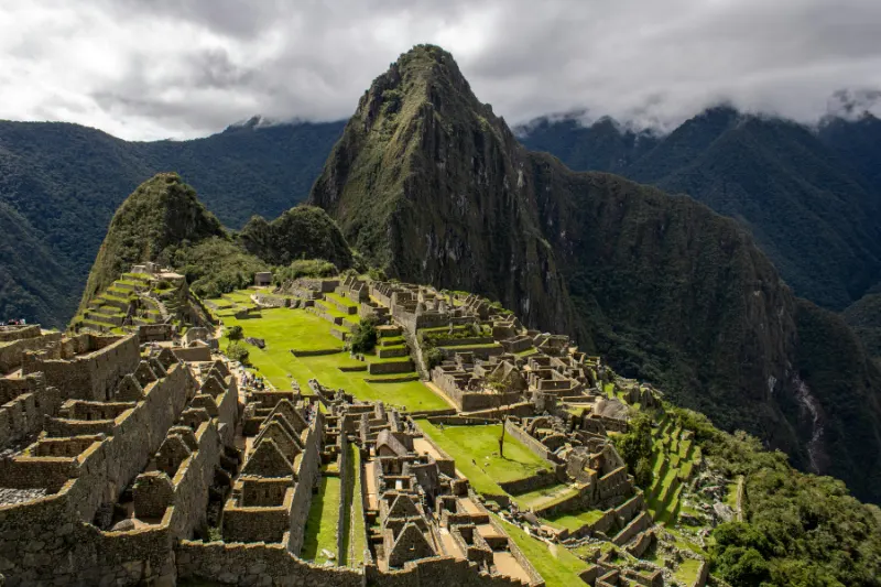
Best time to visit peru machu picchu falls squarely within the dry season, no real debate. Citadel sits lower than Cusco at around 7,970 feet, right on the edge of the cloud forest. Borders the jungle so it catches more rain year-round than the higher Andes do.

June through August though, views clear, stone steps stable, rain interruptions minimal. Morning mist burns off by mid-morning most days. That’s the window where the place actually looks like the photographs rather than a gray foggy ruin people paid a lot to see.

Trekking in the Dry Season

Peru is genuinely one of the best trekking countries on the planet. Dry season peru is when it’s safest and most comfortable to actually do that. Dry paths, clear views, conditions that reward preparation rather than punish it.

The Inca Trail and Southern Treks

Inca Trail peaks between May and September. Dry stone paths mean significantly less slipping on the steep sections like Dead Woman’s Pass. Views open up across valleys and glaciers that wet season clouds just swallow entirely.

Salkantay and Ausangate benefit equally from dry season in peru. Salkantay campsites sit above 12,000 feet, July nights there drop to 15°F (-9°C). Four-season sleeping bag isn’t optional gear at those elevations, it’s a safety item.

The Cordillera Blanca in the North

Southern Peru gets all the attention but the northern Andes are genuinely spectacular. Cordillera Blanca during dry season peru, based out of Huaraz, is the kind of landscape that doesn’t look real. Jagged ice-covered peaks, turquoise glacial lakes, the whole thing.

Santa Cruz and Huayhuash Circuit cross high mountain passes above 15,000 feet. Dry season gives the safest conditions for those crossings. Intense sun during the day, bitterly cold nights, both simultaneously true the whole time.
peru dry season

Into the Amazon Rainforest

Amazon covers nearly 60% of Peru and peru dry season changes the jungle experience significantly. Water levels in Amazonian rivers drop during these months, which actually opens things up considerably:

  • Jungle walks: Flooded wet-season trails become accessible, extensive terrestrial exploration possible.
  • Wildlife viewing: Animals concentrate around shrinking water sources, spotting gets considerably easier.
  • Macaw clay licks: Famous collpas where hundreds of macaws gather to eat mineral-rich clay are most active during dry months.
  • Fewer mosquitoes: Slight reduction in mosquito populations compared to wet season, slight being the key word.

Tropical downpours still happen during dry season in peru, even here. Friajes hit occasionally too, cold fronts sweeping up from Patagonia dropping temperatures to 50°F (10°C) out of nowhere for a few days.

The Cultural Pulse: Festivals of the Dry Season

Peru dry season also lines up with the best festivals, not just the best weather. Clear skies make massive outdoor celebrations actually possible in ways the wet season doesn’t allow. Ancient Incan beliefs and Catholic traditions both driving a packed calendar.

Inti Raymi (The Festival of the Sun)

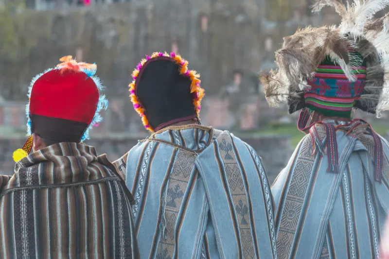
June 24th in Cusco every year, coincides with the winter solstice. Hundreds of actors in traditional costumes, music everywhere, dancing filling the streets. Starts at the Qorikancha, ends in a hours-long ceremony of Inti Raymi at Sacsayhuamán above the city. One of the biggest cultural events in South America.

Peruvian national holidays

Independence celebrated July 28th and 29th, parades and street food and music across the whole country. Peru travel tips for this specific window, book accommodation extremely early. Cusco hotel prices spike and last-minute rooms basically don’t exist.

Virgin of Carmen

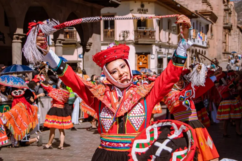
Mid-July in Paucartambo, few hours from Cusco. Elaborate masked dances, indigenous and Catholic traditions mixed together in ways that feel genuinely unique. One of the more authentic things available during dry season in peru for people willing to leave the main tourist circuit.

Managing the Crowds: Peak Season vs. Shoulder Season

Dry season peru lines up with North American and European summer vacations, so peak tourism and best weather arrive together. Machu Picchu, Sacred Valley, Cusco, all busy. That’s just what comes with traveling during the optimal window.

Navigating Peak Tourism

June, July, August means crowds, accepting that upfront makes everything easier. Machu Picchu at 6am opening time or late afternoon entry is considerably quieter than the 10am to 2pm window. Sites like Choquequirao offer similar quality with a fraction of the people.

The Magic of the Shoulder Season

May and September through October sit in a genuinely sweet spot. May has the post-rain lushness, crowds not peaked yet, weather mostly clear. September and October warm slightly, the July and August crowds thinning considerably. Either shoulder month often better than peak for people with flexible schedules.
peru dry season

Essential Logistics and Booking

Peru travel tips for dry season peru start with one thing, don’t leave logistics late. Peak period means everything fills up fast, flights, trains, entry tickets, accommodation.

Classic Inca Trail permits need six to eight months minimum lead time. Government caps at 500 people per day total including guides and porters, May through July permits selling out by December the previous year. Machu Picchu entry and Ollantaytambo train tickets need the same advance planning, timed-entry circuits making desirable slots disappear fast.

Hotels in Cusco, Sacred Valley, Lima book out months ahead too. Peru weather being universally favorable during this window drives demand that makes short-notice bookings expensive and unrealistic. Set the itinerary, make reservations immediately after.

Health and Wellness in the Andes

High Andes during dry season in peru means managing two things most people underestimate, altitude and UV exposure. Atmosphere is significantly thinner, less protection from UV rays than anywhere at sea level. Both hit harder than expected and both require proactive management rather than reactive damage control.

Practical steps for managing altitude in sunny peru dry season conditions:

  • Hydration: Arid air means losing moisture constantly with every breath. Water intake is primary altitude sickness defense.
  • Sun protection: SPF 50+ sunscreen, UV-blocking sunglasses, wide-brimmed hat, every single day without exception.
  • Acclimatization: Fly into Cusco, immediately head down to Sacred Valley around 9,000 feet for the first few nights before returning higher.
  • Coca tea: This tea everywhere, helps stimulate the body and soothe the stomach, locals have used it at these elevations forever.
peru dry season

The Ultimate Packing List for the Dry Season

Multiple climate zones means packing for peru dry season needs real thought. Misty cool Lima, freezing Andean nights, humid jungle, all potentially in one trip. Layering is the concept that makes all of it manageable without overpacking.

Clothing

  • Base layers: Moisture-wicking short and long-sleeved shirts, merino wool best for temperature regulation and smell management on multi-day treks.
  • Mid layers: Warm fleece or alpaca wool sweater, alpaca versions available cheap in Cusco and Pisac markets.
  • Outerwear: Lightweight puffer jacket for cold mornings and evenings, packable rain jacket still useful around Machu Picchu cloud forest.
  • Bottoms: Lightweight trekking pants, zip-offs work well in the Andes, comfortable jeans for cities.
  • Thermal underwear: Non-negotiable for trekking and camping, sleeping at high campsites requires them.

Footwear

  • Hiking boots: Sturdy, broken-in, waterproof, excellent ankle support for Inca Trail or Cordillera Blanca.
  • Trail runners or walking shoes: Sacred Valley ruins, Cusco cobblestones, Machu Picchu touring, these cover all of that.
  • Camp shoes: Lightweight sandals, feet need actual rest after long days on steep terrain.

Accessories and Gear

  • Daypack: 20 to 30 liter pack for water, camera, sunscreen, and the layers being shed as the sun rises.
  • Cold weather accessories: Warm beanie, insulated gloves, thick scarf, all available locally in alpaca which makes decent souvenirs too.
  • Sun protection: Wide-brimmed hat, polarized sunglasses, SPF 50+ lip balm.
  • Power bank: Cold kills phone and camera batteries fast, portable charger essential.
  • First aid: Blister treatments, ibuprofen, altitude medication if a doctor prescribed it before departure.

Exploring Beyond the Andes

The Coastal Desert and Lima

Lima May through October means lowering sunshine expectations considerably. Humboldt Current creates the garúa, flat gray sky sitting over the city, chilly damp air around 60°F (15°C). Peru weather on the coast during the dry season is the opposite of what the name suggests. Gloomiest window of the year for the capital.

Culinary scene makes Lima worth visiting regardless of the sky. Miraflores and Barranco restaurants serving ceviche, lomo saltado, pisco sours at world-class level. Head south to Paracas or Nazca and dry season peru conditions actually improve, skies clearing significantly once away from the Humboldt’s influence.

The Southern Highlights: Arequipa and Lake Titicaca

Arequipa, the “White City,” gets over 300 days of sunshine annually, including during winter months. Sits lower than Cusco at around 7,600 feet, making it a genuinely useful acclimatization stop before heading deeper into the Andes. Peru weather here is some of the most consistent in the country.

Lake Titicaca at 12,500 feet during dry season in peru means crystal clear skies and intense bright sunlight reflecting off the world’s highest navigable lake. Puno nights drop well below freezing though, no getting around that. Heavy thermals are necessary regardless of how the daytime temperatures feel.

Making the Most of Your Itinerary

Dry season peru itinerary requires pacing above everything else. First few days overbooked is the most common mistake, altitude and time zones both demanding rest that most travelers don’t budget for. Practical 10 to 14 day framework:

  • Lima: 1 to 2 days, culinary exploration and coastal acclimatization.
  • Arequipa: Optional but recommended, 2 days, Santa Catalina Monastery, lower elevation acclimatization.
  • Cusco via Sacred Valley: Transfer immediately into lower elevation for first nights in Peru.
  • Sacred Valley: 2 days, ruins, altitude adjustment, clear dry-season skies.
  • Machu Picchu: Train or hike in, full day exploring in clear dry conditions.
  • Cusco: 3 days fully acclimatized, Sacsayhuamán, San Pedro market, city exploration.
  • Extension: Multi-day trek, Amazon at Puerto Maldonado, or Lake Titicaca at Puno.
peru dry season

Final Thoughts on Timing Your Peruvian Adventure

Inca Trail trekking, Machu Picchu under a flawless blue sky, Cordillera Blanca photography, the peru dry season is when all of that is reliably available. Trails safe, festivals running, jungle accessible, mountains clear.

Sharing the experience with more travelers, booking everything months ahead, packing for freezing nights, those are the trade-offs. Minor compared to what dry season peru actually delivers during those months.

Best time to visit peru depends on the specific trip. But for the vast majority of what draws people to Peru in the first place, the dry season in peru delivers it in a way the wet season genuinely cannot.
stairs of death peru

First it suggests a dangerous path full of threatening elements, but it is nothing so deadly. Visitors who have been studying the Stairs of Death in Peru for some time have explored the design of this site in relation to death, and recently searched it online as ‘stairs of death peru,’ ‘the stairs of death peru,’ or ‘peru stairs of death’—but this route doesn’t really have anything to do with death.

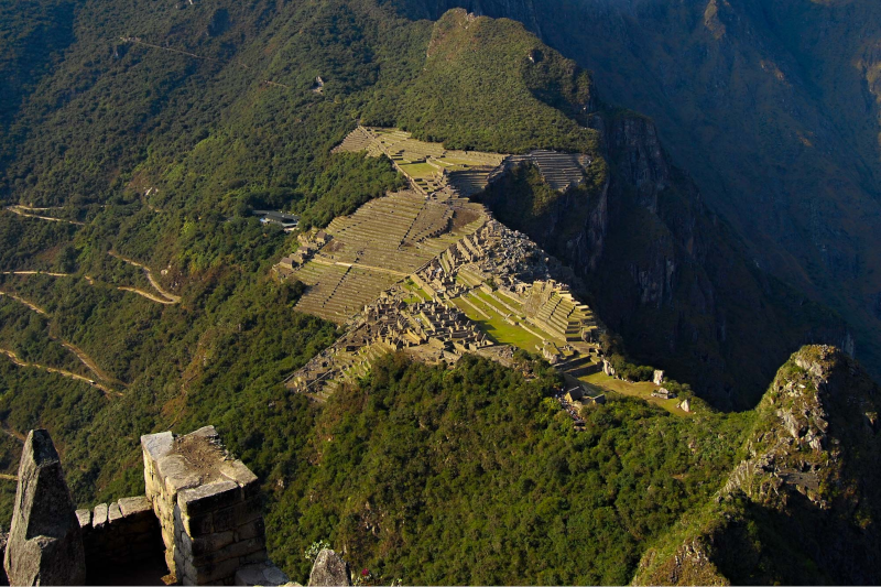
If you compare almost any picture of the classic view of this city of Machu Picchu, you’ll see a green thumb looking out of place, almost like it is pointing up. It’s Huayna Picchu. It is not located inside the primary citadel, but is one of the mountains that rises about 1,000 feet above the sanctuary and the misty dancing waves of the Urubamba River below.

Why the Huayna Picchu Stairs Are So Steep

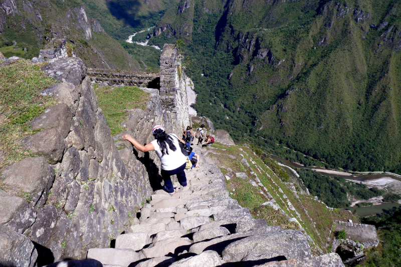
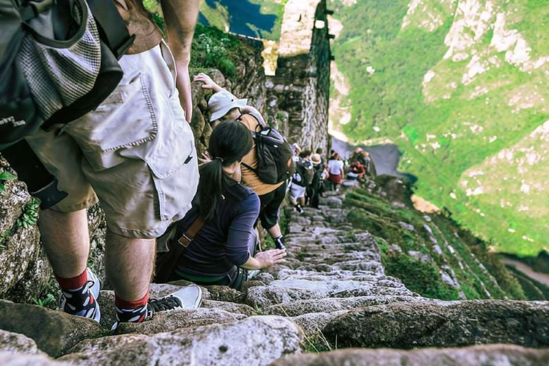
Why have steps in the large ramp made 60 degrees? They created these footpaths to lead up to the summits of the hills, fitting stones into the side of the hill at such an angle that it seems more like walking up an over-high ladder. As a result, the Huayna Picchu hike becomes extremely difficult, and many climbers must hold onto the rock with their hands just to maintain grip on the sheer granite face.

Today’s safety statistics by the park officers in Peru indicate that this route is not a “death-trap,” but rather a carefully-monitored track. Motorized machinery is currently driving rock stands and cables into the rock to provide visitors with a safe grip – turning this once terrifying Incan scouting route into a safe (although challenging) bucket list item.

Why the Incas Built a ‘Ladder into the Sky’: Engineering vs. Drama

In the course of looking up at the near-vertical slope of Huayna Picchu one might ask, “Why would anyone have constructed such a terrifying staircase?”. We aren’t searching for action on the part of the Incas, we’re searching for commanding control. 

This peak provided an unbeatable vantage point to guard Machu Picchu. Furthermore, the grueling path connected sacred sites, tying into the history of the great cavern ruins hidden within the mountain below. To reach these high-altitude sanctuaries safely, engineers had to conquer gravity.

Constructing steps in dirt was not enough, builders tied their paths to the mountain.In fact, engineers can describe the notorious Stairs of Death as an engineering school for slope and structure stabilization. The Inca builders designed them as arduous retaining structures that actively support the entire mountainside, preventing it from washing away.

The Engineering Behind the Stairs of Death

This 500 year longevity is based on three aspects of the masonry of the Incas, which are still apparent on the structures today:

  • The granite is finely cut and blocks fit together tightly without any mortar called ashlar.
  • Drainage channels: The channel structures, which are provided as a built-in effect, so that heavy rainfall from the Andes can be diverted from the foundations.
  • Interlocking joints: Stones tightly placed in the bedrock to ameliorate the impacts of an earthquake.

Imagine these high steps as an enormous drainage stone! The Incas learned how to control the flow of water to make its trails not liable to collapse in mud slides by understanding trial hydrology, or how water flowed down the steep ridge. This is not a walk along a trail, this is a journey up a super-smart water management system. It’s an invisible armor and the act of recognizing it is infinitely rewarding; however, the task is not the only hard task which awaits visitors to the tower. Deciding on the different goals of all the mountains to climb requires taking the physical requirements of each trail into consideration.

Choosing Your Peak: Huayna Picchu vs. Machu Picchu Mountain

Sitting in the ancient citadel, you’ll have to make your choice of Huayna Picchu vs. Machu Picchu Mountain: which form of exhaustion are you looking for? The path known as the “Stairs of Death” is a fast and swift scramble up vertical rocks and steel scaffolding that requires a good head for heights. The other mountain, however, is a good go-to take-it-easy endurance run. Your gain adjusts accordingly: Huayna Picchu places you almost directly above the ruins, delivering that famous bird’s-eye view, while the taller peak gives you a panoramic overview of the entire river valley.

Trying to determine the fitness needed for Peru treks is best done by comparing the hard data. These two trails require totally different type of energy reserves from hikers:

  • The total distance & elevation of the Huayna Picchu trail is about 950 feet over the course of one steep mile, while the other mountain trail has its elevation rose to 2100 feet in 2 mile hike.
  • Trail Style: Huayna has a narrow two-step path with often hand-over-hand climbing, its neighbor, however, involves a prolonged two-hour hike up paths that are wider and made of stones.

Finally, it is up to your personal preference if you choose to take a thrilling journey towards the top or burnt out legs hiking gently upwards. Posting your stone steps booking on either of the two sets entails some very limited modern-day booker system.

Bureaucracy: Circuit 4 Tickets and Permit Secrets

Modern foresight is needed to access these ancient steps. Travelers favor May to October as the best period to trek Huayna Picchu because the stones stay solid and dry instead of slippery and wet. During this peak season, authorities limit daily entry to preserve the ruins, so travelers must book 4–6 months in advance. Treat the process like buying front-row tickets to a show—if you wait too long, the mountain sells out.

The official government website is your next hurdle, where you must specifically select Machu Picchu Circuit 4 entrance tickets combined with the mountain. Circuit 4 acts as your designated pathway through the lower ruins, leading directly to the trailhead. A reliable permit booking guide will remind you these passes are timed and strictly non-transferable. Rangers meticulously check passports and enforce entry windows to prevent dangerous overcrowding on the ancient stairs.

Once past the checkpoint, the paperwork quickly fades into a very physical reality. Rangers mandate a strict one-way traffic flow, meaning there is no turning back once you commit to the narrowest sections. This system prevents dangerous bottlenecks on ledges plunging hundreds of feet into the valley below. You do realise as you’ll approach that you’re unlikely to be able to pull back quickly, adding to the psychological challenge of trying to climb back up. Which is their one-way trip and a different mindset towards dealing with the sheer vertical and the thickness of going up.

Conquering Verticality: Managing Fear of Heights and Altitude

A stone staircase of 60° descend is a brave person’s challenge for the bravest traveler. The “three points of contact” rule is used at Machu Picchu as a way of countering their fear of heights. When working up a steep attic ladder, grasp and take only two hands and one foot at a time—or two feet and one hand. This realistic and practical exercise allows you to concentrate on the solid rock in front and get onto it, rather than the dizzying plunge down into the valley.

How to Handle Altitude and Steep Terrain

stairs of death peru

But atop almost 9,000 feet, there’s another unseen battle going on in your body. Active hypoxia management, as opposed to passive measures, is essential to effective altitude illness prevention in Peru hikes. During hypoxia (or low oxygen) your tissues require oxygen but you don’t, and your heart begins to pound upon standing up! You can control this by taking intentional, rhythmic breaths and stepping gently on the ground, coordinating your breathing with your steps up the terraces instead of running.

The last layer of physical stability comes from your equipment. The key pieces of equipment for successful summits are those which allow for agility… and are close to the mountain, that is the centre of gravity:

  • Non-slip hiking boots: The ancient polished granite demands deep rubber footwear for comfortable grip.
  • Light daypack: A compact and secure pack allows you to have both your hands free for the climb.
  • A continuous supply of water: The need for 2 liters capacity for water to get rid of the symptoms at the heights efficiently.

A consistent pace and select gear can make the ascent of a mountain seem like a walk in the park! Once you understand how to safely navigate the verticality, the next crucial decision dictates your view from the top, hinging on weather and timing.

The Morning Choice: Early vs. Late Climbing Slots

The selection of an early or late morning climb can determine your whole mountain days experience physically and visually. The Andean mountains form a special micro-climate at sunrise which is characterized by frequent cloud covering of the mountains. The 7:00am entry is through hearty cool fog. It can build a “wall of white clouds” from the summit if you are looking for the famous valley views from the summit, but it may give a mysterious look to the ruins as well.

The 10:00 AM group wants an intense equatorial sun with the sacrifice of that morning chill.It’s a tradeoff between an intense, equatorial sun and the morning chill for the 10:00 AM group! When the mist clears, hard, intense light floods the ruins and enhances that famous “Machu Picchu” shot that belongs on magazine covers. Given the dramatic quality of the exposure, some people asked themselves if it is dangerous for visitors to walk by the “Inca steps” in the Full Sun. The heat of the day will make climbing a lot harder on the lungs, but the morning dew WON’T be as slippery as the stones baked dry by the sun during the day, and that’s a good thing.

In the end it’s a choice between cool and enigmatic mountains and panoramic views pouring down the sun. If you’re looking for a picture with a perfectly hit landscape, then you might prefer the latter. You’ve conquered the mountain and in many ways experienced the incredible beauty of this remarkable landscape, but now the descent reveals the one thing you might not have thought to look for: an incredible but lesser-known detour.

Beyond the Summit: Finding the Great Cavern and Temple of the Moon

For the trail up, there is a concealed option on the down side which could make it a very different hike. A faint fork just below the peak takes visitors off onto the shadowy side of the mountain which leads to the Temple of the Moon. This is a very ambitious route that takes a considerably longer detour (an additional hour of scrambling down followed by an intense climb back on the way to the start) so do be careful to consider your leg endurance when undertaking this trail.

Why construct a building within the shadowed overhang? The Great Cavern ruins have a rich historical and spiritual link with Incan spirituality and binding with the underworld. In contrast to the buildings built on the surface and designed to reflect the light of the sun, this underground location recognized the earth’s unique energies from within. Incan engineers incorporated sculpted stone altars into the natural rock face to help form a connection between the physical world and the spiritual world below.

Why the Temple of the Moon Is Worth the Detour

For the tourist, it’s a great way to explore routes to the Temple of the Moon. This challenging way is rewarded by three possibilities:

  • Spanning double doorways: This kind of entrances, each with its own 2-jamb, denoted high rank and are still gorgeous in this instance.
  • Acoustics of the ‘Great Cavern’ – the stone takes the form of a bend, which helps to amplify every sound and gives off a ‘temple atmosphere’ effect.
  • Less crowds: Many people miss out on this exhausting extra so you can enjoy exploring the ancient masonry near you.

To move away from those cool shadows it will take yet one more, deep-breathing effort to get up the granite stairs to the main exit path. This is your mystical detour to strengthen you physically and mentally on the way to its ultimate heartwarming stoking.

Final Ascent: Integrating the Experience into Your Travel Story

stairs of death peru

It’s no longer a sensationalised myth on the internet that you have to face Peru’s infamous stairs of death. Now, this high, steep granite ascent is a demonstration of ancient engineering and human effort. Climbing Huayna Picchu is not only about physical fitness; it is about physically connecting with the skill and craftsmanship of the Incan builders who, centuries ago, shaped and carried these stones by hand.

How to Prepare for the Huayna Picchu Climb

Taking this historical information and creating your own summits requires careful planning; you may need to perform significant physical work to climb this trail. When taking this bucket-list trip, walk through the following, factual time line:

  • Book four months ahead: Obtain your mountain permits in advance – only a certain number are available for each day!
  • 2 day acclimatization period in Cusco or Sacred Valley: Let your lungs acclimatize before taking the tough climb.
  • Wear shoes that grip stone like razors: Get quality hiking shoes with stepped / crisscrossed soles that will have enough traction to walk safely on the narrow and moist stone stairs.

The “deadly” part of the term is an exaggeration for well-prepared modern travelers, but “demanding” of course means very little. With your preparation you will take a frightening climb on a hill, make it a bridge that puts you right into the Incan’s heart of resilience. Each grievous inhale and all sorts of assiduous footsteps mimic the fidelity of the state that fashioned it from the heavens.

As you make that final step over the last terrace, and onto the pinnacle, the ancient world is revealed below. It’s easy to see exactly why they built upwards when you take in the extensive ruins of Machu Picchu from the exact same point the Incan priests once used to view from. This is the big eyeshot, it’s not a mere marvelous picture, it’s a right view taken which forever alters the manner in which you perceive the horizon of human capacity.

Frequently Asked Questions

Are the “Stairs of Death” at Huayna Picchu Actually Dangerous?

Although people use the nickname, it exaggerates the risk. Steel hand cables secure sections of the trail, one-way signs manage traffic on narrow stretches, and ranger-controlled timed entry regulates access. The route rises steeply, feels exposed, and demands effort at nearly 9,000 feet, but it does not become reckless or dangerous for reasonably fit and cautious.

Why Did the Incas Build Such a Steep Staircase?

The trail links religious locations and provides a strategic vantage point from which the Incas watch over Machu Picchu.These stone steps provide the mountain with additional stability, by precisely masonry built and included with proper drainage and stones which ensure they are strong enough and capable to support heavy rains and earthquakes.

Which Hike Should You Choose: Huayna Picchu or Machu Picchu Mountain?

Narrow stairs, dramatic views overlooking the ruins, Huayna Picchu is short, steep and exciting. Overall, there is more elevation and resistance to the hike at Mountain of Machu Picchu, with the paths being wider and views posted across the neighboring valleys.

How Do Permits and Circuit 4 Work?

Permits are likely to be sold out 4-6 months before the peak season. Over to Huayna Picchu can be hiked only with the Machu Picchu Circuit 4 (Huayna Picchu pass included). Passport checked, access limited and in terms of time so that no overcrowding takes place.

Should You Choose the Early or Late Morning Slot?

Early entries are cooler and quieter, with often times views being restricted by fog and stones that can be slippery. Subsequent entries tend to be less cloudy and drier, although they may prove to be more challenging due to the brighter sun.

Lake Sandoval Peru catches people completely off guard. Not because the photographs are misleading exactly, but because standing at that dark mirror with a giant otter family somewhere beyond the palm trees hits differently than any image. Nearby waterways rush past heavy with silt but this water does something else entirely: it sits perfectly still and dark in a silence that feels genuinely earned rather than empty.

Getting there takes real effort and local conse3rvationists describe these still waters as massive magnets for wildlife, pulling creatures out of dense foliage far more reliably than turbulent flooded riverbanks ever could. That pull becomes visible from the first minutes on the canoe.

What makes Lake Sandoval Peru genuinely different is the sheer volume of visible life concentrated along its quiet edges. Multiple monkey species, apex predators, prehistoric-looking birds, and nocturnal reptiles all share the same shoreline in ways that feel almost impossible given how much Amazon sprawls beyond these banks.

lake sandoval

From rushing river to silent mirror: how oxbow lakes form

Something the Madre de Dios River has been doing for longer than anyone can comprehend is twisting like a giant snake across flat jungle terrain. Over centuries those wide curves grow so extreme that the river carves a straight shortcut through the forest and simply abandons the loop behind it. Settling mud seals off that abandoned bend through sediment deposition and the classic horseshoe shape of an oxbow lake is what remains.

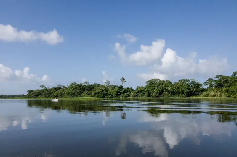
Stripped of the river’s churning currents Lake Sandoval Peru completely transforms. Muddy water clears as silt drops to the bottom leaving behind a dark tannin-stained black water ecosystem that acts like a perfect mirror. Delicate aquatic palms thrive in this perfectly still environment creating a lush underwater nursery for fish that concentrates the food supply the giant otters depend on.

Meeting the wolves of the water: finding giant river otters

Six feet long and sitting comfortably at the top of the local food chain, giant river otters rule Lake Sandoval Peru and make that clear immediately upon appearing. They hunt together in highly coordinated family packs that herd swift fish into the shallows through collective strategy rather than individual speed.

Wildlife encounters in tambopata are unlike anything available elsewhere in South America and the giant river otter family at Lake Sandoval is the clearest example of why. Any serious tambopata national reserve tours guide will explain that finding this endangered species requires using all your senses before any splash appears. Three unmistakable clues signal that a family is active nearby:

  • Loud rhythmic snorting or barking sounds echoing across the quiet water from somewhere along the bank.
  • Freshly cleared dirt dens carved directly into steep muddy banks indicating recent activity in the area.
  • Strong scent markings left on fallen logs to boldly claim their hunting grounds from competing families.

Once a family appears maintaining quiet respectful distance is crucial to avoid interrupting their vital feeding routine. Through binoculars the creamy white patches on their throats become visible, unique patterns that act like human fingerprints allowing researchers to identify individual animals across years of observation.

lake sandoval

Prehistoric echoes: identifying the hoatzin and macaws

Up from the water at Lake Sandoval Peru the canopy anchors itself in aguajales, flooded palm swamps where a fascinating ecological partnership between macaws and dead palms unfolds continuously. Dead palms provide hollowed trunks for macaw nesting while the birds scatter seeds to grow new trees. Three iconic residents define this canopy layer:

  • Blue-and-Yellow Macaw: bright canopy dwellers nesting high in dead palm trunks visible from the canoe.
  • Amazon Kingfisher: emerald hunters perched low over the water watching intensely for fish below the surface.
  • Hoatzin: bizarre blue-faced birds that look exactly like living dinosaurs and smell considerably worse.

The hoatzin earned the nickname stinkbird honestly and the smell confirms it immediately upon approach. Instead of a standard stomach it relies on bacterial fermentation to break down tough leaves acting like a flying cow. That process produces a distinct manure-like odor that guarantees memorable encounters as these birds clumsily flop through the foliage.

Eyes in the dark: spotting black caimans after sunset

Darkness arrives in the jungle fast and the daytime chorus fades almost immediately as nocturnal predators claim the shoreline. Gliding through Lake Sandoval Peru on night spotting canoes the first thing visible is glowing red orbs hovering just above the surface. That eerie shine is the tapetum lucidum, a reflective layer in the caiman’s eye that maximizes tiny amounts of moonlight helping them hunt in complete darkness.

Three species share the lake: the small Spectacled, the elusive Smooth-fronted, and the massive Black Caiman. Being cold-blooded they spend daylight hours absorbing warmth from sun-baked shallows to fuel their nightly patrols. The lake’s absolute stillness allows these reptiles to detect the faintest ripples of approaching prey in ways that moving water would completely mask.

lake sandoval

The path to paradise: navigating Puerto Maldonado logistics

At the Puerto Maldonado waterfront tambopata national reserve tours begin with a shift in scenery that catches most people off guard. Travelers board motorized canoes for a thrilling 45-minute journey down the wide rushing Madre de Dios River into the buffer zone, a protective outer ring of secondary forest designed to shield pristine jungle from nearby city expansion.

Our Puerto Maldonado Tambopata Tour 4 Days packages the entire experience into a structured itinerary making these transitions seamless, pairing the river journey with sunrise and sunset canoe outings and guided night spotting sessions after dark. Upon reaching the muddy riverbank a flat two-mile wooden boardwalk winds directly under dense canopy toward the lake. Staying on the established path through these restricted access zones is a vital element of jungle trekking safety rather than a suggestion.

The forest finally parts at the trail’s end revealing the glassy expanse of Lake Sandoval Peru. Motorboats are entirely banned on the lake to protect its profound silence and guides row wooden passenger canoes gently across the water ensuring resident wildlife remains undisturbed.

Timing your expedition: the best seasons for wildlife clarity

Best time to visit Peru for Amazon wildlife observation centers on water level rather than temperature preferences. Heavy rains swell rivers during high-water months allowing wildlife to spread into newly flooded forest while the low-water season shrinks the lake’s borders and concentrates thirsty animals around the remaining shoreline.

Seasonal breakdown for planning visits to Lake Sandoval Peru:

  • May to October low-water: drier conditions maximize chances of spotting predators on the banks with clear sightlines across shrinking shorelines.
  • November to April high-water: plentiful rains trigger widespread fruit abundance drawing vibrant canopy life to the water’s edge.

The friaje deserves mention as a genuine planning consideration. These powerful southern cold fronts temporarily plunge tropical temperatures into surprisingly chilly ranges between May and August catching visitors completely unprepared if they packed only for heat.

lake sandoval

Packing for humidity and jungle safety

Most first-time visitors to Amazon significantly underestimate what the gear situation actually requires. Earth-tone camouflage matters here because muted greens and browns blend into the forest background while bright colors alert wildlife and reduce encounter frequency considerably. Is Peru a good travel destination is a question that answers itself the moment someone steps onto the boardwalk toward Lake Sandoval Peru and hears the first monkey calls growing louder with every step.

Jungle air frequently holds 90 percent moisture and protecting electronics while choosing fabrics that dry quickly are fundamental rather than optional practices. Five non-negotiables for Lake Sandoval Peru:

  • 100% DEET insect repellent applied consistently throughout the visit.
  • Long-sleeved breathable shirts for both insect protection and sun exposure on open water.
  • Polarized sunglasses for cutting water glare during canoe observation sessions.
  • Dry bags for cameras and electronics that cannot recover from humidity damage.
  • A headlamp for night spotting outings and navigating the boardwalk after dark.

Protecting the jewel: how sustainable tourism preserves Lake Sandoval

Tambopata National Park protects this entire ecosystem from illegal logging and mining pressure that has degraded comparable areas across the southwestern Amazon. Lake Sandoval Peru sits within this protected framework and the controlled tourism model operating here proves in practice that a living forest holds far more value than harvested timber. Generating income that directly funds ongoing protection is how that argument wins rather than just gets made.

Booking eco-lodge accommodation that actively partners with local communities ensures visits fund conservation rather than undermining it. Places like Sandoval Lake Lodge channel tourism revenue into the protection frameworks that keep the lake intact. Gliding silently across that dark mirror-like water of Lake Sandoval Peru changes how the rainforest reads, not as scenery but as an interconnected breathing home.

lake sandoval

Q&A

What is an oxbow lake and how did Lake sandoval Peru become a black water mirror?

Lake Sandoval Peru formed when the Madre de Dios River cut a straight shortcut through an extreme meander abandoning a crescent-shaped loop later sealed by sediment deposition. Freed from fast silty currents the waters cleared as silt settled turning dark and tannin-stained. That still black water mirror surface nurtures the delicate aquatic palms and fish nurseries that define the lake’s exceptional wildlife conditions.

Why is wildlife viewing better at Lake Sandoval Peru than along the main river?

Still quiet waters pull animals from dense forest to the open shoreline far more reliably than turbulent flooded riverbanks and the lake’s calm edges concentrate activity in ways that make sightings predictable rather than lucky. During the low-water season from May through October shrinking shorelines further focus wildlife around the remaining water boosting visibility and photography opportunities considerably.

How do you find and respectfully observe giant river otters at Lake Sandoval Peru?

Use ears, eyes, and nose for three telltale signs before any splash appears: loud snorts and barks echoing over the water, fresh dirt dens dug into steep muddy banks, and strong scent marks on fallen logs. Once a family appears quiet respectful distance prevents disruption of their coordinated pack hunts. Binoculars reveal the unique creamy throat patches that function as individual fingerprints for identifying specific animals.

What are the logistics for visiting and what timing offers the clearest wildlife encounters?

From Puerto Maldonado a 45-minute motorized canoe journey down the Madre de Dios River leads into the buffer zone followed by a flat two-mile wooden boardwalk through restricted-access primary forest. Motorboats are banned on the lake so guides row wooden canoes to preserve silence. The low-water season from May through October concentrates predators along the banks while the high-water season brings fruit abundance and vibrant canopy activity.

What nighttime wildlife experience should visitors expect at Lake Sandoval Peru?

After dark tambopata national reserve tours run quiet night-spotting canoe outings where caiman eyes glow red through the tapetum lucidum reflective layer that amplifies moonlight. Three species patrol the lake: the small Spectacled, elusive Smooth-fronted, and massive Black Caiman, all thermoregulating in day-warmed shallows. Guides maintain respectful distance and follow strict safety practices throughout every outing.

Vinicunca stops people mid-sentence when they try to describe it. The photographs look edited and standing directly in front of it produces the same confusion because those horizontal bands of red, gold, lavender, and turquoise have no business looking the way they do. The Rainbow Mountain ATV tour exists because getting there on foot at 5,200 meters is hard in ways altitude specifically makes hard.

Arriving wrecked is a terrible way to experience something this visually extraordinary. Energy saved on the ascent means energy at the summit for actually being there rather than recovering from the climb. That distinction matters far more than most people think before they arrive.

Understanding the magic of Vinicunca

Glacial ice covered Vinicunca for centuries and nobody outside Peru knew it existed until around 2015. The glaciers receded, the mineral surface came into view, the photographs spread fast. The crowds followed those photographs.

The Vinicunca Formation explains what millions of years of tectonic and volcanic activity produced. Diverse mineral layers pushed upward from deep in the earth’s crust over timescales genuinely difficult to comprehend. Iron oxide gives the red, iron sulfide the yellow, oxidized limonite the purple, chlorite the green.

How high is Rainbow Mountain matters before planning any visit. The summit sits at 5,200 meters where oxygen runs roughly half of what it is at sea level. Every step feels heavier up there and that is physics not fitness.

Rainbow Mountain ATV tour

Why choose an ATV over hiking

The traditional hike takes between 1.5 and 2.5 hours and the final push surprises most people regardless of how prepared they felt beforehand. A Rainbow Mountain ATV tour cuts that down to roughly 30 minutes from base camp to the mountain pass.

The ride moves through breathtaking valleys along rugged dirt trails with wind in the face the entire way. Once the ATV drops riders off only a short 5 to 10 minute walk remains before the panoramic viewpoint opens up completely.

The views are identical whether someone hikes or rides but the energy spent getting there is not. For anyone wanting to arrive at the summit with something left in the tank the Rainbow Mountain ATV tour makes considerably more sense than the alternative.

Physical requirements for the ATV tour

No elite athleticism is required for a Rainbow Mountain ATV tour but the ride makes certain physical demands worth knowing before booking. The terrain is uneven, rocky, and sometimes muddy requiring moderate arm and hand strength to hold the handlebars and manage the brakes throughout.

Core engagement maintains balance on bumpy Andean trails and that surprises people who assumed the ATV would be entirely passive. Not cardiovascular fitness but a real physical requirement that the body feels afterward in ways people simply do not anticipate before the ride.

Anyone with severe cardiovascular or respiratory conditions should consult a doctor before booking a Rainbow Mountain ATV tour regardless of how the marketing describes the physical demand level on the route.

Rainbow Mountain ATV tour

Planning the journey: logistics and booking

Pickup in Cusco for a Rainbow Mountain ATV tour happens between 3:30 AM and 4:30 AM. Not optional. Exists to beat the summit crowds and allow enough time for everything the day involves across roughly 10 to 14 hours total.

The standard route heads south from Cusco through the South Valley with a breakfast stop before continuing to the ATV base camp at Japura. The full sequence from Cusco:

  • Early morning pickup: guides collect travelers from accommodation between 3:30 and 4:30 AM.
  • Drive south: approximately two hours by van through the South Valley towns.
  • Breakfast stop: a meal in Pitumarca or Cusipata to fuel the morning ahead.
  • Arrival at base camp: another hour of driving up mountain roads leads to Japura and the safety briefing.

Finding the right operator

Off-roading at 5,200 meters with a company cutting corners on safety is a bad idea that becomes obvious at the worst possible moment. The cheapest Rainbow Mountain ATV tour price on Cusco’s streets is genuinely not where to start. Well-maintained vehicles, proper helmets and gloves, emergency oxygen tanks, and first-aid kits on every trip are the baseline requirements worth verifying before booking anything.

A Rainbow Mountain ATV tour booked through a premium agency allows for a private guide and dedicated driver making the experience far more flexible than group departures for travelers who prefer stopping for photographs without waiting for strangers.

Age restrictions apply consistently: drivers must be at least 16 and younger travelers between roughly 8 and 15 can participate as passengers behind an experienced adult driver or guide on the circuit.

Rainbow Mountain ATV tour

Health and safety at high altitude

The altitude is the actual wildcard of any Rainbow Mountain ATV tour not the riding itself. The ATV carries riders up quickly meaning the body has less time to adjust to thinning air compared to a slow hike. The tradeoff is that cardiovascular exertion stays lower throughout which actually helps manage the immediate exhaustion of high-altitude trekking considerably.

To avoid altitude sickness before attempting a Rainbow Mountain ATV tour these acclimatization steps make a real difference:

  • Take it easy upon arrival: spend the first 48 to 72 hours in Cusco at 3,400 meters or the Sacred Valley without strenuous activity.
  • Hydrate relentlessly: the high mountain air is incredibly dry and water intake needs to exceed what feels necessary throughout the day.
  • Skip the alcohol: avoid alcohol and heavy fatty meals for the first few days since digestion slows at altitude.

Coca tea in Cusco is what most travelers encounter first and it genuinely works for managing symptoms. Drinking mate de coca at breakfast or chewing coca leaves during the ride addresses altitude symptoms in ways local communities have relied on for centuries. Consulting a doctor about Acetazolamide before departure is worth doing for anyone who has experienced altitude sickness previously.

Weather and best time to go

Timing a Rainbow Mountain ATV tour correctly matters considerably more than most operators acknowledge. The Andean climate changes fast and the dry season running May through October brings clear blue skies during the day with temperatures dropping below freezing in mornings and at night.

The wet season runs November through April with heavy rainfall, snow at higher elevations, and thick fog that obscures the mountain’s color bands entirely. Going during wet season makes the trip visually pointless regardless of riding conditions on the trail.

Best times to visit Rainbow Mountain for off-roading fall within the dry season between May and September or the shoulder months of April and October when firm dry paths provide traction and clear skies make the mineral colors appear most vividly.

Rainbow Mountain ATV tour

What to pack for the ride

Riding an open-air vehicle at 5,200 meters means exposure to freezing wind, intense UV radiation, and weather shifts that arrive without warning. A proper packing list for a Rainbow Mountain adventure makes or breaks the comfort level of the entire experience. What actually needs to come along:

  • Layered clothing: a moisture-wicking base layer, an insulating fleece or alpaca sweater, and a windproof waterproof jacket on top.
  • Face and eye protection: a buff or scarf is mandatory since the ATVs kick up significant dust. High-quality polarized sunglasses protect against dust and intense UV glare off lingering snow.
  • Warm accessories: thermal gloves for holding cold handlebars and a warm beanie for the ride and the summit.
  • Sun protection: high-SPF sunscreen applied before departure and reapplied at the summit since UV exposure intensifies considerably at this elevation.
  • Daypack essentials: water, high-energy snacks like chocolate or trail mix, toilet paper, hand sanitizer, and extra soles for tipping guides or using highland restrooms.

Extending the adventure beyond the summit

Most visitors face one direction at the viewpoint and completely miss what sits directly behind them. Turning around reveals sweeping views of the Ausangate glacier, the highest peak in the Cusco region and a deeply sacred Apu for local Andean communities. That contrast between snowy jagged glacier and the red desert-like earth of Vinicunca is visually striking in ways the main viewpoint photograph simply does not capture.6

A day trip from Cusco to Red Valley adds something genuinely worth the extra walking. The Red Valley sits about 20 minutes from the main Rainbow Mountain viewpoint and iron oxide concentration dyes the hills and valleys a deep vibrant crimson. Far fewer tourists make the detour and the result is a quiet almost Martian landscape.

Rainbow Mountain vs Palcoyo is worth understanding before committing to either destination. Palccoyo sits at slightly lower elevation, requires only a gentle 30-minute flat walk, and sees significantly fewer visitors. ATV tours typically do not operate in Palccoyo but it works well as a backup plan for families or anyone struggling to acclimatize to the primary Rainbow Mountain ATV tour elevation.

Rainbow Mountain ATV tour

Frequently asked questions

Why is Vinicunca colorful? 

So the short answer is minerals pushed up from deep underground over millions of years. Each mineral produces a different color when sunlight hits it. Iron oxide does the red, iron sulfide the yellow, oxidized limonite the purple, chlorite the green. Dry season is when those bands look most vivid and most clearly separated. That is honestly why booking a Rainbow Mountain ATV tour between May and September makes such a visible difference compared to any other time of year.

What is the Vinicunca elevation?

5,200 meters at the primary viewpoint and that number deserves real attention before booking any Rainbow Mountain ATV tour. At that height lower oxygen intensifies fatigue, headaches, and nausea in ways that catch people completely off guard even when they thought they were adequately prepared. Spending real time at lower elevation in Cusco or the Sacred Valley before the tour makes a measurable difference in how the summit actually feels on the day.

How far is Vinicunca from Cusco?

Roughly three hours by road depending on which route the operator takes and most Rainbow Mountain ATV tour itineraries include a breakfast stop somewhere along the way. Exact travel time varies by road conditions and whether the approach comes through Pitumarca, Cusipata, or a different access point entirely.

How long is a Rainbow Mountain ATV tour day?

Most group Rainbow Mountain ATV tour days run between 10 and 14 hours door to door from Cusco. That covers transfers, meals, safety briefing at base camp, the ATV segment itself, time at the viewpoint, and the optional Red Valley addition if included. Private tours can run shorter or longer depending on what gets agreed with the operator beforehand.

Do I need ATV experience or a driver’s license?

Most Rainbow Mountain ATV tour operators design the route for people who have never ridden before and include a safety briefing plus a short practice period before the main ride begins. Licensing requirements vary between companies and may differ for drivers versus passengers so confirming policy at booking and bringing identification is advisable regardless of prior experience.

Ready to ride

Most Andean experiences do not offer this kind of balance between genuine adventure and accessible travel. A Rainbow Mountain ATV tour does. The motorized ascent saves energy, beats the crowds to the summit, and adds something to Vinicunca that arriving on foot cannot replicate.

Acclimatize properly in the days before, pack the right gear, choose an operator who takes safety seriously. The ride up to this geological marvel will stand out long after the Peru trip ends.