Puka Pukara sits above Cusco like a quiet coworker in the corner—watching, doing its job, not making a fuss. And then, when you finally pay attention, you realize it’s been holding the whole operation together. Roads. Sightlines. Control points. The kind of “systems thinking” the Inca state was really good at.

So if you’re a history buff, or a traveler who likes your ruins with a little context (and a little less chaos), this is for you.

“It’s a fortress.” Also: it’s not only a fortress.
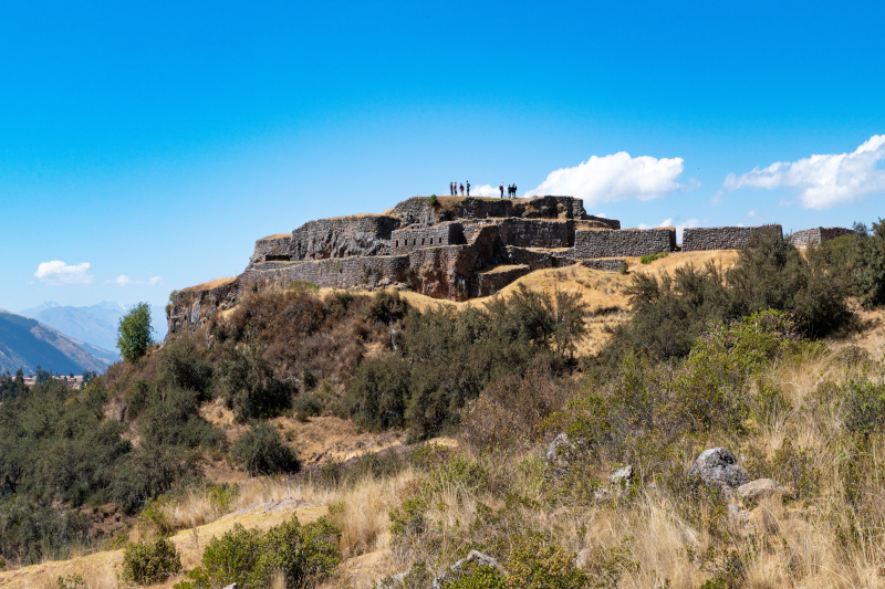
Puka Pukara Archaeological Complex

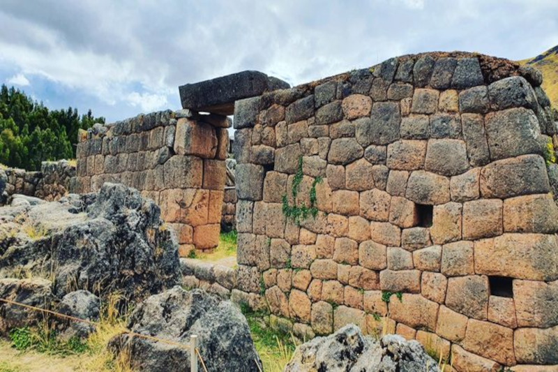
Most people hear “Inca fortress” and picture a dramatic castle vibe. Fair enough. Puka Pukara has defensive-looking walls, high viewpoints, and that unmistakable sense of “this spot matters.”

But here’s the thing: calling it only a fortress is like calling an airport “a building with planes.” True, but you miss the point.

The Puka Pukara Archaeological Complex likely worked as a control site along key routes leading in and out of Cusco. Think checkpoint, lookout, and maybe a small hub for state travel. Not glamorous. Very effective. And if you’re into how empires run on logistics (not only temples), this place suddenly gets interesting.

There’s also the name. “Puka” is commonly read as “red,” and “pukara” as “fortress.” In late afternoon light, the stones can take on a warm, rusty tint. It’s subtle. But it sticks with you.

Okay, so what are you looking at up there?

Let’s be honest: if you arrive with no mental map, Puka Pukara can feel like a quick stroll through broken walls and terraces. Then you leave and wonder why it made the tour list.

So give yourself a simple lens: follow the wayfinding. The Incas were obsessed with guiding movement—where you walk, where you pause, what you can see, what you can’t. Puka Pukara makes more sense when you read it like a designed route rather than a random pile of stone.

Here’s what to notice:

  • Layered terraces: They’re not only “steps.” They shape the hillside into usable platforms, like turning a steep spreadsheet into clean rows you can actually work with.
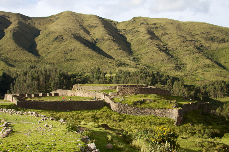
Puka Pukara Archaeological Complex
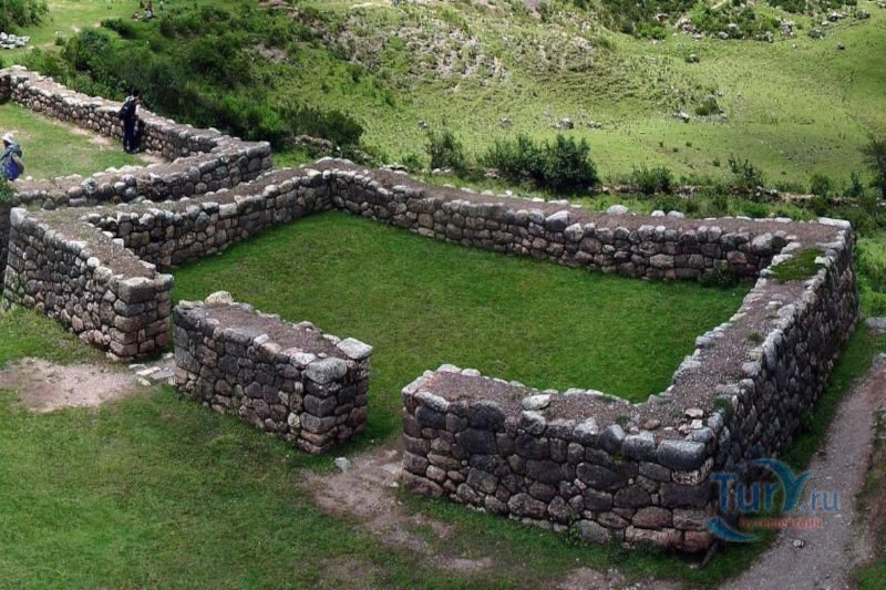
  • Walls with corners and turns: Straight walls are one thing. The bends and angles are where you feel control—narrowing access, creating chokepoints, and setting up sightlines.
  • Small enclosures: Some spaces feel like rooms, others like holding areas. Nobody can promise exactly who stood where, but the layout hints at managed activity, not casual wandering.
  • Viewpoints: This is the big one. The visibility is the feature. Look out and ask: what roads or valleys would be easy to monitor from here?

And yes—part of the fun is that Puka Pukara doesn’t hand you a single “wow” object. It asks you to connect dots. A little more effort, a lot more payoff.

Puka Pukara Peru: the neighborhood matters

Puka Pukara doesn’t sit alone. It’s part of a cluster of sites that get packaged as the Cusco “city tour” circuit, usually alongside Sacsayhuamán, Qenqo, and Tambomachay.

That grouping can feel touristy (because it is), but it’s also historically useful. The Inca heartland around Cusco was dense with function: ceremony, water, carved stone, military control, and the everyday machinery of governance.

If Sacsayhuamán is the headline act, Puka Pukara is the supporting role that makes the plot believable.

Also, it sits close to Tambomachay, which is famous for water channels and ritual associations. Pairing them is a nice contrast: Tambomachay pulls you inward—water, precision, calm. Puka Pukara pushes your attention outward—routes, lookout logic, movement.

Let’s talk about the Puka Pukara altitude (because your lungs will)

Altitude is the quiet factor that changes everything in Cusco. You can be in great shape and still feel a little humbled. That’s not you being dramatic; it’s physics.

The Puka Pukara altitude is often listed in the mid-3,000-meter range above sea level, and sources vary depending on the measuring point. The practical takeaway is simpler: it’s high, it’s exposed, and your pace will slow down.

Small tips that sound boring—until they save your day:

  • Move like you mean it… but slower. Quick bursts on stone steps are where people get woozy.
  • Sun is louder at altitude. A hat and sunscreen feel optional in the city. Up there? They’re part of the kit.
  • Drink water, don’t chug water. Steady sips. Your body’s already adjusting.
  • Bring a light layer. Cusco weather loves mood swings—sun one minute, wind the next.
Puka Pukara Archaeological Complex

And if you’re newly arrived, build your itinerary like a project plan with a buffer. Your first day is not the moment to sprint from one high site to the next. Honestly, letting your body catch up is the most “pro traveler” move you can make.

City tour tips that keep it fun (not frantic)

Here’s the mild contradiction: the city tour is a great idea… and the city tour can be kind of terrible.

It’s great because it’s efficient. Transportation is handled. You see a lot fast. If you’re short on time, it’s the cleanest way to get your bearings.

It can be terrible because “efficient” often means “rushed.” Sites blur together. You spend more time herding than learning. And Puka Pukara, being smaller, becomes the classic victim of the schedule.

So what do you do? You manage the day like a calm operator, not like a passenger.

A few moves that help:

  • Ask the guide for a 10-minute “quiet look” window. Even good guides slip into autopilot. A simple request can change the rhythm.
  • Use Google Maps as your backup brain. Not for a history lecture—just to understand spacing and direction between sites. It helps you grasp the landscape.
  • Bring snacks you actually like. When your blood sugar drops at altitude, everything feels harder. A granola bar becomes a strategic asset.
  • Keep your questions focused. Instead of “What is this?” ask “What’s the strongest evidence for that?” Guides tend to rise to that level.

If you’re going independently, the logistics get simpler than people think. You can hire a taxi for a set loop, or coordinate a ride through apps locals use in Peru (availability varies), or join a small group tour via your hotel or a reputable local operator. The key is timing, not perfection.

When to go (and why your photos aren’t the main point)

Dry season (roughly May through October) tends to bring clearer skies and steadier footing. Rainy season can be lush and dramatic, but paths get slick and the clouds roll in fast.

Time of day matters too. If you want that “red fortress” look, late afternoon light can make the stone feel warmer. Midday can be bright and harsh—good for visibility, less forgiving for faces in photos.

And sure, you’ll take photos. Everyone does. But Puka Pukara is one of those sites where the real memory is a feeling: standing on a terrace, wind in your ears, and realizing the Incas chose this spot because it controls the story the landscape tells.
Puka Pukara Archaeological Complex

A quick “history buff” checklist (without turning it into homework)

If you like leaving a site with more than a vague impression, keep these questions in your pocket:

  • What can you see from here that you can’t see from below? Visibility is power.
  • Where would movement be easy, and where would it be slowed? That’s the difference between a path and a controlled approach.
  • How does this compare to nearby sites? Puka Pukara makes more sense when you contrast it with Tambomachay’s water focus or Sacsayhuamán’s monumental scale.

None of this requires a PhD. It’s more like reading a well-designed city: you notice why streets turn, why plazas open, why some buildings sit high. The logic is there if you look.

So, is Puka Pukara “worth it”?

Yes—and not because it’s the flashiest stop near Cusco.

Puka Pukara is worth it because it shows the Inca state in working mode. It’s the kind of place that whispers, “This empire didn’t run on vibes.” It ran on routes, control points, and smart use of terrain.

If you’re traveling through Puka Pukara Peru territory on a city tour, try giving this site a little extra attention. Slow down. Look outward. Trace the lines of walls the way you’d trace a plan on a whiteboard.

And then, when you head back to Cusco—maybe for a coffee, maybe for a pisco sour, maybe for an early night because altitude wins—you’ll realize something nice happened. The day didn’t feel like a checklist. It felt like a story you could actually follow.
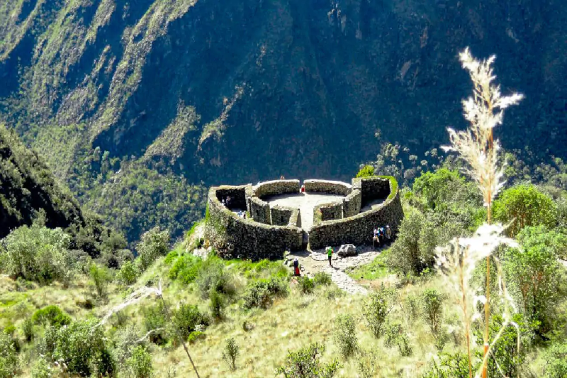
Runkurakay is one of those places that’s easy to miss on paper and hard to forget in person. It’s not huge. It doesn’t scream for attention. But when you reach it on the Inca Trail—lungs working overtime, legs negotiating those stone steps—it hits different. You stop. You look. And you think, wait… why here?

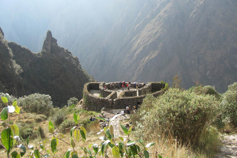
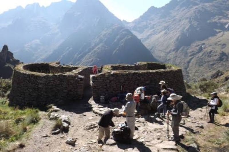
The Runkurakay ruins sit up in the Andes on the way to Machu Picchu. People often describe the site as “circular,” and that’s fair. The shape feels unusual compared to many boxier Inca buildings. It’s like the trail hands you a round stone pause button.

So what is Runkurakay, really?

Runkurakay

Most guides will tell you Runkurakay likely worked as a tampu—basically a way station. Think of it as a trail-side operations node. A place for rest, a place for oversight, maybe a place where supplies were staged or messages were relayed. Not glamorous, but important.

And here’s the mild contradiction: it feels both practical and a bit ceremonial. That sounds like a hedge, I know. But it fits the Inca way of building—function and meaning often shared the same walls. A checkpoint can also be a statement. A shelter can also be a signal.

Also, you’ll see the name spelled a few ways (Runkurakay, Runkuraqay, and so on). Don’t stress. Quechua place names get spelled the way different ears hear them, and the trail doesn’t care about our spelling debates.

The climb, the pass, and that “why am I doing this?” moment

Runkurakay is tied to the climb toward Runkurakay Pass, a high point on the route. Sitting at 3,760 meters (12,335 feet)—with the pass itself looming just above at nearly 3,950 meters (12,959 feet)—elevation up there is no abstract number; it’s an experience. Your pace slows. Your breath gets louder. Your brain does that funny thing where it gets emotional about a rock because the rock is… still there, and you are tired.

But that’s also why the location makes sense. If you’re running a long-distance mountain route—ancient or modern—you plan for fatigue, weather, and bottlenecks. In project terms, this is risk management and resource planning, except the “resources” are people, food, and time, and the “weather report” is the cloud line rolling in.

One more quiet detail: a spot like this can do several jobs at once. It can offer cover. It can watch a corridor of movement. It can mark a threshold between valleys. It can also make travelers feel seen—which is a kind of control, isn’t it?

Small walls, big questions

Runkurakay feels mysterious because it leaves space. You can tell it mattered, but it doesn’t hand you a neat label. Who stayed here—messengers, porters, officials? How often? For how long? And what did the place mean to them when the mountains weren’t a backdrop for photos, but a living force with moods?

Runkurakay

The rounded layout adds to that feeling. Curves change how you move. They change how sound carries. They change how you look out at the slope. And even if you’re not an architecture person, you can feel the difference in your body. The place nudges you to slow down.

Zoom out a bit: the Inca Trail as a “system”

It’s tempting to treat the Inca Trail like a single task: hike, arrive, celebrate. But the trail was a network—more like a well-run logistics chain than a lone footpath. Sites along the way act like checkpoints, handoff points, and support hubs. If you’ve ever worked on a team project with deadlines, you know how much effort goes into the parts nobody claps for.

And that’s where Runkurakay starts to shine. It’s not trying to compete with Machu Picchu. It’s doing a different job. It shows how an empire handled movement through harsh terrain: steady, planned, and a little bit intimidating. Not in a villain way—more in a “we’ve thought this through” way.

That said, archaeology is careful work. Some interpretations are strong; others are educated guesses. If you hear two versions of the story on the same day, that’s not failure. That’s the field doing its job.

Little things to notice (without turning it into homework)

When you arrive, try this simple sequence—quick, not fussy:

  • Look out first. What can the site “see”? What can it’t?
  • Then look close. Stone fit, wall lines, doorways—small choices with big intent.
  • Then look back at the trail. Where did you come from, and where are you being sent next?

It’s a bit like reviewing a workflow. You notice the inputs, the bottlenecks, the handoffs. Only here, the “workflow” is a mountain pass, and the stakeholders are time, weather, and human endurance.

Quick reality check: how to enjoy it without wrecking it

Runkurakay

Runkurakay is tough enough to reach; it doesn’t need extra wear and tear. Stay on the path. Don’t climb on fragile stone. Give other hikers room—trail etiquette matters when everyone’s running on thin air and snack bars.

And yes, this is where modern trends show up. People track altitude on watches, compare trekking poles, post clips, chase the “quiet season.” None of that is wrong. But the site rewards a different kind of attention, too—the kind that lasts longer than a feed refresh.

Leaving with the right kind of aftertaste

Runkurakay doesn’t deliver a grand finale. It delivers a lingering thought. You pass through, you recover your breath, and you carry on. Later, you’ll remember the curve of the walls, the sharp air, the feeling that the trail was designed by people who understood both logistics and awe.

So if you’re headed that way, give it a minute. Not a rushed minute—an honest one. Let the place be both a practical stop and a strange little question mark. Because, really, isn’t that what makes travel stick?

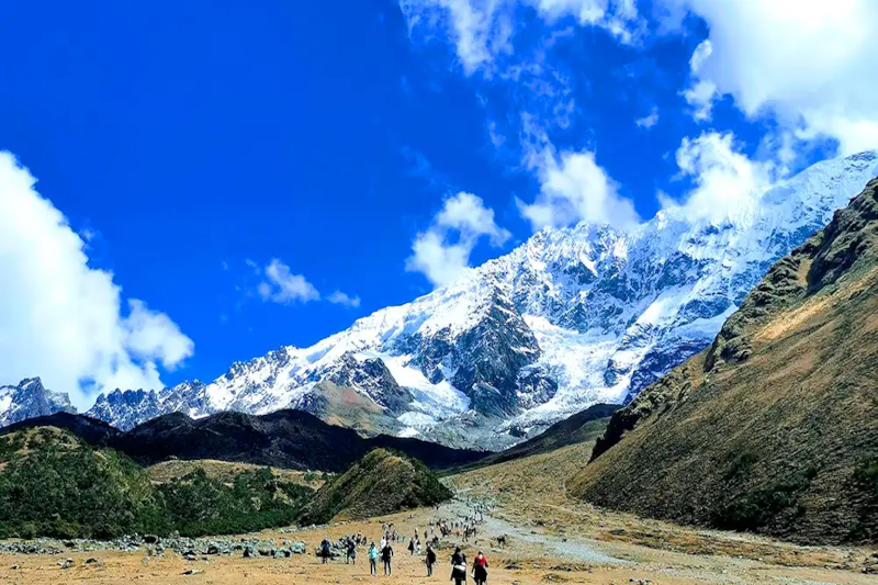
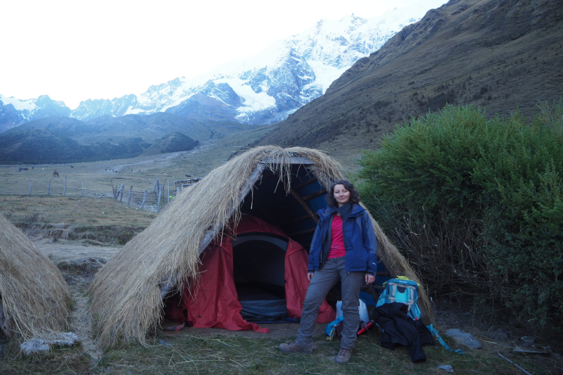
Soraypampa is the kind of place that makes you feel two opposite truths at once: you’re wildly alive under a sky packed with stars—and you’re also very aware you’re trying to sleep at nearly 13,000 feet. This is Soraypampa Campsite: What Sleeping at 3, 900m Feels Like in real life: a thin-air night where your body negotiates for oxygen, your gear choices suddenly matter, and your “normal” sleep routine gets rewritten.

If you’re heading to Soraypampa Peru on the Salkantay route, this guide breaks down what the altitude does to sleep, what the Soraypampa camping experience is actually like, and how to make the night more comfortable—whether you’re in tents vs cabins Soraypampa, a Soraypampa lodge, or a Soraypampa hostel-style setup.

Where Soraypampa Sits on the Trek (and Why It Feels So High)

soraypampa

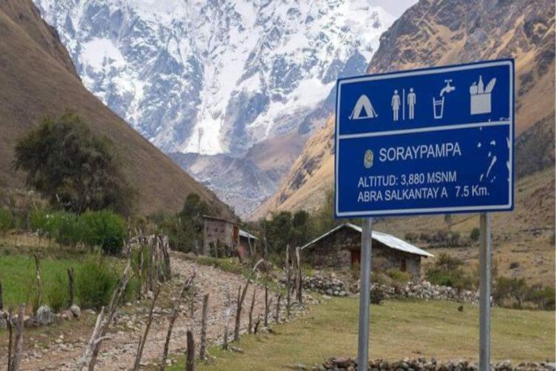
Soraypampa campsite altitude is commonly cited around 3,900 m, and you feel it fast. The campsite is a classic first-night stop for many itineraries—especially if you travel Mollepata to Soraypampa on day one—because it positions you for an early climb toward the Salkantay Pass the next morning.

What that means for sleep:

  • Your body may not be fully acclimatized yet.
  • You might arrive tired, slightly dehydrated, and with appetite changes.
  • Nighttime cold plus low oxygen can make rest feel “light” or broken.

The Soraypampa altitude isn’t just a number; it’s the reason people lie awake thinking, “Why am I breathing like this while I’m doing nothing?”

What Sleeping at 3,900m Actually Feels Like

Sleeping high isn’t always dramatic. Often, it’s subtle—until it isn’t. Common sensations at Salkantay Trek Soraypampa camp include:

1) Weird breathing patterns

At altitude, you can experience periodic breathing: you drift off, breathe shallowly, then wake up feeling like you need a deeper breath. It’s not necessarily dangerous, but it’s unsettling if you’ve never felt it.

2) A “wired but tired” body

You’re exhausted from hiking, yet your sleep feels thin—like you’re hovering near the surface instead of dropping into deep rest.

3) Cold you notice in your bones

Even if your upper body feels warm, feet and hips can get chilled quickly. Soraypampa temperature at night often drops close to freezing (and can dip below), depending on season and wind exposure.

4) Appetite changes (and the snack dilemma)

Some people don’t feel hungry at dinner, then wake up at 2 a.m. starving. Others have the opposite: no appetite at all, which makes it harder to keep energy up.

5) Morning head pressure

Not always pain—sometimes just a “tight” forehead sensation. This is one of the classic sleeping at 3900 meters symptoms many hikers describe after a restless first night.

Altitude Symptoms vs. “Normal Discomfort”: What’s Typical?

soraypampa

Most people experience mild effects at Soraypampa campsite. Typical altitude sickness symptoms:

  • Light headache
  • Slight nausea
  • Reduced appetite
  • Restless sleep
  • Shortness of breath on small efforts

Red flags are different:

  • Severe headache not improving with rest/hydration
  • Persistent vomiting
  • Confusion, trouble walking straight
  • Chest tightness, severe breathlessness at rest

If red flags appear, don’t try to “tough it out.” Descending is the most effective response.

Soraypampa Campsite Facilities: What to Expect on Arrival

Soraypampa campsite facilities vary by operator and season, but generally you’ll find:

  • Designated camping zones with wind exposure
  • Bathrooms (sometimes basic; sometimes better-managed)
  • A dining tent/communal shelter with guided groups
  • Limited lighting at night (headlamp required)
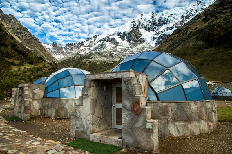
  • Some sites offer cabins or domes (a big comfort upgrade)

If you’re comparing comfort levels, Soraypampa accommodation often splits into:

  • Soraypampa camping in tents (most common)
  • Dome-style glamping such as Sky Camp Soraypampa
  • A Soraypampa lodge or cabin option (warmer, less wind, easier sleep)
  • Budget-friendly “hostel-like” options (often referred to by travelers as a Soraypampa hostel experience, though the setup can be rustic)
soraypampa

Soraypampa Peru Weather: The Night Is the Real Test

When people search Soraypampa Peru weather, they usually want to know one thing: “How cold will it be when I’m trying to sleep?”

Key patterns:

  • Afternoons can be sunny and deceptively mild.
  • Wind increases chill quickly once the sun drops.
  • Nights are cold year-round at this elevation.
  • In wetter months, dampness plus cold can feel harsher than the temperature suggests.

Practical take: plan for freezing-adjacent conditions even if your day hike felt warm.

How to Sleep Better at High Altitude (Actionable, Field-Tested)

If you want to know how to sleep better at high altitude, focus on oxygen, warmth, hydration, and routine.

Dial in altitude sickness prevention camping basics

  • Go slower than you think you need to. Arriving less “blown up” improves sleep.
  • Hydrate early, not just at dinner. Clear-ish urine is a decent quick check.
  • Avoid alcohol the day before and the day of sleeping at Soraypampa.
  • Eat a real dinner even if you’re not hungry—carbs often sit easiest.

Use coca tea the right way

Many trekkers use coca tea for altitude sickness (or for the “altitude blah” feeling). It can be soothing and warming at night. Treat it as a comfort tool, not a cure:

  • Sip it earlier in the evening so you’re not up all night peeing.
  • Pair it with hydration and warmth.

Sleep system tweaks that matter

  • Put tomorrow’s clothes in your sleeping bag for warmth.
  • Warm your feet: dry socks + loosened laces before bed.
  • Use a buff as a sleep mask and to warm your face.
  • Keep a small snack accessible (nuts, chocolate, crackers) for 2 a.m. wake-ups.

Best Sleeping Bag for 4000m: What Actually Works at Soraypampa

Choosing the best sleeping bag for 4000m is less about brand and more about temperature rating, insulation type, and whether you sleep cold.

A practical target for Soraypampa:

  • Comfort rating around -5°C to 0°C (23°F to 32°F) for most people
  • If you sleep cold, go warmer—especially in a tent with wind
soraypampa

Other high-impact items:

  • Insulated sleeping pad (more important than people think)
  • Liner (adds warmth and keeps the bag cleaner)
  • Puffy jacket + beanie reserved for camp only (stay dry)

This is where “I’ll be fine” becomes “I’m counting minutes until sunrise.” Don’t under-pack your sleep system.

Getting There: Mollepata to Soraypampa (and Transport Questions)

Most trekkers reach camp as part of a guided itinerary, often after starting in Cusco and transferring toward Mollepata before continuing uphill. If you’re researching the bus from Cusco to Soraypampa, note that independent logistics can vary by season and road conditions; many people end up using:

  • Shared transport to Mollepata, then onward by car/van
  • Private transfer if traveling with a group or tight timeline

Whichever route you take, the day’s elevation gain is what matters for sleep—pace yourself on the ascent from Mollepata to Soraypampa.

soraypampa

Soraypampa vs Huayracmachay Camp vs Chaullay: Which Sleep Is Easier?

If you’re comparing camps, here’s the honest trade-off:

Soraypampa vs Huayracmachay camp

  • Soraypampa: higher, colder, more altitude impact on sleep; iconic views and a common staging point.
  • Huayracmachay: typically lower than Soraypampa (depending on exact site), often slightly easier breathing and warmer sleep—but you may change your next-day pacing.

Soraypampa camp vs Chaullay

  • Chaullay is much lower, usually warmer, and sleep tends to be deeper—many people feel dramatically better there.
  • But if you skip Soraypampa, you may lose the classic early start rhythm for the pass, depending on itinerary.

If your top priority is sleep comfort, lower is usually easier. If your priority is the classic Salkantay staging and sunrise/alpine vibe, Soraypampa wins.

Tents vs Cabins Soraypampa: What to Choose

If you have a choice, tents vs cabins Soraypampa comes down to wind, warmth, and how sensitive you are to altitude sleep disruption.

Tents are great if:

  • You have a warm bag + good pad
  • You’re comfortable with temperature swings and noise
  • You want the “true” Soraypampa camping experience

Cabins/domes (including Sky Camp Soraypampa) can be worth it if:

  • You sleep cold
  • You’re worried about restless nights at altitude
  • You want faster recovery for the pass day

Either way, keep expectations realistic: altitude is altitude, even indoors.

Soraypampa Campsite Booking and What to Pack

For Soraypampa campsite booking, many travelers secure spots through a Salkantay operator who bundles meals, tents, and camp access. If you’re going independent, confirm in advance what’s included and what’s not (sleeping bag rental quality varies).

For what to pack for Soraypampa camp, prioritize sleep and warmth:

  • Warm sleeping bag (see above) + insulated pad
  • Down or synthetic puffy + base layers
  • Beanie, gloves, thick sleep socks
  • Headlamp + spare batteries
  • Lip balm + moisturizer (dry air is real)
  • Electrolytes + easy snacks
  • Earplugs (wind + group camps)

Takeaway: A High Night You’ll Remember (and How to Make It Better)

Sleeping at Soraypampa isn’t about perfect rest—it’s about managing Soraypampa altitude so you can enjoy the landscape and still function for the next day. With the right sleep system, smart pacing, and practical altitude sickness prevention camping habits, you can turn a potentially rough night into a memorable one—stars overhead, cold air in your lungs, and the quiet satisfaction of handling Soraypampa campsite at 3,900 meters.

Looking for a scenic, adrenaline optional way to explore Inca engineering and Andean landscapes, without committing to a full day ride? This half day Sacred Valley bike tour to Maras and Moray is one of the smartest add ons to a Peru itinerary. Especially ideal for acclimating in Cusco before Machu Picchu. Getting moving, breathing the highland air, experiencing the Sacred Valley’s gentler descents before tackling bigger hikes or higher viewpoints.

This guide breaks down why this Maras Moray Bike Tour remains a favorite among travelers wanting culture, countryside, and a rewarding downhill ride, all in one morning.

Why Choose a Half-Day Maras & Moray Ride in the Sacred Valley?

Many travelers search for sacred valley bike tours because they want more than a van and photo stop day. A bike gives that wind in your face feeling that makes the Andean landscape memorable, but a half day format keeps it accessible even for someone new to peru mountain biking.

A well run Maras Moray bike tour hits the sweet spot. Enough riding to feel like a real adventure. Enough guiding to keep logistics simple. Enough time left to enjoy lunch, markets, or another activity in the afternoon.

Comparing peru bike tours? This route also suits travelers wanting an iconic Sacred Valley experience without the bigger time commitment of longer rides.

What You’ll See: Moray + Maras (The Sacred Valley’s Most Photogenic Pair)

A classic sacred valley bike tour stands out because it blends archaeology and living traditions. On this route, the two key stops, Moray and Maras, deliver exactly that.

Moray Terraces: An Inca Agricultural Laboratory

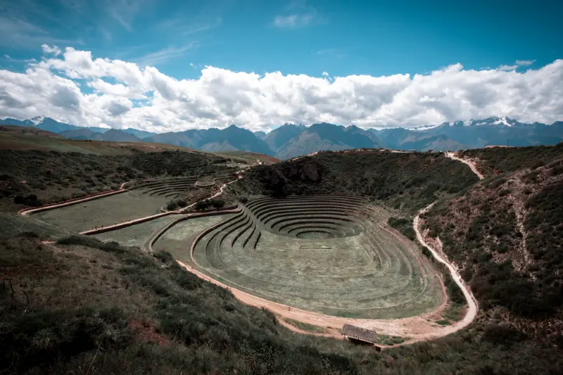
The Moray terraces cycling visit takes travelers to one of the Sacred Valley’s most intriguing sites. Circular, amphitheater like terraces that many interpret as an Inca agricultural laboratory. The terrace “bowls” create temperature differences by layer, forming microclimates that may have helped the Incas test how crops performed under different conditions, essentially an ancient, high altitude research station.

Expect sweeping views from the rim, a fascinating lesson in Inca innovation, and a stop that pairs perfectly with a guided mountain bike tour Peru style of travel. Learn, then ride. Anyone wanting more background before arriving should look into Exploring the Ancient Agricultural Terraces of Moray Peru, which digs deeper into the site’s history than a quick guide stop usually allows.

Maras Salt Terraces: Geometric Ponds Fed by Natural Springs

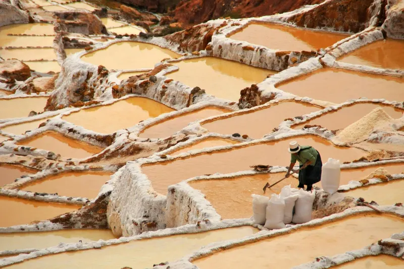
Next, the tour heads to the famous Maras salt works, often called the Maras Salt Terraces. Geometric salt ponds fed by natural springs, cascading down a hillside in hundreds of shimmering basins. Families maintain the ponds using time tested methods, and traditional salt harvesting still gets practiced there, an unforgettable contrast to the ancient stonework at Moray. The full story behind Maras Salt Mines: History and Impact reveals just how long this system has supported local communities in the valley.

Dreaming of Maras salt mines by bike? This ranks among the most satisfying ways to arrive. The landscape opens up gradually, and the salt pans feel like a reveal rather than just a roadside stop.

Tour Style: Small Group (Max 10) or Private Guided Tour

For travelers choosing among the best bike tours Sacred Valley offers, group size matters. This tour operates either as small groups with a maximum of 10 participants, or as a private guided tour, ideal for couples, families, or friends wanting a custom pace.

Both options keep the ride smoother, safer, more personal, especially helpful when navigating altitude or preferring more coaching on descents.

Difficulty, Bike Setup, and Who It’s For

This route classifies as medium difficulty. Not a technical enduro track, but more than a casual cruise. Think mixed surfaces, changing weather, and a few moments where confident braking and body positioning help.

This is also why many travelers call it a downhill bike tour Sacred Valley experience. The riding flow tends to favor descending toward the valley floor, making it approachable for active beginners while still fun for experienced riders.

Coming from Cusco and wondering about Cusco to Maras Moray biking? Most people do this as a supported ride, drive plus bike, rather than pedaling the entire way, which can get tougher at altitude and with time limits.

Detailed Half-Day Itinerary (Maras & Moray to Urubamba)

Here’s what a typical morning looks like for a Sacred Valley cycling route that prioritizes the highlights and keeps the pace efficient.

08:00, hotel pickup in Cusco. Picked up at 08:00 from a Cusco hotel, which makes this easy to fit into a travel day, especially with a train, a cooking class, or a market visit later.

Drive: Cusco to Chinchero (about 40 minutes). After pickup, approximately 40 minutes of driving reaches Chinchero, a highland gateway to the Sacred Valley. This transfer helps riding start in a scenic area without exhausting climbs.

Visit Moray first. The first major stop is Moray, where the guide explains the terraces and their role as an Inca agricultural laboratory with temperature differences by layer.

Then visit Maras Salt Terraces. Next comes Maras, where the geometric salt ponds fed by natural springs appear, along with a look at how traditional salt harvesting works today. Understanding the broader Maras Salt Pans: The Pink-Hued Salt’s System adds real context to what visitors see at ground level during this stop.

Downhill ride to Urubamba (finish). Finally, the bikes come out for a rewarding downhill bike tour Sacred Valley segment, rolling toward a finish in Urubamba, a comfortable hub in the valley and a great place to continue the day.

What’s Included (And What’s Not)

Knowing inclusions matters when comparing peru bike tours and evaluating Maras Moray bike tour price.

Included in this guided mountain bike tour Peru package typically:

  • Professional English-speaking guides
  • Transportation (Cusco pickup + support vehicle logistics)
  • Mountain bike equipment: helmet, gloves, and a GT mountain bike with front suspension
  • Box lunch or snacks (depending on the day’s plan)

Not included, budget separately for entrance tickets and insurance, explicitly not included in either.

Liking clarity upfront? This is also a good question to confirm when booking, which passes get needed, and whether the driver waits at all stops.

What to Pack for Sacred Valley Biking (Practical Checklist)

Been Googling what to pack for Sacred Valley biking? Keep it simple and altitude smart. Conditions can shift quickly, from sunny and warm to windy and cool.

Essentials to bring: cash (small bills help for bathrooms, tips, extra snacks), passport (or a secure copy, depending on preference and operator guidance), jacket (a light windbreaker or warm layer).

Strong recommendation: sun cream, since the high altitude sun in the Andes can feel intense even on cool days. Also consider sunglasses, lip balm, and a refillable water bottle, small comforts that make the ride more enjoyable.

Safety + Altitude: What to Know Before You Ride

People often ask, is Maras Moray bike tour safe? With a reputable operator, good gear, and a guide managing pacing, it’s generally a safe and popular route. The “medium” rating reflects that comfort riding a bike downhill, controlling speed, and handling occasional rough patches all matter.

Altitude tips for cycling Sacred Valley: avoid heavy drinking the night before. Hydrate early, starting before pickup. Eat something light but filling. Tell the guide about any headache, nausea, or unusual fatigue.

Remember, one of the biggest safety upgrades is simply riding within a comfortable pace. The guide can help adjust spacing and speed.

Bike Rental Notes: Should You Rent in Cusco?

Some travelers consider bike rental Cusco for Sacred Valley and doing the route independently. Possible, sure, but the main challenges sit in logistics, transport, timing, route finding, entry coordination. A supported sacred valley bike tour usually offers better value for time, especially wanting a clean, efficient half day plan with a proven finish point in Urubamba.

Going independent anyway? Research how to get to Moray by bike carefully. Road conditions, traffic, and weather can change, and altitude can turn “easy” distances into slow climbs.

Biking vs ATV: Which Is Better for Maras & Moray?

A common comparison, biking versus ATV tour. ATVs can be exciting and fast, but biking runs quieter, more immersive, often feeling more connected to the landscape, especially on scenic descents and rural stretches where the wind and valley become audible.

Choose biking for a more active experience, less engine noise, more nature, a rewarding Sacred Valley cycling route vibe.

Choose ATV for less physical effort, more speed focused thrills, a ride that feels more “motor adventure” than “cycling journey.”

Check TripAdvisor Before You Book

Before choosing among the best bike tours Sacred Valley has available, checking TripAdvisor reviews of the tour makes sense. Look for recent comments about guide quality, bike condition, group size (max 10), pacing, and how the operator handles weather changes, without relying on any single opinion.

Price and Booking Snapshot

For planning purposes, the tour price starts from $149 USD per person, with the option to go small group, up to 10 participants, or private. Comparing the Maras Moray bike tour price across operators? Double check what equipment is included, especially confirming a quality setup like a GT mountain bike with front suspension, plus helmet and gloves.

Takeaway: A Smart, Scenic Warm-Up Before Machu Picchu

For a memorable morning combining culture, landscapes, and fun riding, this Sacred Valley bike tour is hard to beat. A half day adventure showcasing Moray’s ingenious agricultural laboratory terraces, the geometric spring fed salt ponds of Maras, and a satisfying downhill roll into Urubamba, making it one of the most practical, rewarding sacred valley bike tours for travelers acclimating in Cusco before Machu Picchu. Timing the trip well matters too, and checking the Best Time to Visit Peru before booking helps avoid unnecessary weather surprises on riding day.

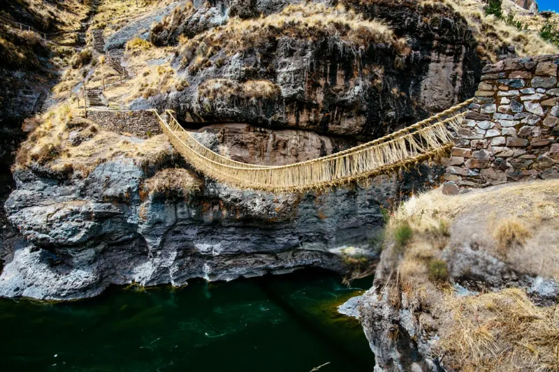
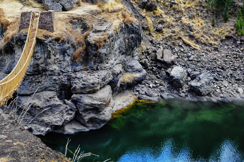
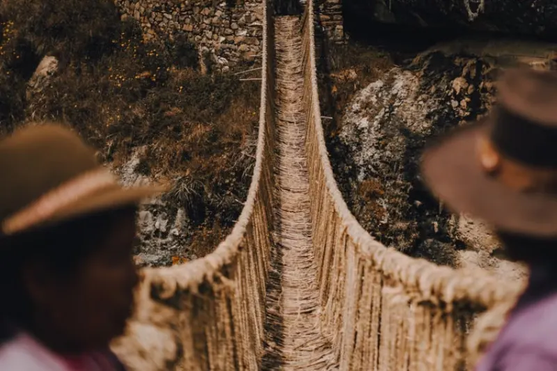
Queswachaka is the last remaining traditional Inca rope bridge still in use today. It is located over the Apurímac River in the Canas province of the Cusco region. The bridge is rebuilt entirely by hand every year using woven grass fibers, following a technique passed down through generations by four surrounding Quechua communities. This guide focuses on what matters most to a traveler: when to go, how to get there, what to pack, physical preparation, and how much it costs.

Unlike most archaeological sites in the region, Queswachaka is not a static ruin. The timing of a visit changes the experience considerably depending on whether it coincides with the annual renewal.

Queswachaka

When to visit: Renewal period vs. rest of the year

The renewal of Queswachaka takes place every June, typically during the second week of the month, and spans approximately four days. Visitors arriving during this window can watch the harvesting and braiding of the grass ropes. They can also witness the final ceremony where the old bridge is replaced with the new one.

Outside of this specific window, the completed bridge remains accessible year-round. Visitors can still walk across it and view the surrounding canyon, though without witnessing any active construction. For travelers whose schedule does not align with the June dates, visiting during the dry season still offers clear weather. Road conditions for the trip out to the site are also easier from May through October.

Visiting during the June renewal requires booking transportation and accommodation well in advance. The event draws significantly more visitors than a typical day trip during the rest of the year. Travelers planning to attend should confirm exact dates with a tour operator a few months ahead. The specific days shift slightly year to year based on the lunar calendar used by the participating communities.

Visitors arriving specifically for the renewal should plan to arrive by early afternoon on the final day. The crossing ceremony and the accompanying celebration typically begin once the last sections of rope have been secured. Timing can shift depending on how quickly the braiding work progresses that year.

How to get there

Queswachaka is located roughly 3 to 4 hours from Cusco by road, depending on the specific route and starting point. Most visitors reach the site as part of an organized day tour. The location is somewhat remote and public transportation options are limited in this part of the region.

Independent travel is possible for those with a rental vehicle or willing to arrange transportation through local drivers. Road conditions can vary depending on the season, particularly during the wet months when unpaved sections become harder to navigate safely. Booking through a tour operator remains the more practical option for most travelers. This is especially true during the renewal period, when demand for transportation increases significantly and independent drivers become harder to find on short notice.

Day tours typically depart from Cusco early in the morning, between 5:00 and 6:00 AM. This accounts for the round-trip distance and the time needed at the site itself. Some operators offer the option to combine this excursion with stops in nearby towns along the route, which can extend the day but adds context to the broader region.

Queswachaka

Cost of visiting

Pricing for a Queswachaka day trip varies depending on a few factors. Whether travelers book independently or through an organized tour matters, as does whether the trip coincides with the June renewal period.

  • Organized day tour (regular season): generally includes transportation, a guide, and sometimes lunch, priced in the mid range for a full-day excursion from Cusco.
  • Organized day tour (June renewal period): typically priced higher due to increased demand and the added length of the excursion during ceremony days.
  • Independent transportation: can be less expensive if arranged directly with a local driver, though it requires more planning and Spanish or Quechua language skills to negotiate effectively on arrival.
  • Entrance: the bridge itself does not require a separate ticket similar to the Boleto Turístico used at other Cusco sites. Local communities do sometimes request informal contributions at the site, though.

Booking a few weeks in advance for the regular season generally secures better pricing. For the June renewal, booking several months ahead is advisable. Group tours booked through the same operator as other Cusco excursions sometimes offer a modest discount when bundled together, which is worth asking about directly.

What to pack

Given the remote location and significant altitude of the surrounding region, packing appropriately matters more than for closer, more accessible sites near Cusco.

  • Clothing layers: temperatures swing significantly between morning and afternoon in this part of the Andes, so a warm layer and a lighter one are both necessary for the full day.
  • Footwear: comfortable walking shoes with good grip, since the paths near the bridge and canyon are uneven and occasionally rocky.
  • Water and snacks: travelers should bring enough for a full day, since food options along the route are limited outside of what a tour provides at scheduled stops.
  • Sun protection: sunscreen and a hat, given the high elevation and generally strong sun in this region even on cooler days.
  • Camera: the bridge and surrounding canyon offer strong photo opportunities, particularly during the final crossing ceremony in June when the whole community gathers.
  • Cash: small denominations of Peruvian soles for any informal purchases or contributions to the local communities along the way.

Motion sickness medication is worth carrying for travelers sensitive to winding mountain roads. The drive includes a considerable amount of curves through the highlands, and the return trip in the late afternoon can feel longer after a full day outdoors.

Queswachaka

Altitude and physical considerations

The region surrounding Queswachaka sits at high elevation, generally comparable to or slightly higher than Cusco itself. Travelers who have not yet acclimatized should spend at least one or two days in Cusco before attempting the trip. A full day of travel combined with altitude can be more tiring than expected, even without significant physical exertion.

The walk from the parking or drop-off point to the bridge itself is relatively short. It does not require significant physical fitness, though the altitude can still cause mild breathlessness for visitors not yet adjusted to elevations above 3,500 meters. Travelers with respiratory or cardiac conditions should consult a physician before planning a full day trip at this elevation, particularly one involving several hours of travel on winding roads.

What happens during the renewal ceremony

For those specifically planning around the June dates, understanding the general structure of the event helps set realistic expectations. The four days typically break down into harvesting and rope preparation on the first two days. Assembly of the main cables happens on the third day, followed by the final replacement of the bridge and community celebrations on the last day.

Visitors are generally welcome to observe the process throughout. The most visually striking moment tends to be the final crossing, when community leaders and participants walk across the newly finished bridge for the first time. Arriving on the last day alone still allows visitors to witness this key moment, even without seeing the earlier preparation stages. This is a reasonable option for travelers with more limited time.

Common mistakes to avoid

A few planning errors account for most disappointing visits to this site. Nearly all of them come down to timing and expectations set incorrectly beforehand.

  • Assuming the bridge is always under construction: only the specific June renewal window offers the chance to see active building; the rest of the year shows only the finished structure.
  • Booking transportation too late for the June period: tours and drivers fill up quickly during the renewal week, sometimes months in advance for the more established operators.
  • Underestimating the drive: the round trip from Cusco takes a significant portion of the day. Travelers expecting a quick excursion are often surprised by the total time commitment involved.
  • Skipping altitude acclimatization: arriving directly from a lower elevation without any adjustment time can make the day feel more exhausting than anticipated, even for otherwise fit travelers.
  • Not confirming what’s included: some day tours include lunch and a guide while others provide transportation only. Travelers should confirm this before booking to avoid surprises on the day itself.
Queswachaka

Practical notes before you go

Because the exact June renewal dates shift slightly each year, confirming the current schedule with a tour operator or local tourism office is worth the extra step. For visitors whose main interest is photography or simply seeing the bridge itself, any time during the dry season works well. This still delivers the same views of the canyon and structure while avoiding the larger crowds tied to the renewal ceremony.

Travelers combining this trip with other excursions in the Cusco region should plan for a full rest day either before or after the Queswachaka visit. This accounts for the length of the round trip and the physical demands of spending most of a day traveling at altitude.

Quick sketch before we hit the trail:

  • What the “7 Lakes” actually look and feel like
  • Altitude: the real project manager of your day
  • Day hike vs. the longer Ausangate trek (and why they’re different moods)
  • Logistics from Cusco, plus what’s worth packing
  • The little extras: hot springs, alpacas, and the kind of silence you remember
7 lakes of ausangate​

The Ausangate 7 Lakes hike is one of those Andes days that sounds like a brochure and then… somehow still beats the brochure. You’re near Cusco, but you’re far from the “line up, snap a photo, line up again” vibe. Instead, you get high mountain air, glacial peaks that look almost unreal, and a chain of lakes that keep changing color like someone’s adjusting the saturation slider.

It’s also a real hike. Not scary-technical, but honest. You’ll feel it in your lungs and maybe in your pride (in a good way). And if you’re coming from the United States, the altitude can be a surprise—like showing up to a meeting and realizing someone moved the agenda to a different timezone.

So… what are the Ausangate 7 Lakes?

They’re a set of alpine lagoons tucked into the Vilcanota range, near the small community of Pacchanta, with Ausangate Mountain looming like a quiet, snowy CEO in the background. Each lake has its own personality. One might look ink-blue and serious. Another flashes green like a gem. Another goes milky-turquoise where glacial minerals swirl in the water.

If you’re into photos, you’ll have a field day—but it’s not just “pretty.” The place has weight. Locals consider Ausangate an apu, a sacred mountain spirit. You don’t need to be spiritual to feel the shift. The landscape makes you lower your voice without anyone asking.

And yes, you’ll see alpacas and llamas doing their daily operations, totally unimpressed by your expensive jacket. That little scene—people herding animals across a wind-swept valley—lands differently when you realize it’s not a performance. It’s life, at 14,000+ feet.

Altitude: the part nobody can “grit” their way through

7 lakes of ausangate​

Let me be slightly contradictory for a second: the 7 lakes hike can feel “easy”… and it can feel brutal. Both can be true. The trail doesn’t demand mountaineering skills. But the Ausangate 7 lakes altitude changes the math. Most routes start around 4,300 meters (about 14,100 feet) and climb higher—often around 4,600–4,700 meters (15,000+ feet), depending on your exact loop.

At that elevation, your body is basically running a bandwidth problem. Less oxygen means your normal pace feels like you’re pushing a heavy cart. The smart move is to treat the hike like a long-term deliverable: steady progress, low drama, lots of check-ins with yourself.

A few practical, non-mystical ways to reduce the odds of altitude trouble:

  • Acclimatize in Cusco for a couple days. Even easy walks help.
  • Hydrate more than you think you need. Coca tea is common here (and yes, it’s part of local culture).
  • Go slow on purpose. If you can chat in short sentences, you’re doing it right.

If you’re the “I’ll power through” type—honestly, same—this is one of those places where powering through backfires. The win is finishing strong, not finishing fast.

Day trip or the full Ausangate trek?

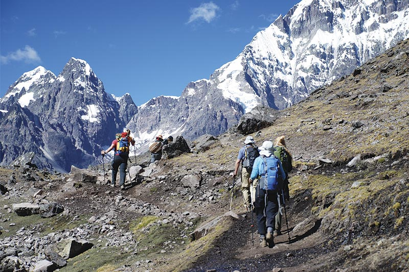
The 7 lakes of Ausangate hike is usually done as a day trip. You’ll start before sunrise from Cusco, bounce along mountain roads for a few hours, and begin hiking once you reach the Pacchanta area. The loop time varies, but many people are on trail around 4–5 hours, plus stops. And you’ll stop. You’ll tell yourself you won’t, then you’ll see another lake and stop anyway.

7 lakes of ausangate​

The Ausangate trek, on the other hand, is a multi-day circuit around the massif. It’s higher, colder, and more remote, with passes that can top 5,000 meters (16,400+ feet). Think of it as a different product line: bigger scope, bigger risk, bigger payoff. The day hike is an intense, beautiful snapshot; the full trek is a full documentary.

People also compare this area with Rainbow Mountain (Vinicunca). Rainbow Mountain is famous for a reason, but it can feel like a viral trend in physical form. The 7 lakes route usually feels quieter and more spacious—less “content creation,” more actual creation of memories.

Logistics from Cusco (aka: making the day run smoothly)

Most travelers go with a tour from Cusco, and it’s not a bad call. Transportation is the biggest hassle, and tours typically bundle it with breakfast, lunch, and entry fees. From a planning perspective, it’s clean: fewer moving parts, fewer chances to miss your window.

Could you go independently? Sure—if you’re comfortable coordinating a driver, leaving early, and dealing with weather swings. The Andes can go from bluebird skies to sleet with no warning. A local guide also adds context: why Pacchanta matters, what you’re seeing, and how people live here year-round.

If you like having a “backup plan” on your phone, download offline maps before you leave Cusco. Google Maps offline helps for towns; for trails, apps like AllTrails or Gaia GPS can be useful (just don’t treat them like infallible truth).

What it feels like on the trail (and why the lakes keep surprising you)

The first stretch often feels like a gentle warm-up—wide views, crunchy grass underfoot, that cold-and-clean air that makes you breathe deeper without thinking. Then the lakes begin showing up, one after another. A lot of hikes have one big “wow” moment. This one is more like a playlist of wow moments.

And the colors aren’t constant. Sunlight shifts, clouds slide in, wind ripples the surface. A lake you thought was bright turquoise can turn steel-gray in a minute. It’s moody, in the best way.

Somewhere in the middle, you might also notice a weird emotional thing: you stop checking your phone. Not because you’re trying to be virtuous—because it stops feeling relevant. The scene is doing all the talking.

Packing: keep it simple, keep it smart

Think layers, not bulk. The temperature can swing hard, and wind is a constant character in the story.

  • Base layer + warm mid-layer + shell (rain and wind protection matters)
  • Waterproof hiking boots with solid grip—mud and rocks are normal
  • Sun protection: sunglasses and sunscreen (high altitude sun is no joke)
  • Snacks you’ll actually eat when you’re slightly nauseous (nuts, chocolate, crackers)
  • A small first-aid kit and blister care—basic risk control

And here’s the funny one: bring a swimsuit. Yes, really.

The hot springs in Pacchanta: the best “closing meeting” you’ll ever attend

7 lakes of ausangate​

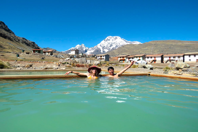
After the hike, many people soak in the hot springs at Pacchanta. It sounds like a luxury add-on, but it feels more like a reset button. Warm water, tired legs, cold air on your face, Ausangate in the distance—your brain finally catches up with what your body just did.

You’ll probably be sitting there thinking, “Why don’t I do things like this more often?” Then you’ll remember: the alarm was brutal, the altitude is real, and comfort has a strong marketing team. Still, this is the kind of day that sticks.

Final thoughts (and a small, honest nudge)

The Ausangate 7 Lakes hike is scenic, yes—but it’s also grounding. It reminds you that nature doesn’t need to be loud to be impressive. Prepare for the altitude, keep your pace steady, and leave room for a little wonder. You’ll come back to Cusco tired, a bit dusty, and oddly energized—like your internal settings got refreshed.

And if you’re debating whether it’s “worth it,” ask yourself a simpler question: when was the last time a place made you pause mid-step, just to look?