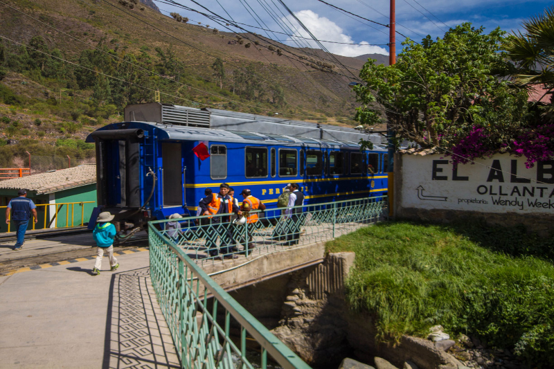
You’ve seen the photos: Machu Picchu floating above the clouds, everyone looking heroic, nobody looking sweaty. Then you start planning and you stumble on a quieter name—Chachabamba. And you think, “Wait… what’s that?” Fair question.

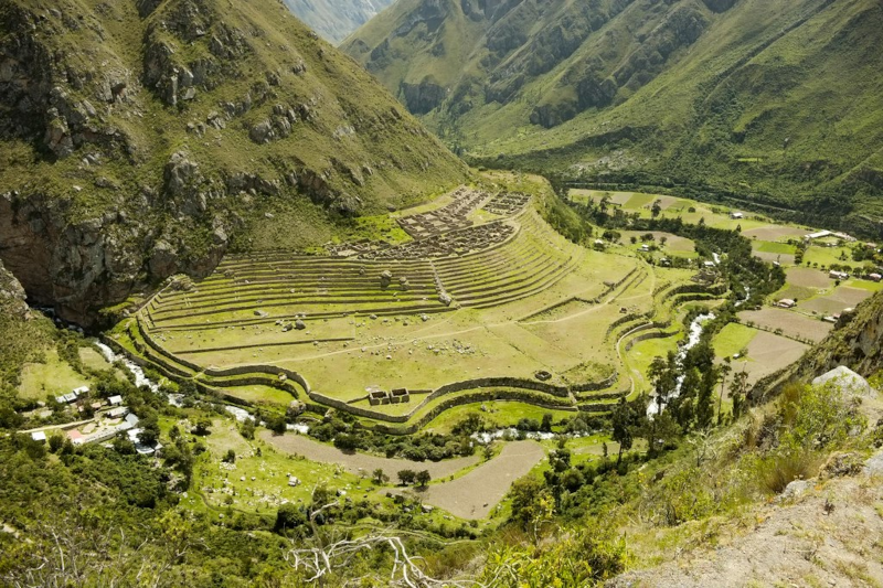
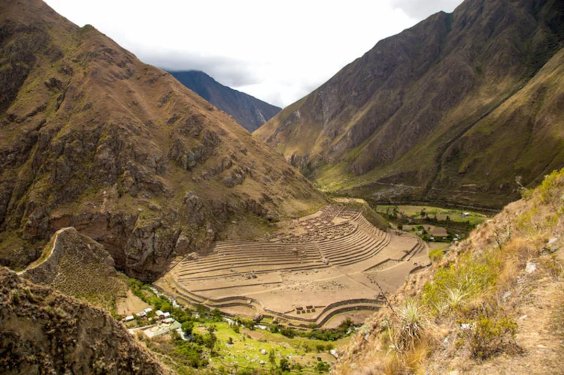
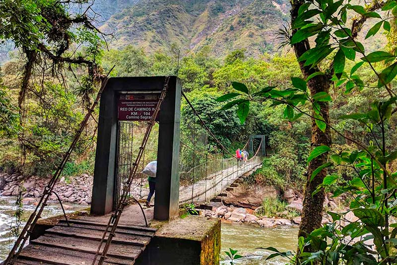
Chachabamba is a compact Inca site in Chachabamba Peru, tucked inside the Historic Sanctuary of Machupicchu near the Urubamba River. Many hikers see it early on the short Inca Trail (the Km 104 route). It’s quick to visit. It’s also the kind of place that changes how you understand the whole trek—like reading the first page of a mystery and suddenly caring about every clue.

A quick map of what we’ll cover (so you’re not wandering)

  • Where the Chachabamba ruins sit and why that location matters
  • What to look for on-site (even if you’re half-asleep from an early train)
  • How the route from Chachabamba to Machu Picchu usually works
  • Practical prep: permits, timing, weather, and a little trail “ops” talk

So… what is Chachabamba, exactly?

chachabamba

Chachabamba is an Inca-built complex near the Km 104 rail stop on the way to Machu Picchu. It’s commonly tied to the short Inca Trail route: Chachabamba → Wiñaywayna Intipunku (the Sun Gate) → Machu Picchu. Peru’s protected-area authority, SERNANP, describes access and visitor rules for this trail network inside the sanctuary. 

Now here’s the mild contradiction: Chachabamba is a “small” site. And it’s not small. The footprint is modest, sure. But the role feels big—like a staging area where the Incas managed movement, water, and ritual in one spot. Think of it as trail infrastructure with a spiritual layer. A kind of ancient check-in desk… except the check-in might involve water ceremonies.

Why the location feels like a plot twist

Chachabamba sits low, close to the river corridor, right where many travelers shift from “train ride” to “we’re hiking now.” That change matters. You go from metal rails and timetables to stone steps and cloud forest. It’s a clean handoff.

And yes, the cloud forest has its own personality. It can be warm, damp, and loud with birds. Or it can be quiet and misty, like the whole valley is holding its breath. If you’ve been acclimating in Cusco, your lungs may still be negotiating. That’s normal. Your pace is the project plan here—set the scope, manage the risk, keep the team moving.

What you’ll see at the Chachabamba ruins (and what to ask your guide)

chachabamba

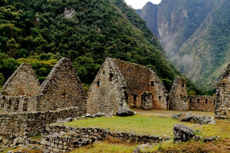
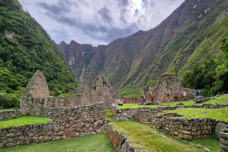
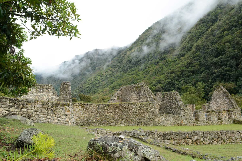
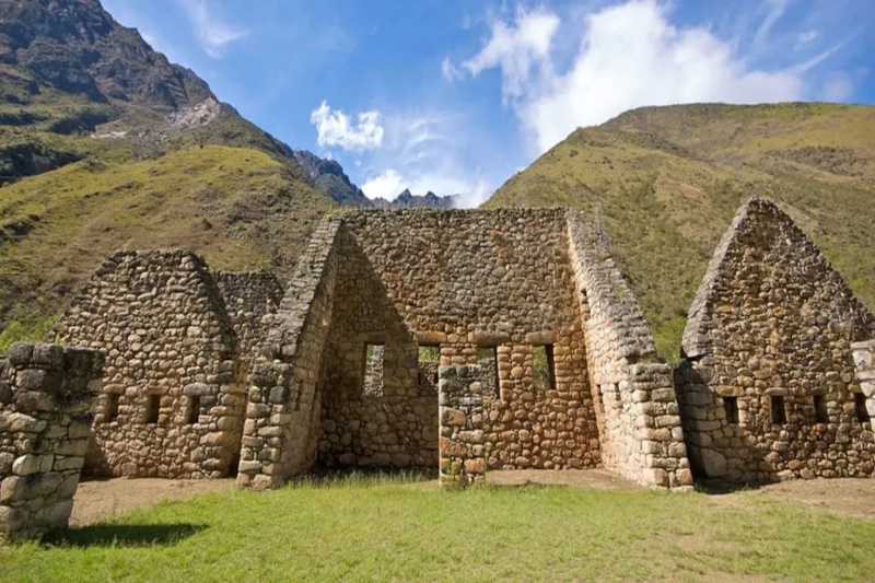
Chachabamba rewards attention. Not a long attention span—just real attention. Instead of scanning for “the one perfect photo,” look for systems: how stone, slope, and water work together.

Here are the main features people notice:

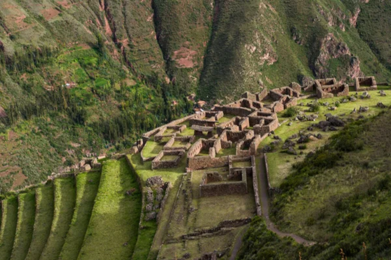
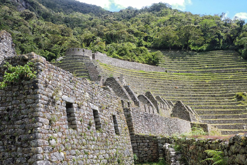
  • Stone foundations and enclosures: Low walls, rooms, and clean stonework that hint at organized use—caretakers, travelers, or staff supporting the route.
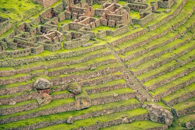
  • Terraces: Not just pretty steps. Terraces stabilize steep ground and can support crops. It’s land management, Inca-style.
  • Channels and water features: This is the heart of the site for many visitors. Water isn’t a background detail in the Andes; it’s power, purity, and planning.

And here’s a good question to toss to your guide (without sounding like you’re in a meeting): Was this a ritual stop, a control point, a service hub—or all of the above? In the Inca world, categories overlap. Roads weren’t only for transport. They connected authority, labor, pilgrimage, and sacred geography.

Let’s talk about water—because the Incas sure did

You’ll hear “hydraulic engineering” a lot around Machu Picchu. It can sound heavy, like a textbook. But the simple version is this: the Incas were excellent at moving water where it needed to go, and they treated it with respect.

chachabamba

At Chachabamba, the water elements make you think about cleansing and transition. Imagine arriving from the river route, washing up, resetting, and then climbing toward higher, more sacred zones. It’s like switching from street shoes to hiking boots. Same person. Different mode.

And if you’re the type who likes a side quest: notice how many Inca sites pair water control with route control. It’s not random. Water is life, and routes are reach—together they’re strategy.

How to get from Chachabamba to Machu Picchu (the real-world logistics)

Most people who search Chachabamba to Machu Picchu are looking for a practical answer: “Can I walk it?” Yes—on the short Inca Trail route—but it’s managed access, not a casual stroll.

SERNANP notes that entry to the Inca Trail network inside the sanctuary is handled through authorized tourism agencies, with checkpoints and rules. In plain terms: you’ll book with a licensed operator who handles permits, guide services, and transport timing.

A typical day flow looks like this:

  1. Start from Cusco or Ollantaytambo. Ollantaytambo often makes the morning schedule less hectic.
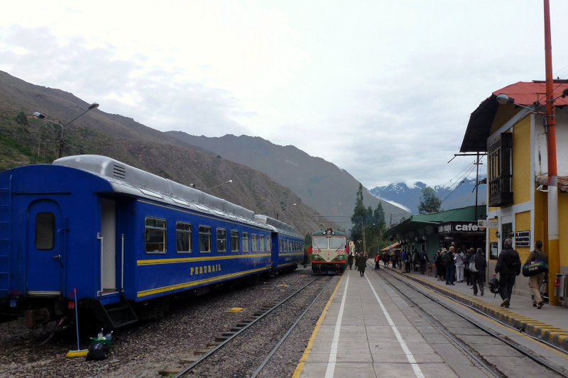
  2. Take the train to Km 104 (Chachabamba). Operators coordinate the correct stop. Train providers like PeruRail and Inca Rail publish schedules, but your agency will match them to permits.
  3. Check in at the control point. Passport out, permit verified, and off you go.
  4. Visit Chachabamba early. This is the calm moment before the climb ramps up.
  5. Hike toward Wiñaywayna, then Intipunku. This section is where “fitness” turns into “grit.” Pace matters.
  6. Arrive at Machu Picchu. Some itineraries give you a short look that day, then a fuller guided circuit later.

One small, modern trend note: shoulder season (April/May or September/October) can feel like the sweet spot—fewer crowds than peak summer, often decent weather. But weather has moods, especially in El Niño years. Pack like you respect surprises.

Timing, weather, and what “prepared” really means

SERNANP lists visiting hours for the Inca Trail network and notes a drier season roughly from April to October, with the rainier stretch from November to March. That lines up with what hikers feel on the ground: rain can turn stone into a slip hazard, and sun can turn a climb into a slow burn.

Here’s the “ops checklist” version—simple, not fussy:

  • Footwear: broken-in shoes with grip (new boots are a trap)
  • Rain layer: even if the forecast looks friendly
  • Water + snacks: keep energy steady; bonking is real
  • Sun and bugs: hat, sunscreen, repellent
  • Mindset: plan to go slower than you want, then enjoy the fact that you’re actually seeing things

Also: follow rules on marked routes and waste. SERNANP emphasizes staying on trails and protecting flora and fauna. It’s not about being a buzzkill; it’s about keeping the sanctuary from getting loved to death.

Why Chachabamba deserves a longer pause than your schedule wants

chachabamba

Machu Picchu is the headline. Chachabamba is the opening scene. If you skip it mentally, you still get the big reveal—but you miss the setup that makes the reveal hit harder.

And there’s something quietly human about it. You start near the river, you step into old stonework, and you feel the trail pull you upward. People did this centuries ago. Different reasons, same legs, same weather, same “Are we there yet?” moment. That’s a connection worth noticing.

Quick FAQs

Can I visit Chachabamba without the Inca Trail permit?
For most travelers, Chachabamba is visited as part of the permitted short Inca Trail (Km 104) experience handled by an authorized operator. Rules can shift, so confirm current access through official sources and your agency.

How long do you spend at Chachabamba?
Often 20–40 minutes, depending on the group’s pace and the day’s timeline. If you like archaeology, ask for a bit more time—politely.

Is it worth it if I’m “only” here for Machu Picchu?
Yes. It adds context. It also gives you a calmer space to get your bearings before the hike gets serious.

Last thought before you hit the trail

If Machu Picchu is the final deliverable, Chachabamba is the kickoff meeting—short, important, and full of signals about how the rest will go. Take it in. Look at the stone. Listen to the water. Then head up the trail and let the story build.

Want the feeling of the classic Inca Trail… but you’ve got one day, not four? The Inca Trail from Km 104 is built for that exact scenario. You take an early train, hike about 10 km (6 miles) through cloud forest and ruins, pop out at the Sun Gate (Intipunku), and then walk into Machu Picchu like the trail was meant to be entered.

It’s a short route. And it’s not really short. The distance is modest, but the day is long, warm, and packed with logistics. If that sounds like your kind of “busy-but-worth-it” travel day, keep reading.

A quick outline (so you can see the flow)

  • Early pickup in Cusco → drive to Ollantaytambo
  • Morning train → get off at Km 104
  • Hike through cloud forest → ruins → Wiñay Wayna
  • Sun Gate first view → walk down into Machu Picchu
  • Guided tour (~2 hours) → free time / optional hikes (ticket-dependent)
  • Bus to Aguas Calientes → lunch → train back → transfer to Cusco

So what is the Km 104 Inca Trail, exactly?

The “short Inca Trail” with the big finale

Inca Trail From Km 104

The Km 104 Inca Trail is often called the short Inca Trail because you start at a checkpoint on the rail line (that’s the “Km 104” part). From there, you hike a real chunk of the original trail and enter Machu Picchu from above. That Sun Gate entry is the headline moment. It’s why people do this version instead of a simple train-and-bus visit.

How it differs from the multi-day trek

You won’t camp. You won’t spend days ramping up to the big view. Instead, the experience is compressed into a single itinerary with tight timing—more like a well-run project schedule than a lazy day out. You still get ruins on the way (especially Wiñay Wayna), but you’ll want a steady pace and a bit of stamina.

Before you book: permits, seasons, and reality checks

Permits and operators (the non-fun but important part)

This route still uses the regulated Inca Trail system, so you’ll usually book with a licensed operator who handles permits and the checkpoint process. Think of it as the “admin work” that keeps your day moving. Bring your passport (or the document linked to your ticket). If it doesn’t match, you’ll have a bad time. No one wants that.

Weather: hot, humid… and sometimes weird

On paper, it’s “hot and humid,” and that’s often true in the cloud forest. But mountain weather has mood swings. Pack for sun and rain on the same day. If you like checking forecasts, Peru’s SENAMHI updates are a solid place to start, and your operator’s local read matters even more.

Day 1 itinerary (Cusco → Km 104 → Wiñay Wayna → Sun Gate → Machu Picchu)

This is the reference flow you shared, with a few practical notes added—the kind of small details that keep the day from feeling chaotic.

Early pickup in Cusco → drive through the Sacred Valley

You’ll get picked up early at your hotel in Cusco. Then it’s a drive through the Sacred Valley to Ollantaytambo. It’s scenic, sure, but it’s also the first “handoff” in the day: hotel → vehicle → train station. Keep your essentials where you can grab them fast.

Ollantaytambo → morning train (timing depends on availability)

You’ll board a tourist train toward Aguas Calientes. Common options are the Expedition around 6:10 AM or a Voyager around 6:40 AM, depending on what’s available. (These are the kinds of details that change, so confirm close to departure.)

Inca Trail From Km 104

Get off at Km 104 → the trail starts in cloud forest

You’ll exit at Km 104, go through entry formalities, and then the hike begins. Right away, the vibe shifts: train noise fades, and the cloud forest takes over. Expect thick greenery, birds, and that damp warmth that makes you drink more water than you think you’ll need.

On-trail ruins → then Wiñay Wayna (the “wow” site on this route)

Over the next stretch, you’ll pass smaller ruins and viewpoints. Then you’ll reach Wiñay Wayna, one of the most striking sites on the short trail. Terraces stack along the hillside, stone walls hold their lines, and water channels still make sense when your guide explains them. It’s a nice reminder that Machu Picchu wasn’t a lone masterpiece—it was part of a whole system.

Wiñay Wayna → Sun Gate (Intipunku): the first Machu Picchu view

Inca Trail From Km 104

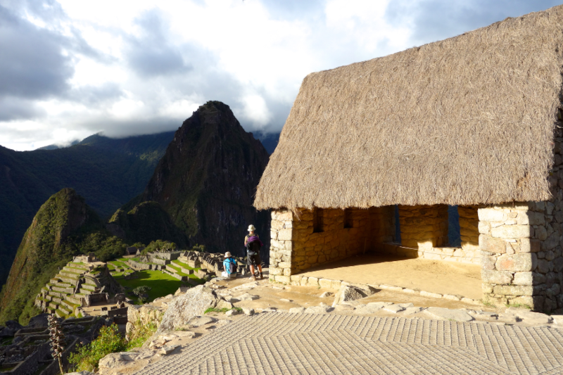
After Wiñay Wayna, you climb toward Sun Gate. This is the classic arrival point for Inca Trail hikers. When Machu Picchu finally shows up below you, it can hit hard—quietly, not like a movie scene. People compare the view to big bucket-list landmarks like the Great Wall of China, and yeah, the scale and history do scratch that same itch.

Sun Gate → Machu Picchu: guided tour, then free time

From Sun Gate you descend into Machu Picchu. The standard guided tour is about two hours. It’s part history, part navigation—your guide is also managing time windows and route rules. After that, you’ll usually have some free time, based on your ticket circuit and the day’s timing.

Bus down to Aguas Calientes → lunch → train back

When you’re done at Machu Picchu, you’ll take the bus down to Aguas Calientes. Lunch is often at a local restaurant. During the hike, travelers typically carry a box lunch, so your daypack should be comfortable. Later, you’ll catch a train back to Ollantaytambo around 4:00 PM (rough reference), then transfer by road back to Cusco, arriving around 9:30 PM.

Distance, pace, and the Km 104 Inca Trail elevation (plain-English version)

Key numbers at a glance

If you’re searching km 104 inca trail elevation, here are the main markers:

  • Start (Km 104): ~2,000 m
  • High point (Sun Gate): ~2,720 m
  • Finish near Machu Picchu: ~1,900 m
Inca Trail From Km 104

How it actually feels on your body

Altitude here isn’t extreme, but it’s enough to notice—especially if Cusco is still “new” to your lungs. Add humidity, stone steps, and a long day, and you’ve got a hike that’s friendly… but still demanding. It’s a bit like a workday that looks fine on your calendar, then you realize it has seven meetings and no lunch break.

What to pack (keep it light, keep it smart)

You’ll enjoy the hike more if your bag doesn’t feel like a brick. Here’s a tight list that covers the real needs without turning your daypack into a storage unit:

  • Water (and a plan to refill if your operator supports it)
  • Sun protection: hat + sunscreen
  • Rain layer (a light jacket beats a bulky poncho in wind)
  • Insect repellent (the cloud forest can be bitey)
  • Snacks + your box lunch
  • Passport (and any permit/ticket info your operator asks for)
  • Cash for small purchases in Aguas Calientes
  • Phone + power bank (photos add up fast)

If you like gear that “doesn’t fight back,” trekking poles can help on steps and descents (check your operator’s rules). And yes, broken-in shoes matter. New boots on stone stairs? That’s a rookie mistake with a very real blister budget.

Keeping the day smooth: logistics, safety, and little time buffers

Hydration and altitude: boring topic, big payoff

Altitude and dehydration can team up. The fix is simple: drink early, sip often, and don’t wait until you feel wiped out. If you’re sensitive at altitude, acclimate in Cusco first. A chill day or two—walks, light hikes, good sleep—can change everything.

Stairs, knees, and pacing like a pro

This inca trail hike has plenty of steps. If your knees complain on descents, go slower and use the handrails where they exist. Your goal isn’t speed. Your goal is a clean finish, with enough energy left to enjoy Machu Picchu instead of staring at it like a tired zombie.

Train schedules: treat them like deadlines

Trains don’t run on “we’re almost there” time. They run on actual time. Build a little margin in your mindset, because delays happen: weather, crowds, checkpoint lines, bus queues. It’s not a crisis; it’s normal friction in a high-demand place.

Inca Trail From Km 104

Optional hikes after Machu Picchu (only if your ticket supports them)

Huayna Picchu

This one is famous and often limited. If you booked it, your guide will point you to the trailhead. It’s steep, and it can feel exposed, so it’s more “focus mode” than sightseeing mode.

Machu Picchu Mountain

Also a serious climb, but different in feel. It’s longer and usually less crowded than Huayna Picchu. Still, doing it after the Km 104 day is a lot. Not impossible—just a real ask.

Going back toward Sun Gate

Some routes allow a return walk toward Sun Gate (Intipunku). If it’s open and your timing works, it can be a calmer second look. And sometimes that’s the magic: the first view is exciting, the second view actually sinks in.

A few side notes you’ll be glad you knew

Maps and phone signal (a tiny tech digression)

Signal can be patchy. Download offline maps before you go—Google Maps offline areas or an app like Maps.me can help. You probably won’t need them with a guide, but it’s comforting to have a backup. Like a spare charger at an airport: you hope you won’t need it, but you’re happy when you do.

Bathrooms and small costs

Carry some coins or small bills. Bathrooms and small snacks in Aguas Calientes can be cash-only, depending on the spot. Also, keep hand sanitizer handy. Not glamorous, very useful.

Leave-no-trace, but make it realistic

This trail gets a lot of foot traffic. Pack out your trash, keep snacks secured, and follow your guide’s rules at ruins. The place feels alive because it’s cared for. That’s the deal.

Why the Inca Trail from Km 104 is a highlight (even if you’re tired)

The inca trail from km 104 gives you a full story arc in one day: Sacred Valley train ride, cloud forest hike, ruins with context, and then the big reveal at Sun Gate. You finish at the foot of Machu Picchu, not at a random endpoint, and that makes the effort feel complete.

If you can handle the early start and the long return to Cusco, this route is a strong pick. And if you catch late light on the stone at Machu Picchu—maybe even a soft sunset—well, that’s the kind of moment you replay on the flight home. You’ll be tired. You’ll also be glad you did it.