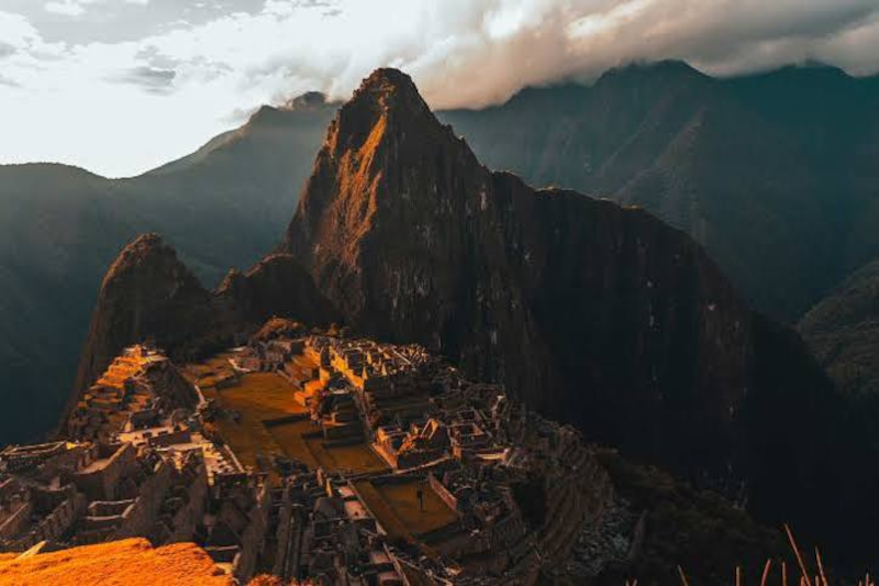
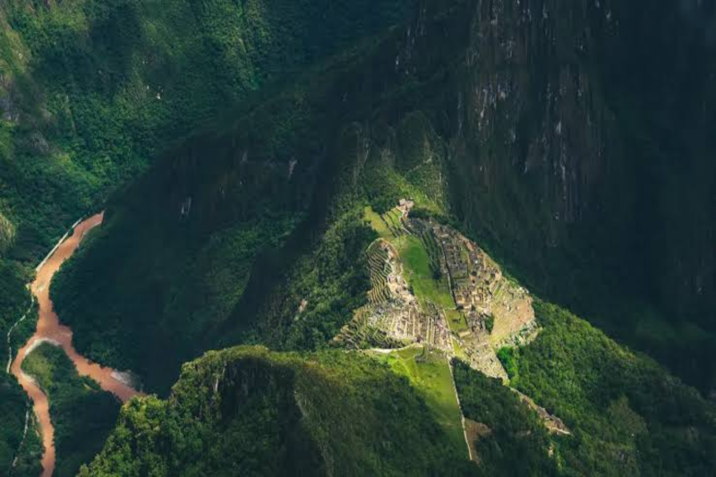
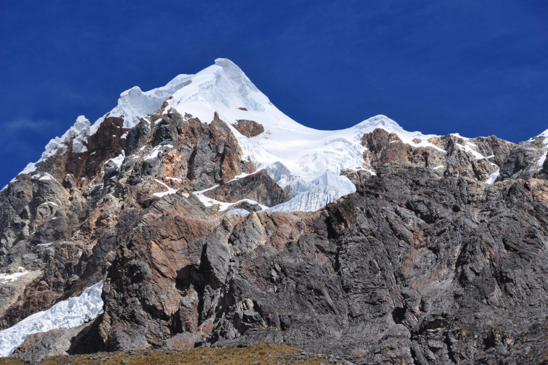
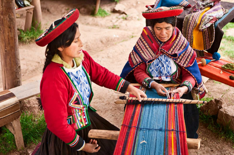
Quick outline (so the story stays on track)

  • Where Llactapata fits on Day 1 of the Classic Inca Trail
  • What you’ll see at the ruins (and what you won’t)
  • How the day actually feels: KM 82 Llactapata Ayapata
  • Smart logistics: permits, packs, weather, pacing
  • A few respectful habits that keep the trail special

Llactapata is one of those places that surprises you. Not because it’s huge (it’s not). Not because it’s flashy (also not). It surprises you because it shows up early on the Inca Trail and quietly sets the tone. Like, Okay- we’re really doing this.
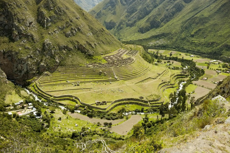
llactapata

Most people think the Inca Trail is all about the grand finale at Machu Picchu. Fair. But the first day has its own magic, and Llactapata is a big reason why. It’s often the first major Inca site you explore after you start at KM 82 (Piskacucho), and it makes the trek feel less like a long walk and more like stepping into a living timeline.

First things first: which Llactapata are we talking about?

There are a few places in Peru that get called Llactapata (or Llaqtapata). So let’s pin it down: this article is about the Llactapata on the Classic Inca Trail– the one most trekkers reach on Day 1, after the early sites and before the climb toward the first campsite area (often Ayapata).

If your operator says Day 1 looks like Cusco Ollantaytambo KM 82 Llactapata Ayapata, you’re in the right place.

Day 1 starts early 

The morning usually begins in Cusco while it’s still dark. You roll out of bed, grab a jacket, and hope your coffee kicks in fast. Then comes the drive through the Sacred Valley toward Ollantaytambo and on to KM 82, the official trailhead.

It’s a pretty drive- terraces on the hillsides, small villages, that big Andean sky. It also works as a mental warm-up. Your brain is shifting from trip mode into trek mode.

At KM 82, your crew typically gathers: guide, porters, and cooks. This is where the operation starts to feel like a well-run field project. Gear gets sorted. Duffel bags get handed off. And you check, double-check, then check again what stays in your daypack.

A tiny but important reality check about your daypack

Once you start hiking, you don’t have easy access to your duffel. So treat your daypack like your on-hand essentials kit. Water, rain layer, sun protection, snacks, meds- that kind of thing. If you’ll get cranky without it, keep it close.

Permits and passports: the least romantic part (but it matters)
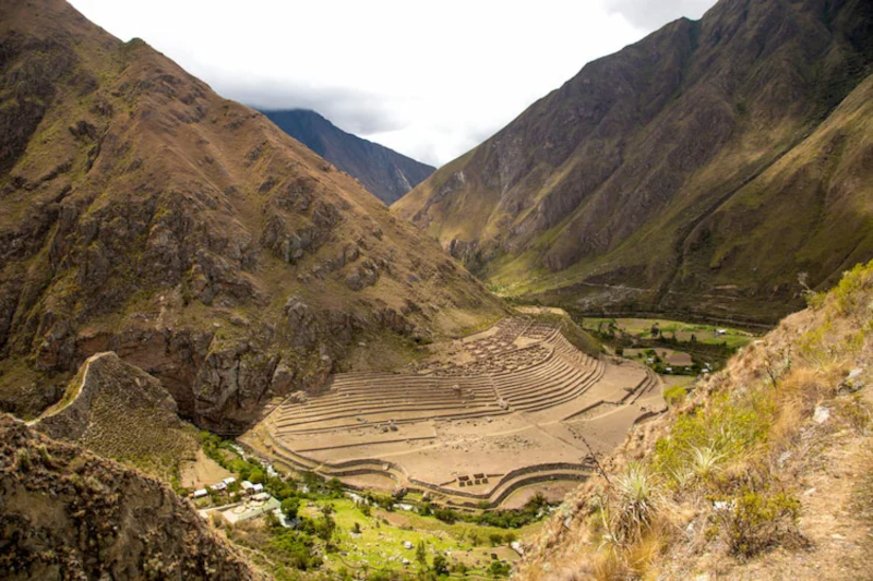
llactapata

Before you walk through the gate, authorities check permits against your original passport. It’s quick, but it’s strict. No passport, no entry. That’s not drama; that’s policy.

Then your guide usually runs a safety briefing. This is where the professional talk shows up: pacing, hydration, trail etiquette, and what to do if you feel off. It’s a little like a pre-flight briefing, just with more mountains.

The early miles: gentle trail, big scenery

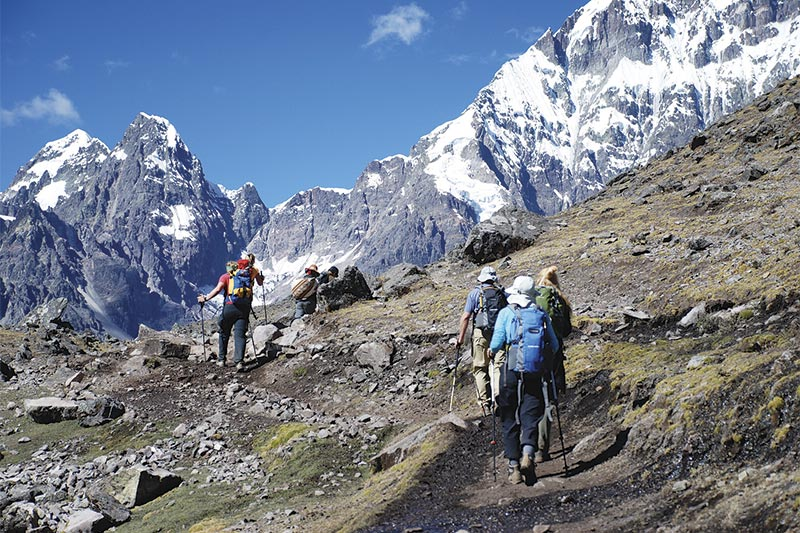
The first stretch is often fairly mellow. You walk along the Urubamba Valley with open views and a comfortable grade. For a couple of hours, it can feel almost too easy- and that’s fine. Let it be easy. Day 1 is about finding rhythm, not proving something.

And then: Llactapata (the quiet high city)

After those early stops, the trail tends to climb more steadily for a few hours. This is where you start to feel the work. Your breathing gets louder. Your steps get more deliberate. And then you reach Llactapata.

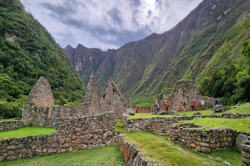
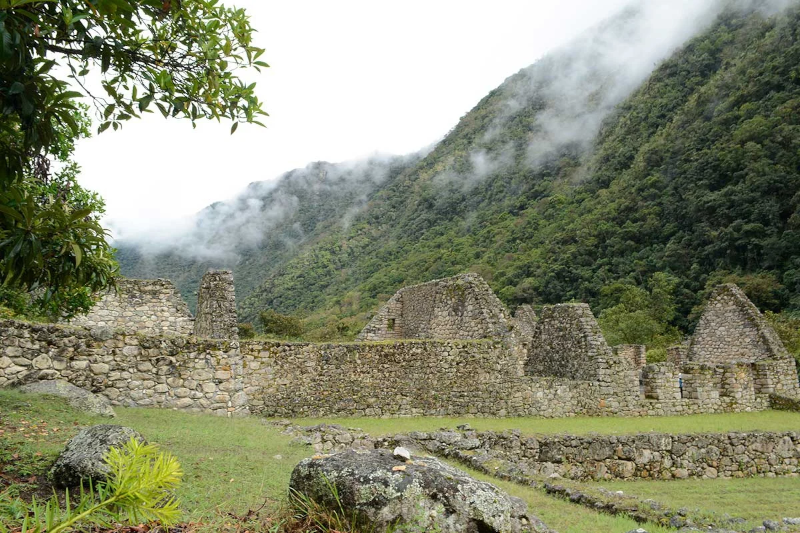
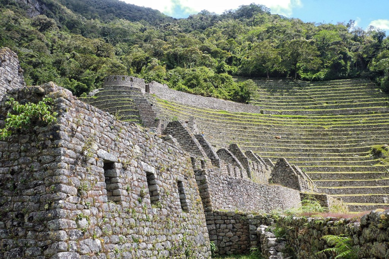
Llactapata is often translated from Quechua as High City. The label fits. Set around 2,840 meters (9,317 feet), the site gives you a first-hand look at Inca stonework and terracing without the crowds and choreography of the big headline ruins.

What do you do there? You slow down. You listen to your guide. You look at how the stones sit, how the terraces hold the slope, how the site relates to the valley. It’s not a long visit for most groups, but it sticks with you. Why? Because it’s your first real We are walking through history moment.

Also- and this is easy to miss- Llactapata is a mood setter. It reminds you that the Inca Trail is not a single destination. It’s a sequence. One place leads to the next. One effort buys the next view.

A small digression: altitude isn’t a villain, but it’s not your buddy either

At around 2,800 to 3,300 meters on Day 1, some hikers feel fine and some feel weird. Light headache. Low appetite. That faint, foggy why am I tired already? feeling. If that’s you, you’re not failing. You’re adjusting.

This is why guides often offer coca tea at breaks and camps. It’s traditional, it’s comforting, and it can help some people feel steadier. The practical move is still the boring one: hydrate, snack often, and keep your pace steady.

From Llactapata to Ayapata: the day keeps going (but you’re ready now)
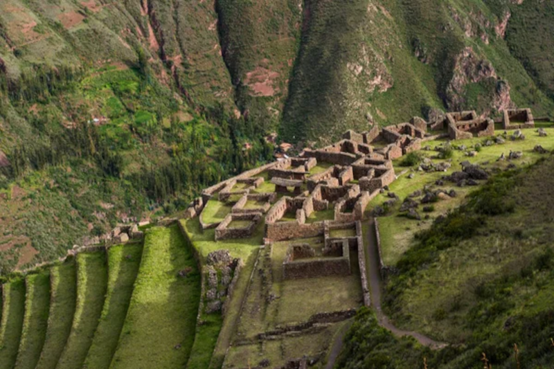
llactapata

After Llactapata, most itineraries push on toward lunch and then continue to the first campsite, often Ayapata, around 3,300 meters (10,827 feet). The afternoon can include passing small communities where you can buy basics- maybe a drink, maybe a snack- and then the trail climbs again.

You’ll notice something: the group energy changes late in the day. People talk less. Feet shuffle more. And then camp appears, and everyone perks up like someone flipped a switch.

By evening, there’s usually a routine: wash up (as best you can), snack, warm drink, then dinner. If your crew is good, dinner feels almost unfairly nice for being in the mountains. Then you crawl into your tent and let the day shut down. Stars overhead. Legs humming. Tomorrow waiting.

Day 1 hiking stats (typical, but always varies)

  • Distance: about 14 km / 8.7 miles
  • Time: about 67 hours of hiking
  • Difficulty: moderate
  • Elevation gain: about 993 m / 3,257 ft
  • Camp altitude: about 3,300 m / 10,827 ft

What to pack for this day (keep it simple, keep it smart)

You don’t need a massive kit. You need a useful one. A few basics that make the day smoother:

  • Rain layer
  • Sun hat + sunscreen
  • Water (and a way to refill if your group supports it)
  • Snacks you’ll actually eat
  • Light warm layer for the evening
  • Blister care (because blisters don’t care about your plans)

If you like a little structure, ask your guide a simple question in the morning: What’s the hardest hour today? It frames the day, and it keeps you from wasting energy worrying about everything at once.

How to be a good guest on the trail
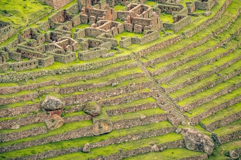
llactapata

Llactapata and the Inca Trail aren’t theme parks. They’re protected places, and they’re meaningful to living communities. So the basics matter:

  • Stay on the trail and don’t climb on walls.
  • Keep noise reasonable near sites (let other groups have their moment too).
  • Pack out trash- even the tiny stuff.
  • Respect the crew. They’re not background characters; they’re the reason the trek runs.

Final thought: Llactapata is small on paper, huge in the story

Llactapata won’t be the biggest ruin you see. It won’t be the most photographed. And that’s exactly why it works.

It’s the first stop that feels like the Inca Trail is opening up. The first place where history stops being something you read about and starts being something you walk through. And when you leave Llactapata and head toward Ayapata, you’ve got momentum. Real momentum.

Day 1 is only the beginning. But it’s a strong beginning. Strong, strong.
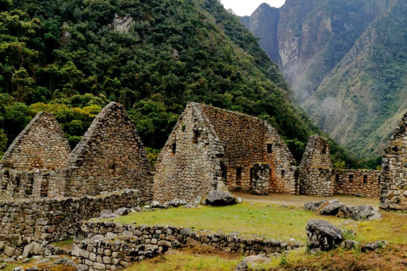
You’ve seen the photos: Machu Picchu floating above the clouds, everyone looking heroic, nobody looking sweaty. Then you start planning and you stumble on a quieter name—Chachabamba. And you think, “Wait… what’s that?” Fair question.

Chachabamba is a compact Inca site in Chachabamba Peru, tucked inside the Historic Sanctuary of Machupicchu near the Urubamba River. Many hikers see it early on the short Inca Trail (the Km 104 route). It’s quick to visit. It’s also the kind of place that changes how you understand the whole trek—like reading the first page of a mystery and suddenly caring about every clue.

A quick map of what we’ll cover (so you’re not wandering)

  • Where the Chachabamba ruins sit and why that location matters
  • What to look for on-site (even if you’re half-asleep from an early train)
  • How the route from Chachabamba to Machu Picchu usually works
  • Practical prep: permits, timing, weather, and a little trail “ops” talk

So… what is Chachabamba, exactly?

chachabamba

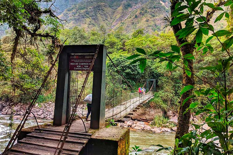
Chachabamba is an Inca-built complex near the Km 104 rail stop on the way to Machu Picchu. It’s commonly tied to the short Inca Trail route: Chachabamba → Wiñaywayna Intipunku (the Sun Gate) → Machu Picchu. Peru’s protected-area authority, SERNANP, describes access and visitor rules for this trail network inside the sanctuary. 

Now here’s the mild contradiction: Chachabamba is a “small” site. And it’s not small. The footprint is modest, sure. But the role feels big—like a staging area where the Incas managed movement, water, and ritual in one spot. Think of it as trail infrastructure with a spiritual layer. A kind of ancient check-in desk… except the check-in might involve water ceremonies.

Why the location feels like a plot twist

Chachabamba sits low, close to the river corridor, right where many travelers shift from “train ride” to “we’re hiking now.” That change matters. You go from metal rails and timetables to stone steps and cloud forest. It’s a clean handoff.

And yes, the cloud forest has its own personality. It can be warm, damp, and loud with birds. Or it can be quiet and misty, like the whole valley is holding its breath. If you’ve been acclimating in Cusco, your lungs may still be negotiating. That’s normal. Your pace is the project plan here—set the scope, manage the risk, keep the team moving.

What you’ll see at the Chachabamba ruins (and what to ask your guide)

chachabamba

Chachabamba rewards attention. Not a long attention span—just real attention. Instead of scanning for “the one perfect photo,” look for systems: how stone, slope, and water work together.

Here are the main features people notice:

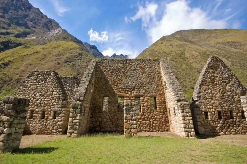
  • Stone foundations and enclosures: Low walls, rooms, and clean stonework that hint at organized use—caretakers, travelers, or staff supporting the route.
  • Terraces: Not just pretty steps. Terraces stabilize steep ground and can support crops. It’s land management, Inca-style.
  • Channels and water features: This is the heart of the site for many visitors. Water isn’t a background detail in the Andes; it’s power, purity, and planning.

And here’s a good question to toss to your guide (without sounding like you’re in a meeting): Was this a ritual stop, a control point, a service hub—or all of the above? In the Inca world, categories overlap. Roads weren’t only for transport. They connected authority, labor, pilgrimage, and sacred geography.

Let’s talk about water—because the Incas sure did

You’ll hear “hydraulic engineering” a lot around Machu Picchu. It can sound heavy, like a textbook. But the simple version is this: the Incas were excellent at moving water where it needed to go, and they treated it with respect.

chachabamba

At Chachabamba, the water elements make you think about cleansing and transition. Imagine arriving from the river route, washing up, resetting, and then climbing toward higher, more sacred zones. It’s like switching from street shoes to hiking boots. Same person. Different mode.

And if you’re the type who likes a side quest: notice how many Inca sites pair water control with route control. It’s not random. Water is life, and routes are reach—together they’re strategy.

How to get from Chachabamba to Machu Picchu (the real-world logistics)

Most people who search Chachabamba to Machu Picchu are looking for a practical answer: “Can I walk it?” Yes—on the short Inca Trail route—but it’s managed access, not a casual stroll.

SERNANP notes that entry to the Inca Trail network inside the sanctuary is handled through authorized tourism agencies, with checkpoints and rules. In plain terms: you’ll book with a licensed operator who handles permits, guide services, and transport timing.

A typical day flow looks like this:

  1. Start from Cusco or Ollantaytambo. Ollantaytambo often makes the morning schedule less hectic.
  2. Take the train to Km 104 (Chachabamba). Operators coordinate the correct stop. Train providers like PeruRail and Inca Rail publish schedules, but your agency will match them to permits.
  3. Check in at the control point. Passport out, permit verified, and off you go.
  4. Visit Chachabamba early. This is the calm moment before the climb ramps up.
  5. Hike toward Wiñaywayna, then Intipunku. This section is where “fitness” turns into “grit.” Pace matters.
  6. Arrive at Machu Picchu. Some itineraries give you a short look that day, then a fuller guided circuit later.

One small, modern trend note: shoulder season (April/May or September/October) can feel like the sweet spot—fewer crowds than peak summer, often decent weather. But weather has moods, especially in El Niño years. Pack like you respect surprises.

Timing, weather, and what “prepared” really means

SERNANP lists visiting hours for the Inca Trail network and notes a drier season roughly from April to October, with the rainier stretch from November to March. That lines up with what hikers feel on the ground: rain can turn stone into a slip hazard, and sun can turn a climb into a slow burn.

Here’s the “ops checklist” version—simple, not fussy:

  • Footwear: broken-in shoes with grip (new boots are a trap)
  • Rain layer: even if the forecast looks friendly
  • Water + snacks: keep energy steady; bonking is real
  • Sun and bugs: hat, sunscreen, repellent
  • Mindset: plan to go slower than you want, then enjoy the fact that you’re actually seeing things

Also: follow rules on marked routes and waste. SERNANP emphasizes staying on trails and protecting flora and fauna. It’s not about being a buzzkill; it’s about keeping the sanctuary from getting loved to death.

Why Chachabamba deserves a longer pause than your schedule wants

chachabamba

Machu Picchu is the headline. Chachabamba is the opening scene. If you skip it mentally, you still get the big reveal—but you miss the setup that makes the reveal hit harder.

And there’s something quietly human about it. You start near the river, you step into old stonework, and you feel the trail pull you upward. People did this centuries ago. Different reasons, same legs, same weather, same “Are we there yet?” moment. That’s a connection worth noticing.

Quick FAQs

Can I visit Chachabamba without the Inca Trail permit?
For most travelers, Chachabamba is visited as part of the permitted short Inca Trail (Km 104) experience handled by an authorized operator. Rules can shift, so confirm current access through official sources and your agency.

How long do you spend at Chachabamba?
Often 20–40 minutes, depending on the group’s pace and the day’s timeline. If you like archaeology, ask for a bit more time—politely.

Is it worth it if I’m “only” here for Machu Picchu?
Yes. It adds context. It also gives you a calmer space to get your bearings before the hike gets serious.

Last thought before you hit the trail

If Machu Picchu is the final deliverable, Chachabamba is the kickoff meeting—short, important, and full of signals about how the rest will go. Take it in. Look at the stone. Listen to the water. Then head up the trail and let the story build.

Want the feeling of the classic Inca Trail… but you’ve got one day, not four? The Inca Trail from Km 104 is built for that exact scenario. You take an early train, hike about 10 km (6 miles) through cloud forest and ruins, pop out at the Sun Gate (Intipunku), and then walk into Machu Picchu like the trail was meant to be entered.

It’s a short route. And it’s not really short. The distance is modest, but the day is long, warm, and packed with logistics. If that sounds like your kind of “busy-but-worth-it” travel day, keep reading.

A quick outline (so you can see the flow)

  • Early pickup in Cusco → drive to Ollantaytambo
  • Morning train → get off at Km 104
  • Hike through cloud forest → ruins → Wiñay Wayna
  • Sun Gate first view → walk down into Machu Picchu
  • Guided tour (~2 hours) → free time / optional hikes (ticket-dependent)
  • Bus to Aguas Calientes → lunch → train back → transfer to Cusco

So what is the Km 104 Inca Trail, exactly?

The “short Inca Trail” with the big finale

Inca Trail From Km 104

The Km 104 Inca Trail is often called the short Inca Trail because you start at a checkpoint on the rail line (that’s the “Km 104” part). From there, you hike a real chunk of the original trail and enter Machu Picchu from above. That Sun Gate entry is the headline moment. It’s why people do this version instead of a simple train-and-bus visit.

How it differs from the multi-day trek

You won’t camp. You won’t spend days ramping up to the big view. Instead, the experience is compressed into a single itinerary with tight timing—more like a well-run project schedule than a lazy day out. You still get ruins on the way (especially Wiñay Wayna), but you’ll want a steady pace and a bit of stamina.

Before you book: permits, seasons, and reality checks

Permits and operators (the non-fun but important part)

This route still uses the regulated Inca Trail system, so you’ll usually book with a licensed operator who handles permits and the checkpoint process. Think of it as the “admin work” that keeps your day moving. Bring your passport (or the document linked to your ticket). If it doesn’t match, you’ll have a bad time. No one wants that.

Weather: hot, humid… and sometimes weird

On paper, it’s “hot and humid,” and that’s often true in the cloud forest. But mountain weather has mood swings. Pack for sun and rain on the same day. If you like checking forecasts, Peru’s SENAMHI updates are a solid place to start, and your operator’s local read matters even more.

Day 1 itinerary (Cusco → Km 104 → Wiñay Wayna → Sun Gate → Machu Picchu)

This is the reference flow you shared, with a few practical notes added—the kind of small details that keep the day from feeling chaotic.

Early pickup in Cusco → drive through the Sacred Valley

You’ll get picked up early at your hotel in Cusco. Then it’s a drive through the Sacred Valley to Ollantaytambo. It’s scenic, sure, but it’s also the first “handoff” in the day: hotel → vehicle → train station. Keep your essentials where you can grab them fast.

Ollantaytambo → morning train (timing depends on availability)

You’ll board a tourist train toward Aguas Calientes. Common options are the Expedition around 6:10 AM or a Voyager around 6:40 AM, depending on what’s available. (These are the kinds of details that change, so confirm close to departure.)

Inca Trail From Km 104

Get off at Km 104 → the trail starts in cloud forest

You’ll exit at Km 104, go through entry formalities, and then the hike begins. Right away, the vibe shifts: train noise fades, and the cloud forest takes over. Expect thick greenery, birds, and that damp warmth that makes you drink more water than you think you’ll need.

On-trail ruins → then Wiñay Wayna (the “wow” site on this route)

Over the next stretch, you’ll pass smaller ruins and viewpoints. Then you’ll reach Wiñay Wayna, one of the most striking sites on the short trail. Terraces stack along the hillside, stone walls hold their lines, and water channels still make sense when your guide explains them. It’s a nice reminder that Machu Picchu wasn’t a lone masterpiece—it was part of a whole system.

Wiñay Wayna → Sun Gate (Intipunku): the first Machu Picchu view

Inca Trail From Km 104

After Wiñay Wayna, you climb toward Sun Gate. This is the classic arrival point for Inca Trail hikers. When Machu Picchu finally shows up below you, it can hit hard—quietly, not like a movie scene. People compare the view to big bucket-list landmarks like the Great Wall of China, and yeah, the scale and history do scratch that same itch.

Sun Gate → Machu Picchu: guided tour, then free time

From Sun Gate you descend into Machu Picchu. The standard guided tour is about two hours. It’s part history, part navigation—your guide is also managing time windows and route rules. After that, you’ll usually have some free time, based on your ticket circuit and the day’s timing.

Bus down to Aguas Calientes → lunch → train back

When you’re done at Machu Picchu, you’ll take the bus down to Aguas Calientes. Lunch is often at a local restaurant. During the hike, travelers typically carry a box lunch, so your daypack should be comfortable. Later, you’ll catch a train back to Ollantaytambo around 4:00 PM (rough reference), then transfer by road back to Cusco, arriving around 9:30 PM.

Distance, pace, and the Km 104 Inca Trail elevation (plain-English version)

Key numbers at a glance

If you’re searching km 104 inca trail elevation, here are the main markers:

  • Start (Km 104): ~2,000 m
  • High point (Sun Gate): ~2,720 m
  • Finish near Machu Picchu: ~1,900 m
Inca Trail From Km 104

How it actually feels on your body

Altitude here isn’t extreme, but it’s enough to notice—especially if Cusco is still “new” to your lungs. Add humidity, stone steps, and a long day, and you’ve got a hike that’s friendly… but still demanding. It’s a bit like a workday that looks fine on your calendar, then you realize it has seven meetings and no lunch break.

What to pack (keep it light, keep it smart)

You’ll enjoy the hike more if your bag doesn’t feel like a brick. Here’s a tight list that covers the real needs without turning your daypack into a storage unit:

  • Water (and a plan to refill if your operator supports it)
  • Sun protection: hat + sunscreen
  • Rain layer (a light jacket beats a bulky poncho in wind)
  • Insect repellent (the cloud forest can be bitey)
  • Snacks + your box lunch
  • Passport (and any permit/ticket info your operator asks for)
  • Cash for small purchases in Aguas Calientes
  • Phone + power bank (photos add up fast)

If you like gear that “doesn’t fight back,” trekking poles can help on steps and descents (check your operator’s rules). And yes, broken-in shoes matter. New boots on stone stairs? That’s a rookie mistake with a very real blister budget.

Keeping the day smooth: logistics, safety, and little time buffers

Hydration and altitude: boring topic, big payoff

Altitude and dehydration can team up. The fix is simple: drink early, sip often, and don’t wait until you feel wiped out. If you’re sensitive at altitude, acclimate in Cusco first. A chill day or two—walks, light hikes, good sleep—can change everything.

Stairs, knees, and pacing like a pro

This inca trail hike has plenty of steps. If your knees complain on descents, go slower and use the handrails where they exist. Your goal isn’t speed. Your goal is a clean finish, with enough energy left to enjoy Machu Picchu instead of staring at it like a tired zombie.

Train schedules: treat them like deadlines

Trains don’t run on “we’re almost there” time. They run on actual time. Build a little margin in your mindset, because delays happen: weather, crowds, checkpoint lines, bus queues. It’s not a crisis; it’s normal friction in a high-demand place.

Inca Trail From Km 104

Optional hikes after Machu Picchu (only if your ticket supports them)

Huayna Picchu

This one is famous and often limited. If you booked it, your guide will point you to the trailhead. It’s steep, and it can feel exposed, so it’s more “focus mode” than sightseeing mode.

Machu Picchu Mountain

Also a serious climb, but different in feel. It’s longer and usually less crowded than Huayna Picchu. Still, doing it after the Km 104 day is a lot. Not impossible—just a real ask.

Going back toward Sun Gate

Some routes allow a return walk toward Sun Gate (Intipunku). If it’s open and your timing works, it can be a calmer second look. And sometimes that’s the magic: the first view is exciting, the second view actually sinks in.

A few side notes you’ll be glad you knew

Maps and phone signal (a tiny tech digression)

Signal can be patchy. Download offline maps before you go—Google Maps offline areas or an app like Maps.me can help. You probably won’t need them with a guide, but it’s comforting to have a backup. Like a spare charger at an airport: you hope you won’t need it, but you’re happy when you do.

Bathrooms and small costs

Carry some coins or small bills. Bathrooms and small snacks in Aguas Calientes can be cash-only, depending on the spot. Also, keep hand sanitizer handy. Not glamorous, very useful.

Leave-no-trace, but make it realistic

This trail gets a lot of foot traffic. Pack out your trash, keep snacks secured, and follow your guide’s rules at ruins. The place feels alive because it’s cared for. That’s the deal.

Why the Inca Trail from Km 104 is a highlight (even if you’re tired)

The inca trail from km 104 gives you a full story arc in one day: Sacred Valley train ride, cloud forest hike, ruins with context, and then the big reveal at Sun Gate. You finish at the foot of Machu Picchu, not at a random endpoint, and that makes the effort feel complete.

If you can handle the early start and the long return to Cusco, this route is a strong pick. And if you catch late light on the stone at Machu Picchu—maybe even a soft sunset—well, that’s the kind of moment you replay on the flight home. You’ll be tired. You’ll also be glad you did it.

Puka Pukara sits above Cusco like a quiet coworker in the corner—watching, doing its job, not making a fuss. And then, when you finally pay attention, you realize it’s been holding the whole operation together. Roads. Sightlines. Control points. The kind of “systems thinking” the Inca state was really good at.

So if you’re a history buff, or a traveler who likes your ruins with a little context (and a little less chaos), this is for you.

“It’s a fortress.” Also: it’s not only a fortress.

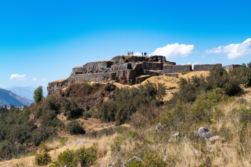
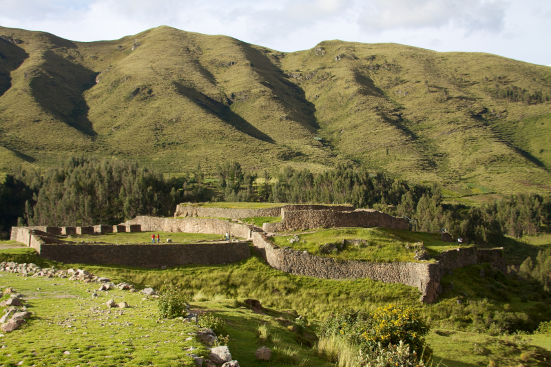
Puka Pukara Archaeological Complex

Most people hear “Inca fortress” and picture a dramatic castle vibe. Fair enough. Puka Pukara has defensive-looking walls, high viewpoints, and that unmistakable sense of “this spot matters.”

But here’s the thing: calling it only a fortress is like calling an airport “a building with planes.” True, but you miss the point.

The Puka Pukara Archaeological Complex likely worked as a control site along key routes leading in and out of Cusco. Think checkpoint, lookout, and maybe a small hub for state travel. Not glamorous. Very effective. And if you’re into how empires run on logistics (not only temples), this place suddenly gets interesting.

There’s also the name. “Puka” is commonly read as “red,” and “pukara” as “fortress.” In late afternoon light, the stones can take on a warm, rusty tint. It’s subtle. But it sticks with you.

Okay, so what are you looking at up there?

Let’s be honest: if you arrive with no mental map, Puka Pukara can feel like a quick stroll through broken walls and terraces. Then you leave and wonder why it made the tour list.

So give yourself a simple lens: follow the wayfinding. The Incas were obsessed with guiding movement—where you walk, where you pause, what you can see, what you can’t. Puka Pukara makes more sense when you read it like a designed route rather than a random pile of stone.

Here’s what to notice:

  • Layered terraces: They’re not only “steps.” They shape the hillside into usable platforms, like turning a steep spreadsheet into clean rows you can actually work with.
Puka Pukara Archaeological Complex
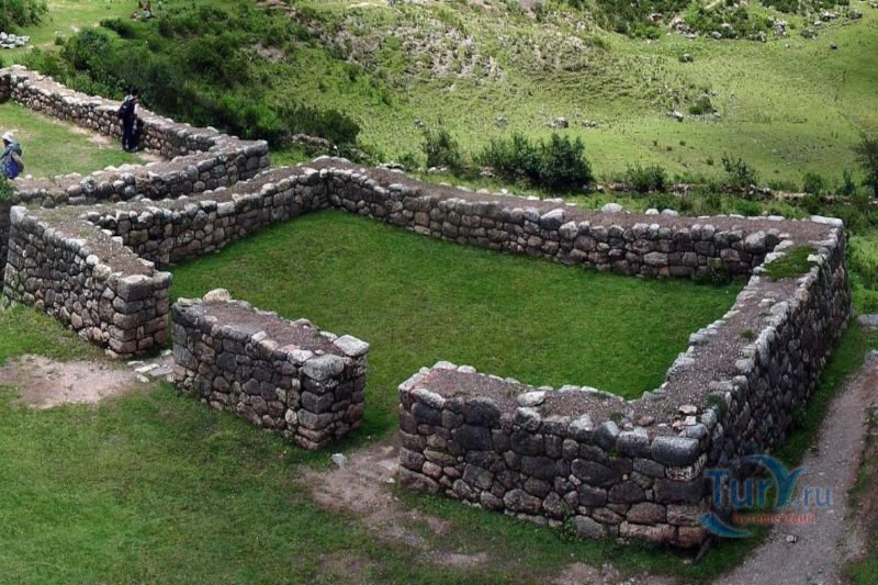
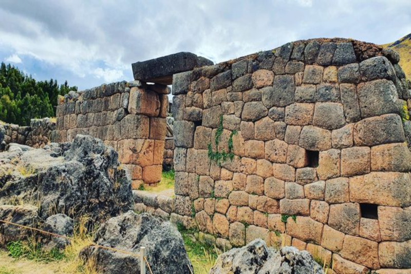
  • Walls with corners and turns: Straight walls are one thing. The bends and angles are where you feel control—narrowing access, creating chokepoints, and setting up sightlines.
  • Small enclosures: Some spaces feel like rooms, others like holding areas. Nobody can promise exactly who stood where, but the layout hints at managed activity, not casual wandering.
  • Viewpoints: This is the big one. The visibility is the feature. Look out and ask: what roads or valleys would be easy to monitor from here?

And yes—part of the fun is that Puka Pukara doesn’t hand you a single “wow” object. It asks you to connect dots. A little more effort, a lot more payoff.

Puka Pukara Peru: the neighborhood matters

Puka Pukara doesn’t sit alone. It’s part of a cluster of sites that get packaged as the Cusco “city tour” circuit, usually alongside Sacsayhuamán, Qenqo, and Tambomachay.

That grouping can feel touristy (because it is), but it’s also historically useful. The Inca heartland around Cusco was dense with function: ceremony, water, carved stone, military control, and the everyday machinery of governance.

If Sacsayhuamán is the headline act, Puka Pukara is the supporting role that makes the plot believable.

Also, it sits close to Tambomachay, which is famous for water channels and ritual associations. Pairing them is a nice contrast: Tambomachay pulls you inward—water, precision, calm. Puka Pukara pushes your attention outward—routes, lookout logic, movement.

Let’s talk about the Puka Pukara altitude (because your lungs will)

Altitude is the quiet factor that changes everything in Cusco. You can be in great shape and still feel a little humbled. That’s not you being dramatic; it’s physics.

The Puka Pukara altitude is often listed in the mid-3,000-meter range above sea level, and sources vary depending on the measuring point. The practical takeaway is simpler: it’s high, it’s exposed, and your pace will slow down.

Small tips that sound boring—until they save your day:

  • Move like you mean it… but slower. Quick bursts on stone steps are where people get woozy.
  • Sun is louder at altitude. A hat and sunscreen feel optional in the city. Up there? They’re part of the kit.
  • Drink water, don’t chug water. Steady sips. Your body’s already adjusting.
  • Bring a light layer. Cusco weather loves mood swings—sun one minute, wind the next.
Puka Pukara Archaeological Complex

And if you’re newly arrived, build your itinerary like a project plan with a buffer. Your first day is not the moment to sprint from one high site to the next. Honestly, letting your body catch up is the most “pro traveler” move you can make.

City tour tips that keep it fun (not frantic)

Here’s the mild contradiction: the city tour is a great idea… and the city tour can be kind of terrible.

It’s great because it’s efficient. Transportation is handled. You see a lot fast. If you’re short on time, it’s the cleanest way to get your bearings.

It can be terrible because “efficient” often means “rushed.” Sites blur together. You spend more time herding than learning. And Puka Pukara, being smaller, becomes the classic victim of the schedule.

So what do you do? You manage the day like a calm operator, not like a passenger.

A few moves that help:

  • Ask the guide for a 10-minute “quiet look” window. Even good guides slip into autopilot. A simple request can change the rhythm.
  • Use Google Maps as your backup brain. Not for a history lecture—just to understand spacing and direction between sites. It helps you grasp the landscape.
  • Bring snacks you actually like. When your blood sugar drops at altitude, everything feels harder. A granola bar becomes a strategic asset.
  • Keep your questions focused. Instead of “What is this?” ask “What’s the strongest evidence for that?” Guides tend to rise to that level.

If you’re going independently, the logistics get simpler than people think. You can hire a taxi for a set loop, or coordinate a ride through apps locals use in Peru (availability varies), or join a small group tour via your hotel or a reputable local operator. The key is timing, not perfection.

When to go (and why your photos aren’t the main point)

Dry season (roughly May through October) tends to bring clearer skies and steadier footing. Rainy season can be lush and dramatic, but paths get slick and the clouds roll in fast.

Time of day matters too. If you want that “red fortress” look, late afternoon light can make the stone feel warmer. Midday can be bright and harsh—good for visibility, less forgiving for faces in photos.

And sure, you’ll take photos. Everyone does. But Puka Pukara is one of those sites where the real memory is a feeling: standing on a terrace, wind in your ears, and realizing the Incas chose this spot because it controls the story the landscape tells.

Puka Pukara Archaeological Complex

A quick “history buff” checklist (without turning it into homework)

If you like leaving a site with more than a vague impression, keep these questions in your pocket:

  • What can you see from here that you can’t see from below? Visibility is power.
  • Where would movement be easy, and where would it be slowed? That’s the difference between a path and a controlled approach.
  • How does this compare to nearby sites? Puka Pukara makes more sense when you contrast it with Tambomachay’s water focus or Sacsayhuamán’s monumental scale.

None of this requires a PhD. It’s more like reading a well-designed city: you notice why streets turn, why plazas open, why some buildings sit high. The logic is there if you look.

So, is Puka Pukara “worth it”?

Yes—and not because it’s the flashiest stop near Cusco.

Puka Pukara is worth it because it shows the Inca state in working mode. It’s the kind of place that whispers, “This empire didn’t run on vibes.” It ran on routes, control points, and smart use of terrain.

If you’re traveling through Puka Pukara Peru territory on a city tour, try giving this site a little extra attention. Slow down. Look outward. Trace the lines of walls the way you’d trace a plan on a whiteboard.

And then, when you head back to Cusco—maybe for a coffee, maybe for a pisco sour, maybe for an early night because altitude wins—you’ll realize something nice happened. The day didn’t feel like a checklist. It felt like a story you could actually follow.

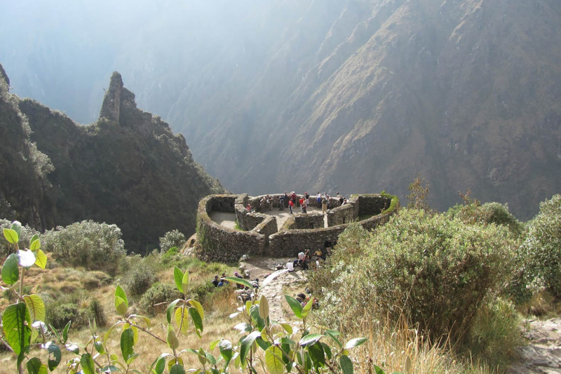
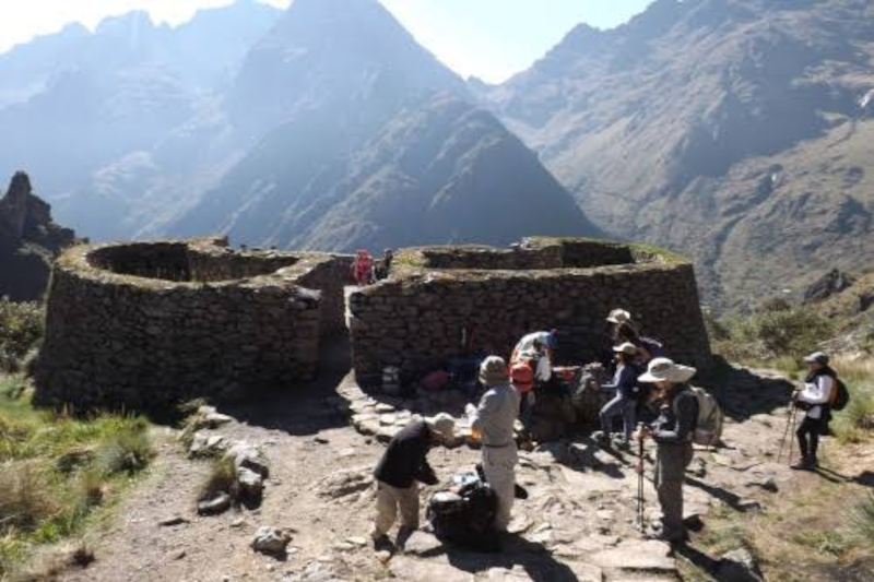
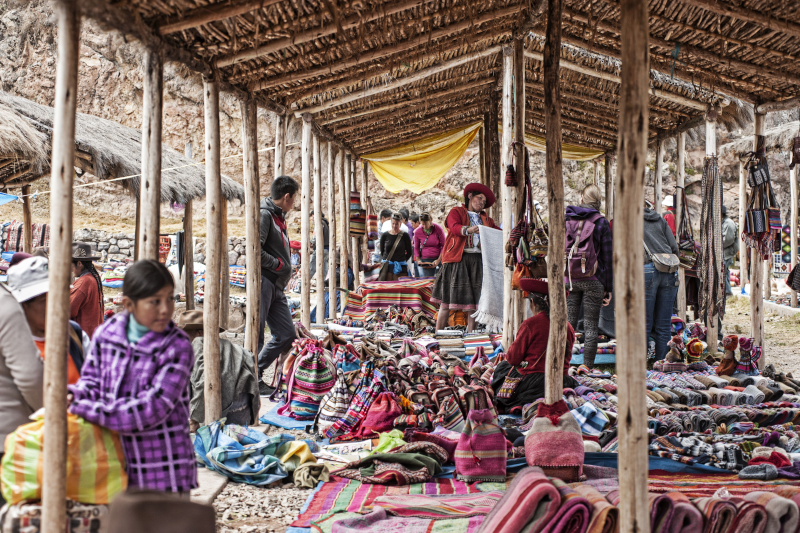
Runkurakay is one of those places that’s easy to miss on paper and hard to forget in person. It’s not huge. It doesn’t scream for attention. But when you reach it on the Inca Trail—lungs working overtime, legs negotiating those stone steps—it hits different. You stop. You look. And you think, wait… why here?

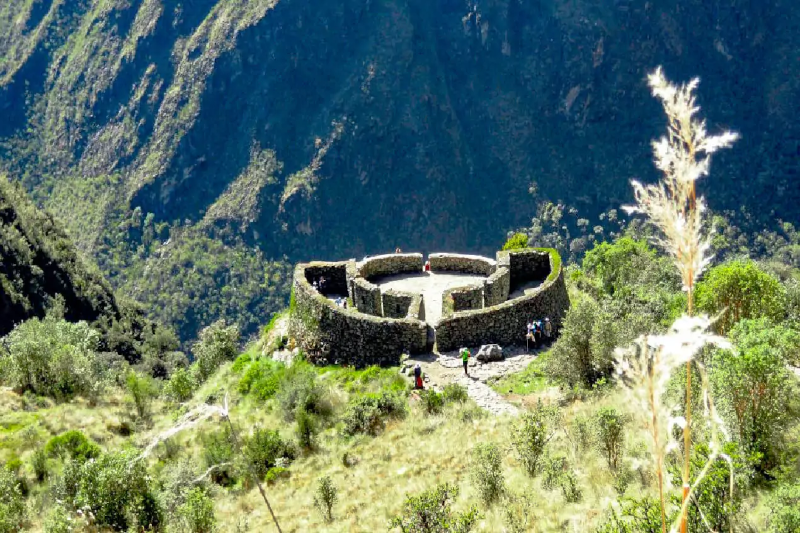
The Runkurakay ruins sit up in the Andes on the way to Machu Picchu. People often describe the site as “circular,” and that’s fair. The shape feels unusual compared to many boxier Inca buildings. It’s like the trail hands you a round stone pause button.

So what is Runkurakay, really?

Runkurakay

Most guides will tell you Runkurakay likely worked as a tampu—basically a way station. Think of it as a trail-side operations node. A place for rest, a place for oversight, maybe a place where supplies were staged or messages were relayed. Not glamorous, but important.

And here’s the mild contradiction: it feels both practical and a bit ceremonial. That sounds like a hedge, I know. But it fits the Inca way of building—function and meaning often shared the same walls. A checkpoint can also be a statement. A shelter can also be a signal.

Also, you’ll see the name spelled a few ways (Runkurakay, Runkuraqay, and so on). Don’t stress. Quechua place names get spelled the way different ears hear them, and the trail doesn’t care about our spelling debates.

The climb, the pass, and that “why am I doing this?” moment

Runkurakay is tied to the climb toward Runkurakay Pass, a high point on the route. Sitting at 3,760 meters (12,335 feet)—with the pass itself looming just above at nearly 3,950 meters (12,959 feet)—elevation up there is no abstract number; it’s an experience. Your pace slows. Your breath gets louder. Your brain does that funny thing where it gets emotional about a rock because the rock is… still there, and you are tired.

But that’s also why the location makes sense. If you’re running a long-distance mountain route—ancient or modern—you plan for fatigue, weather, and bottlenecks. In project terms, this is risk management and resource planning, except the “resources” are people, food, and time, and the “weather report” is the cloud line rolling in.

One more quiet detail: a spot like this can do several jobs at once. It can offer cover. It can watch a corridor of movement. It can mark a threshold between valleys. It can also make travelers feel seen—which is a kind of control, isn’t it?

Small walls, big questions

Runkurakay feels mysterious because it leaves space. You can tell it mattered, but it doesn’t hand you a neat label. Who stayed here—messengers, porters, officials? How often? For how long? And what did the place mean to them when the mountains weren’t a backdrop for photos, but a living force with moods?

Runkurakay

The rounded layout adds to that feeling. Curves change how you move. They change how sound carries. They change how you look out at the slope. And even if you’re not an architecture person, you can feel the difference in your body. The place nudges you to slow down.

Zoom out a bit: the Inca Trail as a “system”

It’s tempting to treat the Inca Trail like a single task: hike, arrive, celebrate. But the trail was a network—more like a well-run logistics chain than a lone footpath. Sites along the way act like checkpoints, handoff points, and support hubs. If you’ve ever worked on a team project with deadlines, you know how much effort goes into the parts nobody claps for.

And that’s where Runkurakay starts to shine. It’s not trying to compete with Machu Picchu. It’s doing a different job. It shows how an empire handled movement through harsh terrain: steady, planned, and a little bit intimidating. Not in a villain way—more in a “we’ve thought this through” way.

That said, archaeology is careful work. Some interpretations are strong; others are educated guesses. If you hear two versions of the story on the same day, that’s not failure. That’s the field doing its job.

Little things to notice (without turning it into homework)

When you arrive, try this simple sequence—quick, not fussy:

  • Look out first. What can the site “see”? What can it’t?
  • Then look close. Stone fit, wall lines, doorways—small choices with big intent.
  • Then look back at the trail. Where did you come from, and where are you being sent next?

It’s a bit like reviewing a workflow. You notice the inputs, the bottlenecks, the handoffs. Only here, the “workflow” is a mountain pass, and the stakeholders are time, weather, and human endurance.

Quick reality check: how to enjoy it without wrecking it

Runkurakay

Runkurakay is tough enough to reach; it doesn’t need extra wear and tear. Stay on the path. Don’t climb on fragile stone. Give other hikers room—trail etiquette matters when everyone’s running on thin air and snack bars.

And yes, this is where modern trends show up. People track altitude on watches, compare trekking poles, post clips, chase the “quiet season.” None of that is wrong. But the site rewards a different kind of attention, too—the kind that lasts longer than a feed refresh.
Leaving with the right kind of aftertaste

Runkurakay doesn’t deliver a grand finale. It delivers a lingering thought. You pass through, you recover your breath, and you carry on. Later, you’ll remember the curve of the walls, the sharp air, the feeling that the trail was designed by people who understood both logistics and awe.

So if you’re headed that way, give it a minute. Not a rushed minute—an honest one. Let the place be both a practical stop and a strange little question mark. Because, really, isn’t that what makes travel stick?

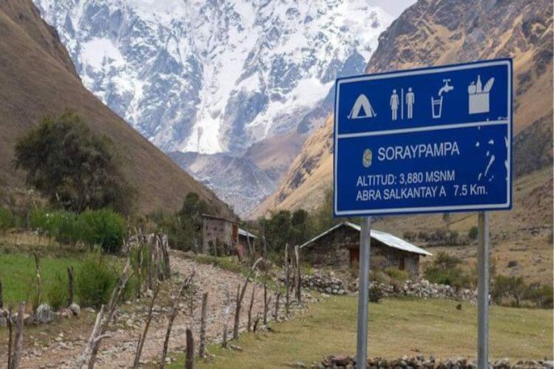
Soraypampa is the kind of place that makes you feel two opposite truths at once: you’re wildly alive under a sky packed with stars—and you’re also very aware you’re trying to sleep at nearly 13,000 feet. This is Soraypampa Campsite: What Sleeping at 3, 900m Feels Like in real life: a thin-air night where your body negotiates for oxygen, your gear choices suddenly matter, and your “normal” sleep routine gets rewritten.

If you’re heading to Soraypampa Peru on the Salkantay route, this guide breaks down what the altitude does to sleep, what the Soraypampa camping experience is actually like, and how to make the night more comfortable—whether you’re in tents vs cabins Soraypampa, a Soraypampa lodge, or a Soraypampa hostel-style setup.

Where Soraypampa Sits on the Trek (and Why It Feels So High)

soraypampa

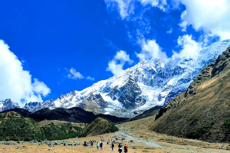
Soraypampa campsite altitude is commonly cited around 3,900 m, and you feel it fast. The campsite is a classic first-night stop for many itineraries—especially if you travel Mollepata to Soraypampa on day one—because it positions you for an early climb toward the Salkantay Pass the next morning.
What that means for sleep:

  • Your body may not be fully acclimatized yet.
  • You might arrive tired, slightly dehydrated, and with appetite changes.
  • Nighttime cold plus low oxygen can make rest feel “light” or broken.

The Soraypampa altitude isn’t just a number; it’s the reason people lie awake thinking, “Why am I breathing like this while I’m doing nothing?”

What Sleeping at 3,900m Actually Feels Like

Sleeping high isn’t always dramatic. Often, it’s subtle—until it isn’t. Common sensations at Salkantay Trek Soraypampa camp include:

1) Weird breathing patterns

At altitude, you can experience periodic breathing: you drift off, breathe shallowly, then wake up feeling like you need a deeper breath. It’s not necessarily dangerous, but it’s unsettling if you’ve never felt it.

2) A “wired but tired” body

You’re exhausted from hiking, yet your sleep feels thin—like you’re hovering near the surface instead of dropping into deep rest.

3) Cold you notice in your bones

Even if your upper body feels warm, feet and hips can get chilled quickly. Soraypampa temperature at night often drops close to freezing (and can dip below), depending on season and wind exposure.

4) Appetite changes (and the snack dilemma)

Some people don’t feel hungry at dinner, then wake up at 2 a.m. starving. Others have the opposite: no appetite at all, which makes it harder to keep energy up.
5) Morning head pressure

Not always pain—sometimes just a “tight” forehead sensation. This is one of the classic sleeping at 3900 meters symptoms many hikers describe after a restless first night.

Altitude Symptoms vs. “Normal Discomfort”: What’s Typical?

soraypampa

Most people experience mild effects at Soraypampa campsite. Typical altitude sickness symptoms:

  • Light headache
  • Slight nausea
  • Reduced appetite
  • Restless sleep
  • Shortness of breath on small efforts

Red flags are different:

  • Severe headache not improving with rest/hydration
  • Persistent vomiting
  • Confusion, trouble walking straight
  • Chest tightness, severe breathlessness at rest

If red flags appear, don’t try to “tough it out.” Descending is the most effective response.

Soraypampa Campsite Facilities: What to Expect on Arrival

Soraypampa campsite facilities vary by operator and season, but generally you’ll find:

  • Designated camping zones with wind exposure
  • Bathrooms (sometimes basic; sometimes better-managed)
  • A dining tent/communal shelter with guided groups
  • Limited lighting at night (headlamp required)
  • Some sites offer cabins or domes (a big comfort upgrade)

If you’re comparing comfort levels, Soraypampa accommodation often splits into:

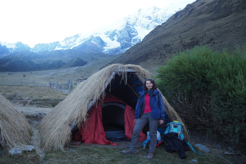
  • Soraypampa camping in tents (most common)
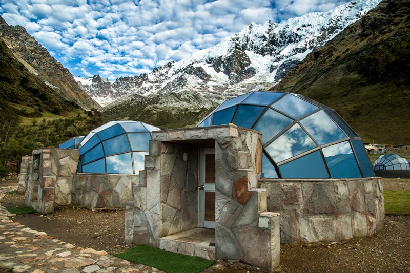
  • Dome-style glamping such as Sky Camp Soraypampa
  • A Soraypampa lodge or cabin option (warmer, less wind, easier sleep)
  • Budget-friendly “hostel-like” options (often referred to by travelers as a Soraypampa hostel experience, though the setup can be rustic)
soraypampa

Soraypampa Peru Weather: The Night Is the Real Test

When people search Soraypampa Peru weather, they usually want to know one thing: “How cold will it be when I’m trying to sleep?”

Key patterns:

  • Afternoons can be sunny and deceptively mild.
  • Wind increases chill quickly once the sun drops.
  • Nights are cold year-round at this elevation.
  • In wetter months, dampness plus cold can feel harsher than the temperature suggests.

Practical take: plan for freezing-adjacent conditions even if your day hike felt warm.

How to Sleep Better at High Altitude (Actionable, Field-Tested)

If you want to know how to sleep better at high altitude, focus on oxygen, warmth, hydration, and routine.

Dial in altitude sickness prevention camping basics

  • Go slower than you think you need to. Arriving less “blown up” improves sleep.
  • Hydrate early, not just at dinner. Clear-ish urine is a decent quick check.
  • Avoid alcohol the day before and the day of sleeping at Soraypampa.
  • Eat a real dinner even if you’re not hungry—carbs often sit easiest.

Use coca tea the right way

Many trekkers use coca tea for altitude sickness (or for the “altitude blah” feeling). It can be soothing and warming at night. Treat it as a comfort tool, not a cure:

  • Sip it earlier in the evening so you’re not up all night peeing.
  • Pair it with hydration and warmth.

Sleep system tweaks that matter

  • Put tomorrow’s clothes in your sleeping bag for warmth.
  • Warm your feet: dry socks + loosened laces before bed.
  • Use a buff as a sleep mask and to warm your face.
  • Keep a small snack accessible (nuts, chocolate, crackers) for 2 a.m. wake-ups.

Best Sleeping Bag for 4000m: What Actually Works at Soraypampa

Choosing the best sleeping bag for 4000m is less about brand and more about temperature rating, insulation type, and whether you sleep cold.

A practical target for Soraypampa:

  • Comfort rating around -5°C to 0°C (23°F to 32°F) for most people
  • If you sleep cold, go warmer—especially in a tent with wind
soraypampa

Other high-impact items:

  • Insulated sleeping pad (more important than people think)
  • Liner (adds warmth and keeps the bag cleaner)
  • Puffy jacket + beanie reserved for camp only (stay dry)

This is where “I’ll be fine” becomes “I’m counting minutes until sunrise.” Don’t under-pack your sleep system.

Getting There: Mollepata to Soraypampa (and Transport Questions)

Most trekkers reach camp as part of a guided itinerary, often after starting in Cusco and transferring toward Mollepata before continuing uphill. If you’re researching the bus from Cusco to Soraypampa, note that independent logistics can vary by season and road conditions; many people end up using:

  • Shared transport to Mollepata, then onward by car/van
  • Private transfer if traveling with a group or tight timeline

Whichever route you take, the day’s elevation gain is what matters for sleep—pace yourself on the ascent from Mollepata to Soraypampa.

soraypampa

Soraypampa vs Huayracmachay Camp vs Chaullay: Which Sleep Is Easier?

If you’re comparing camps, here’s the honest trade-off:

Soraypampa vs Huayracmachay camp

  • Soraypampa: higher, colder, more altitude impact on sleep; iconic views and a common staging point.
  • Huayracmachay: typically lower than Soraypampa (depending on exact site), often slightly easier breathing and warmer sleep—but you may change your next-day pacing.

Soraypampa camp vs Chaullay

  • Chaullay is much lower, usually warmer, and sleep tends to be deeper—many people feel dramatically better there.
  • But if you skip Soraypampa, you may lose the classic early start rhythm for the pass, depending on itinerary.

If your top priority is sleep comfort, lower is usually easier. If your priority is the classic Salkantay staging and sunrise/alpine vibe, Soraypampa wins.

Tents vs Cabins Soraypampa: What to Choose

If you have a choice, tents vs cabins Soraypampa comes down to wind, warmth, and how sensitive you are to altitude sleep disruption.

Tents are great if:

  • You have a warm bag + good pad
  • You’re comfortable with temperature swings and noise
  • You want the “true” Soraypampa camping experience

Cabins/domes (including Sky Camp Soraypampa) can be worth it if:

  • You sleep cold
  • You’re worried about restless nights at altitude
  • You want faster recovery for the pass day

Either way, keep expectations realistic: altitude is altitude, even indoors.

Soraypampa Campsite Booking and What to Pack

For Soraypampa campsite booking, many travelers secure spots through a Salkantay operator who bundles meals, tents, and camp access. If you’re going independent, confirm in advance what’s included and what’s not (sleeping bag rental quality varies).

For what to pack for Soraypampa camp, prioritize sleep and warmth:

  • Warm sleeping bag (see above) + insulated pad
  • Down or synthetic puffy + base layers
  • Beanie, gloves, thick sleep socks
  • Headlamp + spare batteries
  • Lip balm + moisturizer (dry air is real)
  • Electrolytes + easy snacks
  • Earplugs (wind + group camps)

Takeaway: A High Night You’ll Remember (and How to Make It Better)

Sleeping at Soraypampa isn’t about perfect rest—it’s about managing Soraypampa altitude so you can enjoy the landscape and still function for the next day. With the right sleep system, smart pacing, and practical altitude sickness prevention camping habits, you can turn a potentially rough night into a memorable one—stars overhead, cold air in your lungs, and the quiet satisfaction of handling Soraypampa campsite at 3,900 meters.

Quick sketch before we hit the trail:

  • What the “7 Lakes” actually look and feel like
  • Altitude: the real project manager of your day
  • Day hike vs. the longer Ausangate trek (and why they’re different moods)
  • Logistics from Cusco, plus what’s worth packing
  • The little extras: hot springs, alpacas, and the kind of silence you remember
7 lakes of ausangate​

The Ausangate 7 Lakes hike is one of those Andes days that sounds like a brochure and then… somehow still beats the brochure. You’re near Cusco, but you’re far from the “line up, snap a photo, line up again” vibe. Instead, you get high mountain air, glacial peaks that look almost unreal, and a chain of lakes that keep changing color like someone’s adjusting the saturation slider.

It’s also a real hike. Not scary-technical, but honest. You’ll feel it in your lungs and maybe in your pride (in a good way). And if you’re coming from the United States, the altitude can be a surprise—like showing up to a meeting and realizing someone moved the agenda to a different timezone.

So… what are the Ausangate 7 Lakes?

They’re a set of alpine lagoons tucked into the Vilcanota range, near the small community of Pacchanta, with Ausangate Mountain looming like a quiet, snowy CEO in the background. Each lake has its own personality. One might look ink-blue and serious. Another flashes green like a gem. Another goes milky-turquoise where glacial minerals swirl in the water.

If you’re into photos, you’ll have a field day—but it’s not just “pretty.” The place has weight. Locals consider Ausangate an apu, a sacred mountain spirit. You don’t need to be spiritual to feel the shift. The landscape makes you lower your voice without anyone asking.

And yes, you’ll see alpacas and llamas doing their daily operations, totally unimpressed by your expensive jacket. That little scene—people herding animals across a wind-swept valley—lands differently when you realize it’s not a performance. It’s life, at 14,000+ feet.

Altitude: the part nobody can “grit” their way through

7 lakes of ausangate​

Let me be slightly contradictory for a second: the 7 lakes hike can feel “easy”… and it can feel brutal. Both can be true. The trail doesn’t demand mountaineering skills. But the Ausangate 7 lakes altitude changes the math. Most routes start around 4,300 meters (about 14,100 feet) and climb higher—often around 4,600–4,700 meters (15,000+ feet), depending on your exact loop.

At that elevation, your body is basically running a bandwidth problem. Less oxygen means your normal pace feels like you’re pushing a heavy cart. The smart move is to treat the hike like a long-term deliverable: steady progress, low drama, lots of check-ins with yourself.

A few practical, non-mystical ways to reduce the odds of altitude trouble:

  • Acclimatize in Cusco for a couple days. Even easy walks help.
  • Hydrate more than you think you need. Coca tea is common here (and yes, it’s part of local culture).
  • Go slow on purpose. If you can chat in short sentences, you’re doing it right.

If you’re the “I’ll power through” type—honestly, same—this is one of those places where powering through backfires. The win is finishing strong, not finishing fast.

Day trip or the full Ausangate trek?

The 7 lakes of Ausangate hike is usually done as a day trip. You’ll start before sunrise from Cusco, bounce along mountain roads for a few hours, and begin hiking once you reach the Pacchanta area. The loop time varies, but many people are on trail around 4–5 hours, plus stops. And you’ll stop. You’ll tell yourself you won’t, then you’ll see another lake and stop anyway.

7 lakes of ausangate​

The Ausangate trek, on the other hand, is a multi-day circuit around the massif. It’s higher, colder, and more remote, with passes that can top 5,000 meters (16,400+ feet). Think of it as a different product line: bigger scope, bigger risk, bigger payoff. The day hike is an intense, beautiful snapshot; the full trek is a full documentary.

People also compare this area with Rainbow Mountain (Vinicunca). Rainbow Mountain is famous for a reason, but it can feel like a viral trend in physical form. The 7 lakes route usually feels quieter and more spacious—less “content creation,” more actual creation of memories.

Logistics from Cusco (aka: making the day run smoothly)

Most travelers go with a tour from Cusco, and it’s not a bad call. Transportation is the biggest hassle, and tours typically bundle it with breakfast, lunch, and entry fees. From a planning perspective, it’s clean: fewer moving parts, fewer chances to miss your window.

Could you go independently? Sure—if you’re comfortable coordinating a driver, leaving early, and dealing with weather swings. The Andes can go from bluebird skies to sleet with no warning. A local guide also adds context: why Pacchanta matters, what you’re seeing, and how people live here year-round.

If you like having a “backup plan” on your phone, download offline maps before you leave Cusco. Google Maps offline helps for towns; for trails, apps like AllTrails or Gaia GPS can be useful (just don’t treat them like infallible truth).

What it feels like on the trail (and why the lakes keep surprising you)

The first stretch often feels like a gentle warm-up—wide views, crunchy grass underfoot, that cold-and-clean air that makes you breathe deeper without thinking. Then the lakes begin showing up, one after another. A lot of hikes have one big “wow” moment. This one is more like a playlist of wow moments.

And the colors aren’t constant. Sunlight shifts, clouds slide in, wind ripples the surface. A lake you thought was bright turquoise can turn steel-gray in a minute. It’s moody, in the best way.

Somewhere in the middle, you might also notice a weird emotional thing: you stop checking your phone. Not because you’re trying to be virtuous—because it stops feeling relevant. The scene is doing all the talking.

Packing: keep it simple, keep it smart

Think layers, not bulk. The temperature can swing hard, and wind is a constant character in the story.

  • Base layer + warm mid-layer + shell (rain and wind protection matters)
  • Waterproof hiking boots with solid grip—mud and rocks are normal
  • Sun protection: sunglasses and sunscreen (high altitude sun is no joke)
  • Snacks you’ll actually eat when you’re slightly nauseous (nuts, chocolate, crackers)
  • A small first-aid kit and blister care—basic risk control

And here’s the funny one: bring a swimsuit. Yes, really.

The hot springs in Pacchanta: the best “closing meeting” you’ll ever attend

7 lakes of ausangate​

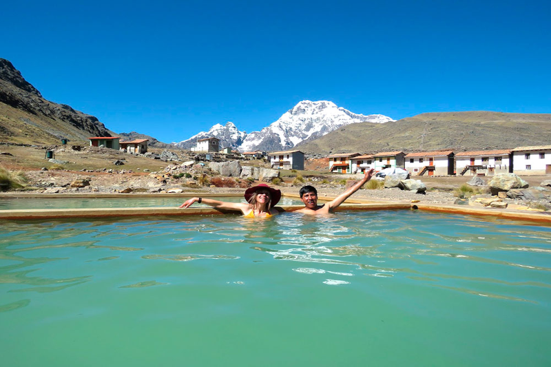
After the hike, many people soak in the hot springs at Pacchanta. It sounds like a luxury add-on, but it feels more like a reset button. Warm water, tired legs, cold air on your face, Ausangate in the distance—your brain finally catches up with what your body just did.

You’ll probably be sitting there thinking, “Why don’t I do things like this more often?” Then you’ll remember: the alarm was brutal, the altitude is real, and comfort has a strong marketing team. Still, this is the kind of day that sticks.

Final thoughts (and a small, honest nudge)

The Ausangate 7 Lakes hike is scenic, yes—but it’s also grounding. It reminds you that nature doesn’t need to be loud to be impressive. Prepare for the altitude, keep your pace steady, and leave room for a little wonder. You’ll come back to Cusco tired, a bit dusty, and oddly energized—like your internal settings got refreshed.

And if you’re debating whether it’s “worth it,” ask yourself a simpler question: when was the last time a place made you pause mid-step, just to look?

You’ve seen the photo: Machu Picchu lit up like someone turned on a soft gold lamp, with mountains stacked behind it like stage scenery. And now you’re wondering the real question—is a Machu Picchu sunrise actually worth the 3:30 AM alarm, the chilly bus line, and the gamble with clouds?

Machu Picchu Sunrise

Here’s the thing: sometimes it’s jaw-dropping. Sometimes it’s a gray, misty slow reveal that feels more like a suspense movie than a postcard. And weirdly? Both can be great.

So, what does “sunrise at Machu Picchu” really look like?

If you’re picturing a clean sun cresting the ridge at 6:10 AM and lighting every stone on cue… I mean, it can happen. But Machu Picchu sits in a cloud forest. Clouds are part of the product. Many mornings start with a thick blanket of mist, and the ruins feel like they’re hiding on purpose.

But the slow reveal is kind of the point. You’re standing there, half-awake, and suddenly a terrace appears. Then a wall. Then the whole city snaps into view like someone pulled a curtain. It’s not always “golden sunrise Machu picchu,” but it’s often mysterious sunrise at Machu Picchu, and that’s not a bad trade.

If you want higher odds of clearer skies, the dry season (roughly May through October) tends to be friendlier. June and July are popular for a reason—more stable mornings, less rain. Still, weather up there changes fast, so treat forecasts like a suggestion, not a promise. (I like checking Meteoblue or AccuWeather the night before, then checking again with coffee in hand.)

Entry times and the morning logistics

Machu Picchu has timed entry slots, and the earliest is typically 6:00 AM. If you want “machu picchu at sunrise,” that early slot is the classic pick. Your main job becomes getting from Aguas Calientes (Machu Picchu Pueblo) up to the gate on time.

Most people take the shuttle bus. Lines can start forming around 3:30–4:00 AM, especially in peak season. The first buses often roll around 5:30 AM, and the ride is about 25–30 minutes. Think of it as a commute with better scenery and worse sleep.

Could you hike up instead? Yes—fit hikers do it, and it’s a flex. But it’s steep, it’s dark, and it can be slippery. If you’re already doing the Inca Trail or another trek, you’ll get your cardio quota anyway.

And yes, there’s a premium shortcut: the Belmond Sanctuary Lodge sits right by the entrance. Staying there doesn’t guarantee sun, but it does cut out the early bus scramble. If your travel style is “pay to reduce stress,” it’s worth knowing about.

Okay, circuits: which one helps with the classic viewpoint?

Machu Picchu Sunrise

Here’s where people get tripped up. Machu Picchu isn’t a free-roam site. It’s structured with circuits, and the circuit you book controls your route and your photos. Rules and naming can shift over time, so always confirm with the official ticket site and the current circuit map before you buy.

In general, if your dream is that iconic wide view—the one that makes your friends say “wait, is that real?”—you’ll want a circuit that includes the upper terraces and the main panoramic viewpoint area (often associated with the popular Circuit 1 or Circuit 2 choices, depending on the current setup).

If you book a route focused more on the lower urban sector, you’ll still get a great visit, but your big “wow” photo might be harder to frame. Not impossible. Just… harder. Like trying to take a team headshot in a crowded elevator.

A small but important note about add-on hikes

If you’re eyeing Huayna Picchu or Machu Picchu Mountain, that’s a different ticket layer. These are limited and can sell out well ahead of time.

How do they compare?

  • Huayna Picchu: steep, dramatic, tighter trails. Big views straight down over the ruins.
  • Machu Picchu Mountain: longer, higher, broader views of the valley. Less “vertical drama,” more “wide-angle calm.”

Either can pair with a sunrise plan, but your timing gets less forgiving. It’s like adding a second meeting to a morning that already starts at 5:00 AM—doable, but you’ll feel it.

Is the 6:00 AM slot always the best? Not exactly (and that’s okay)

I’m going to say something that sounds like heresy: the earliest entry isn’t automatically the “best” for everyone. There. I said it.

Why? Because if your only goal is a clear, bright photo, you might get a better hit rate a little later in the morning—when the sun is higher and the mist has had time to lift. Many days, the most “sunrise at machu picchu” looking light shows up closer to 7:30–9:00 AM, not right at the gate opening.

But then I’ll contradict myself (gently): the 6:00 AM slot is special. Fewer people, softer sound, a calmer pace. It feels like you’re arriving before the world fully clocks in. If you care about atmosphere—about that quiet, almost reverent vibe—early wins.

Crowds: the sneaky factor nobody wants to schedule

Machu Picchu Sunrise

Even at 6:00 AM, you won’t be alone. Sunrise tickets are popular, and everyone has the same idea. The trick isn’t “avoid crowds” (that’s fantasy). The trick is crowd flow.

A simple approach that works:

  • Let the first big wave rush to the viewpoint for the fast photo.
  • Hang back for a minute. Breathe. Take a few close shots.
  • Then move when the pack starts drifting down to the next sections.

It’s low-key traffic management. And yes, it feels a little like timing a lunch break to avoid the office cafeteria line.

What about a Machu Picchu Sunrise Tour—worth it?

A guided Machu Picchu Sunrise Tour can be a smart move if you like context. Guides help with routing, pacing, and the small rules that are easy to miss when you’re bleary-eyed. They also help you read the site—what you’re looking at, why it was built that way, and what still isn’t fully agreed on.

If you’re more of a DIY traveler, you can still get a lot from Machu Picchu using a good guidebook or an audio guide. But if you want the “why this matters” layer without doing homework, a guide is basically your shortcut. Not magic—just efficient.

Photography at dawn (and why your phone might do better than you think)

Let’s talk gear without getting too nerdy. The main issue at dawn is low light plus contrast. The mist can be bright, the stones can be dark, and your camera gets confused.

A few tips that don’t require a photography degree:

  • Expect fog and shoot anyway: fog adds depth and mood. You’ll like those photos later.
  • Wipe your lens: mist and drizzle leave a film. A small microfiber cloth is underrated.
  • Wait for the “open”: the best moment often comes when clouds break for 30 seconds, then close again.

And honestly, modern phones do a solid job here. If you’re on a recent iPhone or Pixel, try a steadier stance and let the night/low-light mode do its thing. If you’ve got a bigger camera, great—just don’t spend the whole sunrise stuck in settings. You came to see the place, not run a photo lab.

Comfort and safety stuff (not exciting, but it matters)

Mornings can be cold—surprisingly cold—then the day warms up fast. Dress like you’re packing for two seasons. A light puffer or fleece, plus a rain shell, is the sweet spot. Gloves and a beanie are nice at 6:00 AM and annoying by 9:30 AM, so make sure they’re easy to stash.

Altitude is the other wildcard. Machu Picchu is lower than Cusco, but plenty of travelers arrive already feeling the altitude hangover from earlier days. If you can, give yourself a couple of days in the Sacred Valley or Cusco first, drink plenty of water, and keep meals simple the night before. Coca tea helps some people; it’s common and easy to find.

One more practical note: rules at the site are enforced. Stay on the marked paths, follow the circuit, and don’t count on being able to “loop back” to a spot you missed. Think of the circuit like a one-way system in a museum—except you’re outdoors and the museum is an Inca city.

So… is a Machu Picchu sunrise worth it?

Machu Picchu Sunrise

If you want quiet, atmosphere, and that feeling of arriving before the day fully starts—yes. A Machu Picchu sunrise is worth it, even when the sun plays hide-and-seek. If you only care about a crisp, bright postcard shot, you may feel happier with a later morning entry, when the clouds have had time to thin out.

But if you’re already going all the way to Peru, waking up early one day isn’t the worst trade. You’ll get the cool air, the shifting mist, and that first look at the terraces when the site feels a bit like it’s waking up with you. And that’s the part people remember.

Plan it like a small work project—tickets, timing, contingencies. Then let it be human once you’re there. Look up. Take the photo. Take another. And when the sun finally hits the stones (or doesn’t), you’ll still have your own version of “machu picchu sunrise.”

Come on admit it; when people say, “I’m going to Machu Picchu,” what they’re visualizing is the stone city, the llamas, and that iconic postcard shot. However, it’s better understood – and more vibrant – as a mountain tale.

So here’s the question that pops up in a lot of trip-planning chats (and group texts): what mountain range is Machu Picchu located in? The short, clean answer: The Andes. In particular, it is located in the Vilcabamba range (also known as Cordillera de Vilcabamba), a mountainous zone within the Andes mountains in southern Peru. And, right there up on a narrow ridge over the Urubamba River, the Inca created a city that looks like it’s up in the clouds.

Machu Picchu Mountain Range

So, is it a “mountain range” or just a few peaks?

Both, kind of. People say “Machu Picchu mountain range” as a handy label for the cluster of steep peaks around the site. Locally and on maps, you’ll usually see the Andes and the Vilcabamba range mentioned more than “Machu Picchu range.” Either way, when you stand there, the geography does the talking.

The mountain behind the ruins (Huayna Picchu in photos) and the mountain in front of the ruins (Machu Picchu Mountain) are two renowned peaks that lie at either side of Machu Picchu. The city is not situated on a level plain. It’s on a ridge. That choice wasn’t random—it was a risk-managed layout before “risk management” was a job title.

The landscape has a split personality (and that’s the magic)

The thing is that you are in the Andes and close to the Amazon basin. Kinda weird and supercool and super funky—cool mountain air one minute, warm jungle breath the next. It is sometimes called cloud forest and that is because the first time the mist goes through the Trees like slow smoke you’ll understand the meaning of the term.

You’ll notice the microclimates fast. Step into the sun. Then shade. Then a light drizzle. Then sun again. It’s like the weather has multiple tabs open and keeps switching.

All round this place doesn’t have to try too hard to impress you with its natural aspects: the orchids on a rock, colorful birds darting about the trail, and plants like you’d find in a science museum. This also means you will sometimes see llamas. They don’t say much, but they are the local force of untrained security, and they don’t like you being at their property.

Machu Picchu Mountain Range

Wait—why did the Inca build there?

This is where the “project plan” angle shows up. Building on a ridge with steep slopes is a headache. And yet, it solved problems.

Defense: the terrain is naturally hard to reach.

Water: springs run through the area, and the Inca engineered channels to move water where it needed to go.

Farming: those terraces weren’t only pretty. They were a food system and a slope-stabilizing system at the same time.

People love to say it was all spiritual. Sure—there’s strong evidence the site had religious meaning. But it’s also practical. And that mix feels very human, doesn’t it? Big beliefs, but still worried about erosion and storage.

Stonework that still makes engineers squint

You don’t need to be an architect to feel it: the stone walls look tight. Like, no gaps tight. The INCAs were able to shape stones to such an exquisite degree that the blocks fit together without being masonry. This is helpful during earthquakes as the resulting earthquake-induced rock motion can adjust a little rather than cracking brittle concrete.

There is drainage at Machu Picchu and this is also something that comes across in your racing quite easily when you are busy putting in images (second or third view already taken). Rain is common here. So under the terraces and plazas, there’s layered stone and gravel that lets water pass through. Think of it as a giant, built-in “stormwater system,” except it’s made of rocks and patience.

There’s a reason civil engineers visit and nerd out a bit. The site is a case study, but it’s also oddly emotional. You’re looking at problem-solving that survived centuries.

Let’s talk Machu Picchu hikes (because the trails are half the point)

If you like walking through a place instead of only looking at it, the hikes here feel like a reward. Some are famous. Some are quieter. Most involve stairs—lots of stairs.

The Classic Inca Trail: the “iconic” choice (with paperwork)

The Classic Inca Trail is legendary for a reason. You move through ruins, forest, and high passes, and you arrive on foot the way travelers did long ago. But it’s also capped and controlled, which means you need a permit through a licensed operator.

Planning note, in plain terms: if you’re aiming for peak season (May to September), book months ahead. If you’re more of a “let’s see how we feel” traveler, you’ll want a backup plan.

Salkantay Trek: tougher, wilder, and very worth it

Machu Picchu Mountain Range

The Salkantay Trek is often pitched as the alternative, but it’s not a consolation prize. It’s a big route with big scenery. You cross high mountain zones and then drop into warmer, greener terrain. Your legs will notice.

Can beginners do it? Yes—if you train and take acclimatization seriously. No technical climbing, but the altitude can be the real boss fight.

Small digression that matters: if you track workouts, you’ll probably love how hiking here feels like a real “performance” day. If you don’t track workouts, you’ll still love it, because your brain stops buzzing after a few hours on a trail. It’s hard to worry about email when you’re counting steps and watching clouds roll over a ridge.

Inside the site: Huayna Picchu vs. Machu Picchu Mountain

After arriving at the citadel, there is a classic choice of who to climb Huayna Picchu or Machu Picchu Mountain.

The Huayna Picchu is rugged and steep. As the trail descends it is narrow and parts of it are exposed.  It’s exciting… and a little spicy if you hate heights.

Machu Picchu Mountain takes longer and climbs higher, but the path is usually wider. The payoff is a broad view of the whole area—the ruins, the river curve, the peaks. It’s less “white-knuckle,” more “slow burn.”

Both require timed tickets. And yes, they sell out. This is one of those moments where planning beats optimism.

The question people keep asking: “Will I get altitude sickness?”

Maybe. That’s the honest answer. One of the reasons you usually need to spend a couple of days acclimatizing in Cusco or the Sacred Valley is that Cusco is higher than Machu Picchu. It’s sort of like welcoming your body on the job! Allow for adjustment, water and gradually get used to the intensity of hard work. Many travelers try coca tea (it’s common in Peru). Some carry medication prescribed by their doctor. Either way, the main move is simple: don’t rush day one.

Here’s a mild contradiction: you can be “fit” and still feel rough at altitude. Fitness helps, but oxygen is a separate problem. If you’ve ever flown to a new time zone and felt off, it’s a similar vibe—your system needs a moment to catch up.

Getting there: the logistics are part of the story

Machu Picchu Mountain Range

Machu Picchu is no ordinary by-pass. The majority of travellers make the journey from Cusco to Ollantaytambo and end up by train to Aguas Calientes (also known as Machu Picchu Pueblo). Train brands like PeruRail and Inca Rail run the route, and the ride is scenic in that “why does my camera roll have 80 river photos?” way.

Budget route? Some people go to Hidroelectrica and walk along the tracks to town. It’s flatter than the big treks, but it’s still a real walk. And it’s a reminder that “cheap” often means “more time.”

Once you’re in Aguas Calientes, you’ll either bus up to the entrance or hike up (steep, early, humid). Either choice works. It depends on your energy budget—and whether your knees file complaints.

When to go (and how the seasons mess with your plans)

The dry season, roughly May through September, gives you the highest odds of clear views. It’s also the busiest. Shoulder months can be a sweet spot: fewer crowds, decent weather, and a calmer feel on the paths.

Cloudy skies and slippery steps may be a feature of rainy season (from about November to March). It can also result in greener hills, moody fog and the feeling that the ruins beam out of their habitat.If you’re the type who likes atmosphere more than perfect skies, don’t write it off.

And a quick modern-trend aside: people are traveling with “content plans” now—photos, reels, drone shots (drones aren’t allowed at the site), all of it. That’s fine. Just remember the place is better when you give it a few minutes without a lens in front of it. You’ll feel the scale more. Your shoulders might drop. It happens.

What to pack (not a spreadsheet, I promise)

Packing for the Machu Picchu mountain range is a bit like packing for a day that can’t commit. Cool mornings, warm afternoons, sudden rain. Layering is the smart play.

  • Broken-in hiking shoes: grippy soles help on stone steps.
  • Light rain jacket: the mist can turn into real rain fast.
  • Warm layer: mornings can feel sharp.
  • Sun protection: hat, sunglasses, sunscreen. High altitude sun is no joke.
  • Water + snacks: steady energy beats heroic energy.
  • Offline maps: apps like AllTrails or Gaia GPS are handy (download ahead).

Also: bring patience. Lines happen. Rules change. Tickets have time windows. It’s not chaotic, but it’s not frictionless either.

Why this place sticks with you (even after the photos fade)

Machu Picchu Mountain Range

By the time you leave, you’ll probably have a favorite moment. It might be a big one—sunrise over the ruins. Or something small—hearing water run through a stone channel, or catching the scent of wet earth after a quick shower of rain.

And maybe that’s the real point of exploring the Machu Picchu mountain range. The mountains aren’t background. They’re the main character, and the city is the bold plot twist sitting right in the middle.

So yes, Machu Picchu is located in the Andes, in the Vilcabamba range. That’s the geography answer. But the lived answer is simpler: it’s a place where the land and the people who shaped it still talk to each other. Quietly. Clearly. If you listen.

Quick outline (so you know where we’re headed)

  • Why Chinchero feels different (even if you’ve done markets before)
  • Chinchero market days + hours (and the “don’t show up late” reality)
  • Getting there from Cusco without turning it into a logistics project
  • Textiles: what you’re seeing, what it means, and what’s worth buying
  • Haggling, but make it respectful
  • Chinchero market vs Pisac market (the honest comparison)
  • What else to do in town + what to eat when your nose leads the way

Chinchero sits high in the Andes, in the Sacred Valley, and it has this calm-but-busy energy that’s hard to fake. People often plan Peru like a project timeline: Cusco, Sacred Valley, Machu Picchu—done. But markets are where the “real life” part shows up. The Chinchero market isn’t a museum display. It’s a weekly rhythm. Local people come to sell, trade, catch up, and yes, make a living.

Chinchero Market

And if you’re wondering whether it’s worth your time when you could be staring at ruins or chasing the perfect postcard view… well, why pick? Chinchero gives you culture, color, and a very practical bonus: you can buy something that you’ll actually use again, not just a souvenir that lives in a drawer.

First impressions: why Chinchero grabs you fast

You walk into the main square and it hits you—reds, deep pinks, bold stripes, and patterns that look like they were designed with zero fear. It’s lively, but not frantic. And here’s the thing: in Chinchero Peru, a lot of people wear traditional clothing because it’s normal, not because a tour bus is watching.

Sometimes travelers say, “I want something authentic.” Fair. But let’s be real: the market is still a business. Money changes hands. Photos get taken. The difference is that in Chinchero, the tradition doesn’t feel like a performance. It feels like a Tuesday.

Chinchero market days and hours (aka: don’t overthink it, but don’t wing it)

Chinchero market days are commonly Tuesday, Thursday, and Sunday, with Sunday usually being the busiest. That’s when more families from nearby communities show up with produce and supplies, not only crafts. If you want the biggest, most energetic version of Chinchero market Peru, Sunday is your day.

Chinchero market hours aren’t posted like a mall schedule. In general, vendors start setting up early—think around 7:00 AM—and the action tapers off around 2:00 PM. If you arrive late, you’ll still see plenty, but you’ll miss the best browsing window. Also: weather and local events can shift things, so if you’re on a tight plan, ask your hotel or guide the day before.

One small, not-so-glam detail: altitude. Chinchero is around 3,700 meters. If you just flew in, your body might be running a slow background update. Go easy. Drink water. If coca tea is offered, try it. And if you feel off, listen to that feeling. No scarf is worth a headache that ruins your day.

Getting there from Cusco (simple choices, real trade-offs)

Chinchero is about 30 km from Cusco. Close enough for a day trip, far enough that you’ll want a plan that matches your style.

  • Colectivo (shared van): Cheap, frequent, and usually quick. It’s also a little chaotic, which is kind of the point.
  • Taxi or private driver: More control, more comfort. If you’re traveling with a group, the cost often makes sense.
  • Tour day: If you’re doing Moray, Maras, or Ollantaytambo anyway, Chinchero slots in neatly. Think of it as stacking stops on one route.

One pro tip from the “I’ve been burned before” department: keep small bills. Markets run on cash. ATMs are not the vibe here. And card readers? Sometimes. Often not.

Textiles: the main event (and why it’s more than shopping)

Chinchero Market

Let’s talk about what you’re actually seeing. Chinchero is known for weaving, and not in a “cute craft corner” way. Weaving here is skill, family knowledge, and income—rolled into one.

You’ll often see a loom demo at a nearby workshop or co-op. It’s worth stopping. Not because you’re required to buy (you’re not), but because once you watch someone spin yarn, set up a pattern, and keep tension with their own body position, you start reading the textiles differently. They stop looking like “a blanket.” They start looking like hours.

Natural dye talk can sound a bit like marketing, but it’s also real. You’ll hear about cochineal (a tiny insect used for reds) and plants, minerals, and even ash used to shift shades. It’s like a color lab—just without fluorescent lights and spreadsheets.

Okay, but is it real alpaca?

This is where a little buyer awareness helps. A lot of stalls will say “alpaca,” and some items are 100% alpaca, some are blends, and some are basically acrylic in disguise. That doesn’t make anyone a villain. It’s just the market.

  • Feel: Alpaca tends to feel smooth and warm quickly. If it’s scratchy, it may be a rougher fiber or a blend.
  • Drape: Better wool hangs with a soft weight. Acrylic can feel stiff.
  • Label reality: If it has a factory tag, read it. If it doesn’t, ask directly. Simple questions work.

Here’s a mild contradiction, and I mean it kindly: you can’t “test” alpaca perfectly in five seconds… but you can get a lot better at guessing once you’ve touched a few pieces side by side. Your hands learn fast.

How to haggle without being that person

Yes, you can negotiate. And yes, you should still be respectful. Think of it like a business chat, not a game show.

A friendly greeting goes a long way. Even a simple Buenos días sets a good tone. Then you can ask the price, pause, and make a counteroffer that feels fair. Often, 10–20% is a normal range. If you try to cut it in half, the vibe gets weird fast.

Also, here’s the part people don’t say out loud: you’re not only paying for an object. You’re paying for time, skill, and a supply chain that looks nothing like Amazon. If you want a “deal,” buy more than one item. That’s a win-win that doesn’t feel stingy.

Chinchero Market

Chinchero market vs Pisac market: which one wins?

If you’re comparing Chinchero market vs Pisac market, you’re not alone. They’re both famous. They’re both in the Sacred Valley. They both have textiles. And they feel very different.

Pisac is larger and tends to have more variety—especially jewelry and mass-made souvenirs. It’s also more crowded, more tour-heavy, and sometimes a bit louder in the “sales pitch” sense.

Chinchero market Peru feels smaller and more focused, especially if textiles are your priority. You’re more likely to talk with the person who made the piece (or someone close to the making of it). That direct connection is the whole point for many travelers.

So which should you choose? If you want variety and scale, Pisac. If you want weaving culture and a more local feel, Chinchero. If you can do both, do both—and then laugh at yourself for thinking you’d buy “just one scarf.”

Don’t leave right away: Chinchero has a second act

Once you’ve wandered the stalls, take 30–60 minutes to walk around town. Chinchero has Inca terraces and stonework nearby, and they’re not usually packed. It’s a nice shift. Market noise fades, and suddenly you’re looking at engineering that still makes modern people nod with respect.

There’s also a colonial church near the square, built over Inca foundations. It’s a beautiful, complicated symbol of history—two worlds layered in one place. If you like art, look for the painted walls and ceiling details. They’re the kind of thing you don’t notice at first, and then you can’t stop noticing.

What to eat (because you’ll smell it before you see it)

Markets make you hungry. It’s science.

Try choclo con queso: big Andean corn with salty cheese. It’s simple and oddly comforting. You’ll also see empanadas, soups, and sometimes sweet treats like picarones (fried rings with syrup). If you’re cautious about street food, start with something hot and freshly cooked. And keep hand sanitizer in your daypack—practical travel is still travel.

A quick tangent that matters: if you’re traveling in the rainy season (roughly November to March), pack a light rain shell. Not because you’ll melt—because the market gets slippery, and nobody looks cool sliding on stone steps. Dry season has its own personality: sunny days, cold mornings, and dust. Layering solves both.

Final thoughts: what you’ll remember later

Chinchero Market

The Chinchero market isn’t only about buying. It’s about seeing how a place works when it’s not trying too hard to impress you. You’ll hear Quechua and Spanish mixed together. You’ll see kids helping, elders bargaining, and visitors trying to keep up. It’s normal life, on display—without being staged.

If you go with curiosity, a little patience, and some small bills, you’ll do great. And when you get home and pull that woven scarf out of your closet months later, you’ll probably feel it again—the thin mountain air, the sharp colors, the quiet pride in the hands that made it. That’s the real takeaway. The rest is just stuff.